
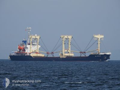
AL NOUR
General Cargo
Current Trip
| Time Travelled | 5 days |
|---|---|
| Remaining Time | 15 mins |
| Distance Travelled | 1322.76 nm |
| Remaining Distance | 18.51 nm |
| AVG Speed | 10.8 Knots |
| MAX Speed | 14.5 Knots |
| AVG Wind | 12.2 knots |
| MAX Wind | 23 knots |
| MIN Temp | 20.8°C / 69.44°F |
| MAX Temp | 28.4°C / 83.12°F |
| Draught | 6.6 m |
| Position Received | 8 m ago |
Current Position
| Longitude | 10.84415° |
|---|---|
| Latitude | 34.63401° |
| Status | Under way using engine |
| Speed | 7.8 Knots |
| Course | 16.9° |
| Area | Mediterranean Sea - Eastern Basin |
| Station | T-AIS |
| Position Received | 8 m ago |
Info
Information
The current position of AL NOUR is in Mediterranean Sea - Eastern Basin with coordinates 34.63401° / 10.84415° as reported on 2024-06-30 05:57 by AIS to our vessel tracker app. The vessel's current speed is 7.8 Knots and is heading at the port of SFAX. The estimated time of arrival as calculated by MyShipTracking vessel tracking app is 2024-06-30 06:21 LT
The vessel AL NOUR (IMO: 9228277, MMSI: 667001786) is a General Cargo that was built in 2000 ( 24 years old ). It's sailing under the flag of [SL] Sierra Leone.
In this page you can find informations about the vessels current position, last detected port calls, and current voyage information. If the vessels is not in coverage by AIS you will find the latest position.
The current position of AL NOUR is detected by our AIS receivers and we are not responsible for the reliability of the data. The last position was recorded while the vessel was in Coverage by the Ais receivers of our vessel tracking app.
The current draught of AL NOUR as reported by AIS is 6.6 meters
Weather
| Temperature | 25°C / 77°F |
|---|---|
| Wind Speed | 3 knots |
| Direction | 315° NW |
| Pressure | 1016 hPa |
| Humidity | 69.4 % |
| Cloud Coverage | 3 % |
Featured Company
Last Port Calls
| Port | Arrival | Departure | Time In Port |
|---|---|---|---|
| 2024-06-24 13:17 | 2024-06-24 13:49 | 32 m | |
| 2024-06-23 12:19 | 2024-06-23 16:43 | 4 h | |
| 2024-06-20 10:24 | 2024-06-23 11:44 | 3 d | |
| 2024-06-17 20:01 | 2024-06-18 05:45 | 9 h | |
| 2024-06-15 14:17 | 2024-06-17 18:42 | 2 d | |
| 2024-06-05 09:03 | 2024-06-08 18:28 | 3 d | |
| 2024-05-29 09:19 | 2024-06-02 08:36 | 3 d | |
| 2024-05-22 10:04 | 2024-05-23 09:24 | 23 h | |
| 2024-05-18 19:16 | 2024-05-18 20:38 | 1 h | |
| 2024-05-17 00:45 | 2024-05-17 05:19 | 4 h |
Last Trips
| Origin | Departure | Destination | Arrival | Distance | |
|---|---|---|---|---|---|
| 2024-06-23 19:43 | 2024-06-24 16:17 | 63.65 nm | |||
| 2024-06-23 14:44 | 2024-06-23 15:19 | 1.12 nm | |||
| 2024-06-18 08:45 | 2024-06-20 13:24 | 539.45 nm | |||
| 2024-06-17 21:42 | 2024-06-17 23:01 | 50.76 nm | |||
| 2024-06-08 21:28 | 2024-06-15 17:17 | 1242.74 nm | |||
| 2024-06-02 10:36 | 2024-06-05 12:03 | 483.69 nm | |||
| 2024-05-23 11:24 | 2024-05-29 11:19 | 8.77 nm | |||
| 2024-05-18 23:38 | 2024-05-22 12:04 | 743.39 nm | |||
| 2024-05-17 08:19 | 2024-05-18 22:16 | 371.29 nm | |||
| 2024-05-17 03:40 | 2024-05-17 03:45 | 0.58 nm |
Events
| Time | Event | Details | Position / Dest | Info |
|---|---|---|---|---|
| 2024-06-30 06:02 | Status Changed | Default Under way using engine |
34.64168 / 10.85008
TNSFA
|
Speed: 7.8 kn Course: 16.9° |
| 2024-06-30 05:57 | Status Changed | Under way using engine Default |
34.63401 / 10.84415
TNSFA
|
Speed: 9.4 kn Course: 16° |
| 2024-06-30 05:54 | IN Coverage |
34.63401 / 10.84415
Mediterranean Sea - Eastern Basin
TNSFA
|
Speed: 7.8 kn Course: 16.9° |
|
| 2024-06-30 04:49 | Status Changed | Default Under way using engine |
34.43577 / 10.83509
TNSFA
|
Speed: 11.4 kn Course: 299.9° |
| 2024-06-30 04:43 | Status Changed | Under way using engine Default |
34.42319 / 10.85104
TNSFA
|
Speed: 11.3 kn Course: 292° |
| 2024-06-30 04:43 | OUT of Coverage |
34.42319 / 10.85104
Mediterranean Sea - Eastern Basin
TNSFA
|
Speed: 11.4 kn Course: 299.9° |
|
| 2024-06-30 04:34 | IN Coverage |
34.42319 / 10.85104
Mediterranean Sea - Eastern Basin
TNSFA
|
Speed: 11.4 kn Course: 299.9° |
|
| 2024-06-30 03:53 | Status Changed | Default Under way using engine |
34.38219 / 11.03188
TNSFA
|
Speed: 11.4 kn Course: 256.2° |
| 2024-06-30 03:35 | OUT of Coverage |
34.39439 / 11.10318
Mediterranean Sea - Eastern Basin
TNSFA
|
Speed: 11.4 kn Course: 256.2° |
|
| 2024-06-30 03:04 | Status Changed | Under way using engine Default |
34.41644 / 11.21793
TNSFA
|
Speed: 11.5 kn Course: 257° |