

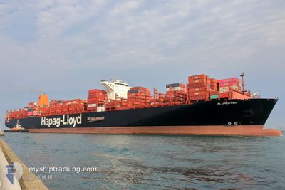
AL JMELIYAH
Cargo A

Current Trip
| Time Travelled | 1 day |
|---|---|
| Remaining Time | --- |
| Distance Travelled | 243.48 nm |
| Remaining Distance | 24.38 nm |
| AVG Speed | 12 Knots |
| MAX Speed | 16.1 Knots |
| AVG Wind | 7.5 knots |
| MAX Wind | 11 knots |
| MIN Temp | 7.2°C / 44.96°F |
| MAX Temp | 10.7°C / 51.26°F |
| Draught | 12.1 m |
| Position Received | 3 m ago |
Current Position
| Longitude | --- |
|---|---|
| Latitude | --- |
| Status | At anchor |
| Speed | 0.1 Knots |
| Course | 160° |
| Area | North Sea |
| Station | T-AIS |
| Position Received | 3 m ago |
Information
The current position of AL JMELIYAH is in North Sea with coordinates 51.91422° / 3.50842° as reported on 2025-03-27 16:53 by AIS to our vessel tracker app. The vessel's current speed is 0.1 Knots and is heading at the port of ROTTERDAM. The estimated time of arrival as calculated by MyShipTracking vessel tracking app is 2025-03-27 09:00 LT
The vessel AL JMELIYAH (IMO: 9732357, MMSI: 211886490) is a Cargo A It's sailing under the flag of [DE] Germany.
In this page you can find informations about the vessels current position, last detected port calls, and current voyage information. If the vessels is not in coverage by AIS you will find the latest position.
The current position of AL JMELIYAH is detected by our AIS receivers and we are not responsible for the reliability of the data. The last position was recorded while the vessel was in Coverage by the Ais receivers of our vessel tracking app.
The current draught of AL JMELIYAH as reported by AIS is 12.1 meters
Weather
| Temperature | 8.1°C / 46.58°F |
|---|---|
| Wind Speed | 8 knots |
| Direction | 222° SW |
| Pressure | 1018.4 hPa |
| Humidity | 80.6 % |
| Cloud Coverage | 5 % |


Featured Company
Last Port Calls
| Port | Arrival | Departure | Time In Port |
|---|---|---|---|
| 2025-03-22 18:54 | 2025-03-25 21:51 | 3 d | |
| 2025-03-19 00:49 | 2025-03-20 08:10 | 1 d | |
| 2025-03-16 01:26 | 2025-03-17 08:52 | 1 d | |
| 2025-03-11 10:42 | 2025-03-14 03:05 | 2 d | |
| 2025-02-05 14:03 | 2025-02-06 16:07 | 1 d | |
| 2025-01-29 05:13 | 2025-01-30 13:49 | 1 d | |
| 2025-01-25 16:01 | 2025-01-26 13:49 | 21 h | |
| 2025-01-14 08:16 | 2025-01-16 15:43 | 2 d | |
| 2025-01-01 22:08 |
Most Visited Ports (Last year)
| Port | Arrivals | |
|---|---|---|
| 6 | ||
| 5 | ||
| 3 | ||
| 3 | ||
| 3 | ||
| 3 |
Last Trips
| Origin | Departure | Destination | Arrival | Distance | |
|---|---|---|---|---|---|
| 2025-03-20 08:10 | 2025-03-22 18:54 | 483.23 nm | |||
| 2025-03-17 08:52 | 2025-03-19 00:49 | 77.18 nm | |||
| 2025-03-14 03:05 | 2025-03-16 01:26 | 474.48 nm | |||
| 2025-02-06 16:07 | 2025-03-11 10:42 | 11993.16 nm | |||
| 2025-01-30 13:49 | 2025-02-05 14:03 | 1520.84 nm | |||
| 2025-01-26 13:49 | 2025-01-29 05:13 | 140.93 nm | |||
| 2025-01-16 15:43 | 2025-01-25 16:01 | 1467.45 nm | |||
| 2025-01-01 22:08 | 2025-01-14 08:16 | 2707.75 nm |
Events
| Time | Event | Details | Position / Dest | Info |
|---|---|---|---|---|
| 2025-03-27 11:28 | ETA Changed | 2025/03/28 18:00 2025/03/27 08:00 |
51.91398 / 3.51118
NLRTM
|
Speed: Course: 223° |
| 2025-03-27 07:11 | Status Changed | At anchor Default |
51.91183 / 3.50697
NLRTM
|
Speed: Course: 53° |
| 2025-03-27 07:05 | Status Changed | Default At anchor |
51.91182 / 3.50699
NLRTM
|
Speed: Course: 53° |
| 2025-03-27 06:47 | Status Changed | At anchor Default |
51.91177 / 3.50695
NLRTM
|
Speed: Course: 52° |
| 2025-03-27 06:35 | Status Changed | Default At anchor |
51.91176 / 3.50694
NLRTM
|
Speed: Course: 52° |
| 2025-03-27 03:59 | Status Changed | At anchor Default |
51.91454 / 3.50865
NLRTM
|
Speed: Course: 175° |
| 2025-03-27 03:57 | Status Changed | Default At anchor |
51.91453 / 3.50867
NLRTM
|
Speed: Course: 179° |
| 2025-03-26 21:59 | Status Changed | At anchor Default |
51.91191 / 3.50764
NLRTM
|
Speed: 0.1 kn Course: 7° |
| 2025-03-26 21:56 | Status Changed | Default At anchor |
51.91192 / 3.50745
NLRTM
|
Speed: Course: 11° |
| 2025-03-26 21:47 | Status Changed | At anchor Default |
51.91192 / 3.50712
NLRTM
|
Speed: Course: 21° |