

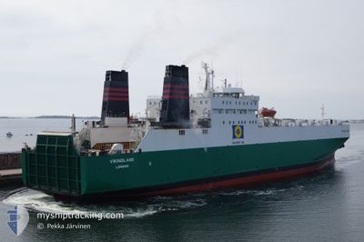
AKRITAS
Ro-Ro Cargo

Current Trip
| Time Travelled | 21 h, 23 mins |
|---|---|
| Remaining Time | --- |
| Distance Travelled | 154.49 nm |
| Remaining Distance | --- |
| AVG Speed | 11.4 Knots |
| MAX Speed | 15.8 Knots |
| AVG Wind | 17.9 knots |
| MAX Wind | 22.8 knots |
| MIN Temp | 11.4°C / 52.52°F |
| MAX Temp | 16.8°C / 62.24°F |
| Draught | 6.5 m |
| Position Received | 2 m ago |
Current Position
| Longitude | --- |
|---|---|
| Latitude | --- |
| Status | At anchor |
| Speed | 0.8 Knots |
| Course | --- |
| Area | Mediterranean Sea - Eastern Basin |
| Station | T-AIS |
| Position Received | 2 m ago |
Information
The current position of AKRITAS is in Mediterranean Sea - Eastern Basin with coordinates 32.91160° / 34.99656° as reported on 2025-02-20 13:42 by AIS to our vessel tracker app. The vessel's current speed is 0.8 Knots
The vessel AKRITAS (IMO: 8020599, MMSI: 209511000) is a Ro-Ro Cargo that was built in 1982 ( 43 years old ). It's sailing under the flag of [CY] Cyprus.
In this page you can find informations about the vessels current position, last detected port calls, and current voyage information. If the vessels is not in coverage by AIS you will find the latest position.
The current position of AKRITAS is detected by our AIS receivers and we are not responsible for the reliability of the data. The last position was recorded while the vessel was in Coverage by the Ais receivers of our vessel tracking app.
The current draught of AKRITAS as reported by AIS is 6.5 meters
Weather
| Temperature | 15.2°C / 59.36°F |
|---|---|
| Wind Speed | 18 knots |
| Direction | 287° WNW |
| Pressure | 1015.2 hPa |
| Humidity | 51.8 % |
| Cloud Coverage | 17 % |


Featured Company
Last Port Calls
| Port | Arrival | Departure | Time In Port |
|---|---|---|---|
| 2025-02-19 08:39 | 2025-02-19 16:21 | 7 h | |
| 2025-02-16 06:40 | 2025-02-17 22:13 | 1 d | |
| 2025-02-14 06:18 | 2025-02-14 15:21 | 9 h | |
| 2025-02-13 04:00 | 2025-02-13 14:38 | 10 h | |
| 2025-02-12 09:33 | 2025-02-12 16:38 | 7 h | |
| 2025-02-09 06:39 | 2025-02-10 23:42 | 1 d | |
| 2025-02-07 13:49 | 2025-02-07 19:50 | 6 h | |
| 2025-02-06 19:42 | 2025-02-07 03:30 | 7 h | |
| 2025-02-05 10:11 | 2025-02-05 16:41 | 6 h | |
| 2025-02-02 06:40 | 2025-02-03 23:57 | 1 d |
Most Visited Ports (Last year)
| Port | Arrivals | |
|---|---|---|
| 86 | ||
| 45 | ||
| 19 | ||
| 6 | ||
| 1 |
Last Trips
| Origin | Departure | Destination | Arrival | Distance | |
|---|---|---|---|---|---|
| 2025-02-18 00:13 | 2025-02-19 10:39 | 490.23 nm | |||
| 2025-02-14 17:21 | 2025-02-16 08:40 | 493.38 nm | |||
| 2025-02-13 16:38 | 2025-02-14 08:18 | 174.79 nm | |||
| 2025-02-12 18:38 | 2025-02-13 06:00 | 151.89 nm | |||
| 2025-02-11 01:42 | 2025-02-12 11:33 | 490.69 nm | |||
| 2025-02-07 21:50 | 2025-02-09 08:39 | 505.23 nm | |||
| 2025-02-07 05:30 | 2025-02-07 15:49 | 148.04 nm | |||
| 2025-02-05 18:41 | 2025-02-06 21:42 | 159.82 nm | |||
| 2025-02-04 01:57 | 2025-02-05 12:11 | 492.38 nm | |||
| 2025-01-31 17:03 | 2025-02-02 08:40 | 493.33 nm |
Events
| Time | Event | Details | Position / Dest | Info |
|---|---|---|---|---|
| 2025-02-20 12:51 | Status Changed | At anchor Default |
32.90985 / 34.99609
ILHFA
|
Speed: 0.5 kn Course: -1° |
| 2025-02-20 12:48 | Status Changed | Default At anchor |
32.90977 / 34.99596
ILHFA
|
Speed: 0.1 kn Course: 511° |
| 2025-02-20 05:15 | STOP Moving | 3.86 nm, West of ACRE |
32.91096 / 34.99542
ILHFA
|
Speed: 0.2 kn Course: 511° |
| 2025-02-20 04:51 | Status Changed | At anchor Under way using engine |
32.91208 / 34.99352
ILHFA
|
Speed: 1.2 kn Course: 511° |
| 2025-02-20 01:28 | Draught Changed | 6.5 6.6 |
32.97279 / 34.73408
ILHFA
|
Speed: 11.8 kn Course: 154.7° |
| 2025-02-20 00:41 | Detected in Sea | Israeli part of the Mediterranean Sea - Eastern Basin |
33.09523 / 34.62998
Mediterranean Sea - Eastern Basin
ILHFA
|
Speed: 11.7 kn Course: 135.7° |
| 2025-02-20 00:40 | Status Changed | Under way using engine Default |
33.09676 / 34.62821
ILHFA
|
Speed: 12.3 kn Course: 131° |
| 2025-02-20 00:40 | IN Coverage |
33.09523 / 34.62998
Mediterranean Sea - Eastern Basin
ILHFA
|
Speed: 11.7 kn Course: 135.7° |
|
| 2025-02-19 17:57 | Status Changed | Default Under way using engine |
34.38817 / 33.39674
ILHFA
|
Speed: 15.1 kn Course: 131.3° |
| 2025-02-19 17:52 | OUT of Coverage |
34.40374 / 33.37481
Mediterranean Sea - Eastern Basin
ILHFA
|
Speed: 15.1 kn Course: 131.3° |