
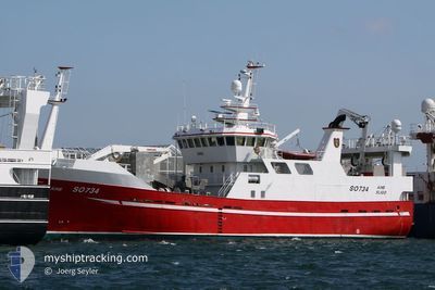
AINE
Fishing
Current Trip
FISHING GROUND
| Time Travelled | 10 days |
|---|---|
| Remaining Time | --- |
| Distance Travelled | 353.14 nm |
| Remaining Distance | --- |
| AVG Speed | 11.6 Knots |
| MAX Speed | 11.9 Knots |
| AVG Wind | 11.1 knots |
| MAX Wind | 27 knots |
| MIN Temp | 6°C / 42.8°F |
| MAX Temp | 8.9°C / 48.02°F |
| Draught | 7.5 m |
| Position Received | 1 d ago |
Current Position
| Longitude | --- |
|---|---|
| Latitude | --- |
| Status | Under way using engine |
| Speed | 10.6 Knots |
| Course | 184.6° |
| Area | North Atlantic Ocean |
| Station | T-AIS |
| Position Received | 1 d ago |
Info
Information
The current position of AINE is in North Atlantic Ocean with coordinates 53.30557° / -10.47209° as reported on 2025-02-16 03:49 by AIS to our vessel tracker app. The vessel's current speed is 10.6 Knots
The vessel AINE (IMO: 9794886, MMSI: 250004765) is a Fishing It's sailing under the flag of [IE] Ireland.
In this page you can find informations about the vessels current position, last detected port calls, and current voyage information. If the vessels is not in coverage by AIS you will find the latest position.
The current position of AINE is detected by our AIS receivers and we are not responsible for the reliability of the data. The last position was recorded while the vessel was in Coverage by the Ais receivers of our vessel tracking app.
The current draught of AINE as reported by AIS is 7.5 meters
Weather
| Temperature | 9°C / 48.2°F |
|---|---|
| Wind Speed | 27 knots |
| Direction | 118° ESE |
| Pressure | 1008.8 hPa |
| Humidity | 88 % |
| Cloud Coverage | 100 % |
Featured Company
Most Visited Ports (Last year)
| Port | Arrivals | |
|---|---|---|
| 6 | ||
| 5 | ||
| 1 | ||
| 1 | ||
| 1 | ||
| 1 |
Events
| Time | Event | Details | Position / Dest | Info |
|---|---|---|---|---|
| 2025-02-16 03:49 | OUT of Coverage |
53.30557 / -10.47209
North Atlantic Ocean
|
Speed: 10.6 kn Course: 184.6° |
|
| 2025-02-16 03:33 | Detected in Sea | Irish part of the North Atlantic Ocean |
53.35226 / -10.46180
North Atlantic Ocean
|
Speed: 10.8 kn Course: 186.3° |
| 2025-02-16 03:33 | IN Coverage |
53.35226 / -10.46180
North Atlantic Ocean
|
Speed: 10.8 kn Course: 186.3° |
|
| 2025-02-07 09:30 | OUT of Coverage |
58.34621 / -6.10435
Inner Seas off the West Coast of Scotland
|
Speed: 11.9 kn Course: 356.7° |