

AGOT
Reefer

Current Trip
| Time Travelled | 6 days |
|---|---|
| Remaining Time | 2 h, 3 mins |
| Distance Travelled | 749.86 nm |
| Remaining Distance | 12.63 nm |
| AVG Speed | 5.9 Knots |
| MAX Speed | 9.6 Knots |
| AVG Wind | 8.9 knots |
| MAX Wind | 23 knots |
| MIN Temp | -10.1°C / 13.82°F |
| MAX Temp | 4.1°C / 39.38°F |
| Draught | 3.9 m |
| Position Received | 1 m ago |
Current Position
| Longitude | --- |
|---|---|
| Latitude | --- |
| Status | Under way using engine |
| Speed | 5.7 Knots |
| Course | 229.8° |
| Area | Norwegian Sea |
| Station | T-AIS |
| Position Received | 1 m ago |
Information
The current position of AGOT is in Norwegian Sea with coordinates 62.63233° / 6.36215° as reported on 2025-02-19 04:01 by AIS to our vessel tracker app. The vessel's current speed is 5.7 Knots and is heading at the port of ALESUND. The estimated time of arrival as calculated by MyShipTracking vessel tracking app is 2025-02-19 06:05 LT
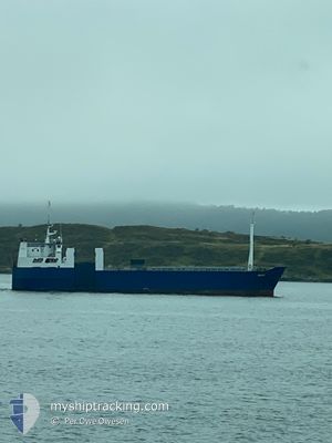
The vessel AGOT (IMO: 7700594, MMSI: 276826000) is a Reefer that was built in 1978 ( 47 years old ). It's sailing under the flag of [EE] Estonia.
In this page you can find informations about the vessels current position, last detected port calls, and current voyage information. If the vessels is not in coverage by AIS you will find the latest position.
The current position of AGOT is detected by our AIS receivers and we are not responsible for the reliability of the data. The last position was recorded while the vessel was in Coverage by the Ais receivers of our vessel tracking app.
The current draught of AGOT as reported by AIS is 3.9 meters
Weather
| Temperature | 0.8°C / 33.44°F |
|---|---|
| Wind Speed | 6 knots |
| Direction | 178° S |
| Pressure | 1026.7 hPa |
| Humidity | 63.7 % |
| Cloud Coverage | 78 % |


Featured Company
Last Port Calls
| Port | Arrival | Departure | Time In Port |
|---|---|---|---|
| 2025-02-06 13:54 | 2025-02-12 07:37 | 5 d | |
| 2025-01-31 10:42 | 2025-02-01 06:28 | 19 h | |
| 2025-01-24 20:08 | 2025-01-25 15:07 | 18 h | |
| 2025-01-17 06:03 | 2025-01-18 14:47 | 1 d | |
| 2025-01-03 13:37 | 2025-01-03 16:22 | 2 h | |
| 2024-12-31 18:33 | 2025-01-03 13:28 | 2 d | |
| 2024-12-21 08:45 | 2024-12-21 12:15 | 3 h | |
| 2024-12-20 10:00 | 2024-12-21 07:50 | 21 h | |
| 2024-12-07 08:44 | 2024-12-08 06:40 | 21 h |
Last Trips
| Origin | Departure | Destination | Arrival | Distance | |
|---|---|---|---|---|---|
| 2025-02-01 07:28 | 2025-02-06 14:54 | 727.55 nm | |||
| 2025-01-25 16:07 | 2025-01-31 11:42 | 788.92 nm | |||
| 2025-01-18 15:47 | 2025-01-24 21:08 | 793.00 nm | |||
| 2025-01-03 17:22 | 2025-01-17 07:03 | 1544.65 nm | |||
| 2025-01-03 14:28 | 2025-01-03 14:37 | 0.20 nm | |||
| 2024-12-21 13:15 | 2024-12-31 19:33 | 1276.90 nm | |||
| 2024-12-21 08:50 | 2024-12-21 09:45 | 6.09 nm | |||
| 2024-12-08 07:40 | 2024-12-20 11:00 | 1487.96 nm | |||
| 2024-11-23 19:18 | 2024-12-07 09:44 | 1475.70 nm |
Events
| Time | Event | Details | Position / Dest | Info |
|---|---|---|---|---|
| 2025-02-17 14:20 | Status Changed | Under way using engine Default |
65.06886 / 11.74165
NOAES
|
Speed: 6.1 kn Course: 219° |
| 2025-02-17 13:51 | Status Changed | Default Under way using engine |
65.10887 / 11.80690
NOAES
|
Speed: 6 kn Course: 191° |
| 2025-02-15 04:11 | Draught Changed | 3.9 3 |
69.70147 / 18.93482
NOAES
|
Speed: 6.4 kn Course: 242° |
| 2025-02-15 04:11 | ETA Changed | 2025/02/19 07:00 |
69.70147 / 18.93482
NOAES
|
Speed: 6.4 kn Course: 242° |
| 2025-02-15 03:58 | Draught Changed | 3 3.9 |
69.71447 / 18.98062
NOAES
|
Speed: 5.8 kn Course: 222° |
| 2025-02-15 03:46 | Draught Changed | 3.9 3 |
69.73098 / 19.01794
NOAES
|
Speed: 6.4 kn Course: 219.2° |
| 2025-02-15 03:46 | ETA Changed | 2025/02/19 07:00 |
69.73098 / 19.01794
NOAES
|
Speed: 6.4 kn Course: 219.2° |
| 2025-02-15 03:40 | Draught Changed | 3 3.9 |
69.73928 / 19.03624
NOAES
|
Speed: 6 kn Course: 220° |
| 2025-02-15 03:34 | Draught Changed | 3.9 3 |
69.74805 / 19.05201
NOAES
|
Speed: 5.9 kn Course: 208° |
| 2025-02-15 03:34 | ETA Changed | 2025/02/19 07:00 |
69.74805 / 19.05201
NOAES
|
Speed: 5.9 kn Course: 208° |