
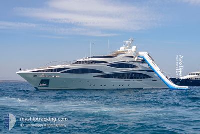
AFRICA I
Yacht
Current Trip
MONEMVASIA
| Time Travelled | 11 h, 52 mins |
|---|---|
| Remaining Time | --- |
| Distance Travelled | 39.11 nm |
| Remaining Distance | --- |
| AVG Speed | 16.1 Knots |
| MAX Speed | 20.8 Knots |
| AVG Wind | 9.9 knots |
| MAX Wind | 21.5 knots |
| MIN Temp | 14.7°C / 58.46°F |
| MAX Temp | 22.5°C / 72.5°F |
| Draught | 2.8 m |
| Position Received | 1 h, 32 m ago |
Current Position
| Longitude | 23.18503° |
|---|---|
| Latitude | 37.28595° |
| Status | Under way using engine |
| Speed | 8.9 Knots |
| Course | 353.5° |
| Area | Aegean Sea |
| Station | T-AIS |
| Position Received | 1 h, 32 m ago |
Info
Information
The current position of AFRICA I is in Aegean Sea with coordinates 37.28595° / 23.18503° as reported on 2024-05-03 14:52 by AIS to our vessel tracker app. The vessel's current speed is 8.9 Knots
The vessel AFRICA I (IMO: 9596521, MMSI: 248702000) is a Yacht that was built in 2010 ( 14 years old ). It's sailing under the flag of [MT] Malta.
In this page you can find informations about the vessels current position, last detected port calls, and current voyage information. If the vessels is not in coverage by AIS you will find the latest position.
The current position of AFRICA I is detected by our AIS receivers and we are not responsible for the reliability of the data. The last position was recorded while the vessel was in Coverage by the Ais receivers of our vessel tracking app.
The current draught of AFRICA I as reported by AIS is 2.8 meters
Weather
| Temperature | 21.3°C / 70.34°F |
|---|---|
| Wind Speed | 20 knots |
| Direction | 288° WNW |
| Pressure | 1009.5 hPa |
| Humidity | 37.9 % |
| Cloud Coverage | --- |
Featured Company
Last Port Calls
| Port | Arrival | Departure | Time In Port |
|---|---|---|---|
| 2024-05-02 16:49 | 2024-05-03 04:33 | 11 h | |
| 2024-04-24 14:26 | 2024-05-02 07:47 | 7 d | |
| 2024-04-24 09:14 |
Last Trips
| Origin | Departure | Destination | Arrival | Distance | |
|---|---|---|---|---|---|
| 2024-05-02 10:47 | 2024-05-02 19:49 | 58.51 nm | |||
| 2024-04-24 12:14 | 2024-04-24 17:26 | 77.57 nm |
Events
| Time | Event | Details | Position / Dest | Info |
|---|---|---|---|---|
| 2024-05-03 14:52 | OUT of Coverage |
37.28595 / 23.18503
Aegean Sea
|
Speed: 8.9 kn Course: 353.5° |
|
| 2024-05-03 13:27 | IN Coverage |
36.85792 / 23.07108
Aegean Sea
|
Speed: 16.7 kn Course: 14.7° |
|
| 2024-05-03 05:19 | OUT of Coverage |
36.83678 / 23.07182
Aegean Sea
|
Speed: 11.1 kn Course: 289.3° |
|
| 2024-05-03 04:34 | Status Changed | Under way using engine Moored |
36.69085 / 23.04322
MONEMVASIA
|
Speed: 6.2 kn Course: 20° |
| 2024-05-03 04:33 | PORT DEPARTURE |
|
36.69057 / 23.04305
MONEMVASIA
|
Speed: 6 kn Course: 21° |
| 2024-05-03 04:33 | START Moving |
36.69030 / 23.04290
[GR] MONEMVASIA
|
Speed: 6 kn Course: 21° |
|
| 2024-05-02 18:51 | Status Changed | Moored Under way using engine |
36.68865 / 23.04187
[GR] MONEMVASIA
|
Speed: Course: 357° |
| 2024-05-02 16:50 | STOP Moving |
36.68867 / 23.04152
[GR] MONEMVASIA
|
Speed: 0.3 kn Course: 83° |
|
| 2024-05-02 16:49 | PORT ARRIVAL |
|
36.68903 / 23.04092
[GR] MONEMVASIA
|
Speed: 5 kn Course: 165.7° |
| 2024-05-02 16:16 | Destination Changed | MONEMVASIA KYPARISSI |
36.81775 / 23.10500
MONEMVASIA
|
Speed: 20.6 kn Course: 160.4° |