

ADLER
Ro-Ro Cargo

Current Trip
TO ORDER
| Time Travelled | 37 days |
|---|---|
| Remaining Time | --- |
| Distance Travelled | 6596.07 nm |
| Remaining Distance | --- |
| AVG Speed | 8.5 Knots |
| MAX Speed | 12.5 Knots |
| AVG Wind | 14.6 knots |
| MAX Wind | 35 knots |
| MIN Temp | -9.8°C / 14.36°F |
| MAX Temp | 33.8°C / 92.84°F |
| Draught | 5.8 m |
| Position Received | 2 d ago |
Current Position
| Longitude | --- |
|---|---|
| Latitude | --- |
| Status | Under way using engine |
| Speed | 8.7 Knots |
| Course | 157.2° |
| Area | Red Sea |
| Station | T-AIS |
| Position Received | 2 d ago |
Information
The current position of ADLER is in Red Sea with coordinates 12.78400° / 43.24012° as reported on 2025-03-22 13:55 by AIS to our vessel tracker app. The vessel's current speed is 8.7 Knots
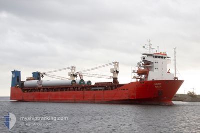
The vessel ADLER (IMO: 9179854, MMSI: 273414440) is a Ro-Ro Cargo that was built in 1998 ( 27 years old ). It's sailing under the flag of [RU] Russia.
In this page you can find informations about the vessels current position, last detected port calls, and current voyage information. If the vessels is not in coverage by AIS you will find the latest position.
The current position of ADLER is detected by our AIS receivers and we are not responsible for the reliability of the data. The last position was recorded while the vessel was in Coverage by the Ais receivers of our vessel tracking app.
The current draught of ADLER as reported by AIS is 5.8 meters
Weather
| Temperature | 26.8°C / 80.24°F |
|---|---|
| Wind Speed | 4 knots |
| Direction | 17° NNE |
| Pressure | 1013.5 hPa |
| Humidity | 72.9 % |
| Cloud Coverage | 5 % |


Featured Company
Last Port Calls
| Port | Arrival | Departure | Time In Port |
|---|---|---|---|
| 2025-03-17 05:49 | 2025-03-17 15:21 | 9 h | |
| 2025-02-12 17:57 | 2025-02-15 21:10 | 3 d | |
| 2025-02-12 16:41 | |||
| 2025-02-12 16:32 | |||
| 2025-01-11 06:33 | 2025-01-12 20:36 | 1 d |
Most Visited Ports (Last year)
| Port | Arrivals | |
|---|---|---|
| 3 | ||
| 2 | ||
| 2 | ||
| 2 | ||
| 1 | ||
| 1 |
Last Trips
| Origin | Departure | Destination | Arrival | Distance | |
|---|---|---|---|---|---|
| 2025-02-16 00:10 | 2025-03-17 07:49 | 4761.44 nm | |||
| 2025-02-12 19:32 | 2025-02-12 20:57 | 12.75 nm | |||
| 2025-01-12 20:36 | 2025-02-12 19:41 | 5577.61 nm | |||
| 2024-12-14 21:13 | 2025-01-11 06:33 | 5017.92 nm |
Events
| Time | Event | Details | Position / Dest | Info |
|---|---|---|---|---|
| 2025-03-22 14:01 | Status Changed | Default Under way using engine |
12.77166 / 43.24597
TO ORDER
|
Speed: 8.7 kn Course: 157.2° |
| 2025-03-22 13:55 | OUT of Coverage |
12.78400 / 43.24012
Red Sea
|
Speed: 8.7 kn Course: 157.2° |
|
| 2025-03-22 13:50 | Status Changed | Under way using engine Default |
12.79580 / 43.23496
TO ORDER
|
Speed: 9 kn Course: 155° |
| 2025-03-22 13:50 | IN Coverage |
12.79288 / 43.23626
Red Sea
|
Speed: 8.7 kn Course: 156.9° |
|
| 2025-03-22 12:45 | Status Changed | Default Under way using engine |
12.93801 / 43.16420
TO ORDER
|
Speed: 8.9 kn Course: 152.9° |
| 2025-03-22 12:38 | OUT of Coverage |
12.95529 / 43.15529
Red Sea
|
Speed: 8.9 kn Course: 152.9° |
|
| 2025-03-22 12:03 | Status Changed | Under way using engine Default |
13.03291 / 43.11545
TO ORDER
|
Speed: 8.9 kn Course: 155° |
| 2025-03-22 11:51 | IN Coverage |
13.03291 / 43.11545
Red Sea
|
Speed: 8.9 kn Course: 153.2° |
|
| 2025-03-22 11:11 | Status Changed | Default Under way using engine |
13.14986 / 43.06138
TO ORDER
|
Speed: 8.6 kn Course: 156.6° |
| 2025-03-22 11:02 | OUT of Coverage |
13.16887 / 43.05287
Red Sea
|
Speed: 8.6 kn Course: 156.6° |