
AASTUN
General Cargo
Current Trip
NOTSX
| Time Travelled | 14 h, 59 mins |
|---|---|
| Remaining Time | --- |
| Distance Travelled | 157.81 nm |
| Remaining Distance | --- |
| AVG Speed | 11 Knots |
| MAX Speed | 15.4 Knots |
| AVG Wind | 13.6 knots |
| MAX Wind | 27.2 knots |
| MIN Temp | 1.5°C / 34.7°F |
| MAX Temp | 8.4°C / 47.12°F |
| Draught | 6.3 m |
| Position Received | 13 h, 27 m ago |
Current Position
| Longitude | --- |
|---|---|
| Latitude | --- |
| Status | Under way using engine |
| Speed | 11.1 Knots |
| Course | 354.5° |
| Area | Inner Seas off the West Coast of Scotland |
| Station | T-AIS |
| Position Received | 13 h, 27 m ago |
Info
Information
The current position of AASTUN is in Inner Seas off the West Coast of Scotland with coordinates 54.86570° / -5.67944° as reported on 2026-01-06 01:07 by AIS to our vessel tracker app. The vessel's current speed is 11.1 Knots
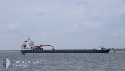
The vessel AASTUN (IMO: 9321407, MMSI: 255768000) is a General Cargo that was built in 2006 ( 20 years old ). It's sailing under the flag of [PT] Portugal.
In this page you can find informations about the vessels current position, last detected port calls, and current voyage information. If the vessels is not in coverage by AIS you will find the latest position.
The current position of AASTUN is detected by our AIS receivers and we are not responsible for the reliability of the data. The last position was recorded while the vessel was in Coverage by the Ais receivers of our vessel tracking app.
The current draught of AASTUN as reported by AIS is 6.3 meters
Weather
| Temperature | 6.9°C / 44.42°F |
|---|---|
| Wind Speed | 29 knots |
| Direction | 317° NW |
| Pressure | 1001.1 hPa |
| Humidity | 83 % |
| Cloud Coverage | 100 % |
Featured Company
Last Port Calls
| Port | Arrival | Departure | Time In Port |
|---|---|---|---|
| 2026-01-04 13:51 | 2026-01-05 23:35 | 1 d | |
| 2026-01-01 22:12 | 2026-01-02 21:43 | 23 h | |
| 2025-12-30 12:17 | 2025-12-30 12:51 | 33 m | |
| 2025-12-26 18:30 | 2025-12-30 10:35 | 3 d | |
| 2025-12-26 16:36 | 2025-12-26 17:34 | 57 m | |
| 2025-12-21 14:03 | 2025-12-22 14:03 | 1 d | |
| 2025-12-15 22:33 | 2025-12-18 01:28 | 2 d | |
| 2025-12-09 03:37 | 2025-12-10 03:14 | 23 h | |
| 2025-12-02 08:29 | 2025-12-02 21:09 | 12 h | |
| 2025-11-27 10:42 | 2025-11-28 08:30 | 21 h |
Last Trips
| Origin | Departure | Destination | Arrival | Distance | |
|---|---|---|---|---|---|
| 2026-01-02 21:43 | 2026-01-04 13:51 | 111.53 nm | |||
| 2025-12-30 12:51 | 2026-01-01 22:12 | 605.11 nm | |||
| 2025-12-30 10:35 | 2025-12-30 12:17 | 10.12 nm | |||
| 2025-12-26 17:34 | 2025-12-26 18:30 | 7.87 nm | |||
| 2025-12-22 14:03 | 2025-12-26 16:36 | 664.22 nm | |||
| 2025-12-18 01:28 | 2025-12-21 14:03 | 671.75 nm | |||
| 2025-12-10 03:14 | 2025-12-15 22:33 | 907.12 nm | |||
| 2025-12-02 21:09 | 2025-12-09 03:37 | 1088.70 nm | |||
| 2025-11-28 08:30 | 2025-12-02 08:29 | 655.94 nm | |||
| 2025-11-22 21:23 | 2025-11-27 10:42 | 874.01 nm |
Events
| Time | Event | Details | Position / Dest | Info |
|---|---|---|---|---|
| 2026-01-06 01:14 | Status Changed | Default Under way using engine |
54.88998 / -5.68353
NOTSX
|
Speed: 11.1 kn Course: 354.5° |
| 2026-01-06 01:07 | OUT of Coverage |
54.86570 / -5.67944
Inner Seas off the West Coast of Scotland
NOTSX
|
Speed: 11.1 kn Course: 354.5° |
|
| 2026-01-05 23:35 | PORT DEPARTURE |
|
54.64556 / -5.86386
NOTSX
|
Speed: 10.2 kn Course: 36° |
| 2026-01-05 23:18 | START Moving |
54.62062 / -5.90506
[GB] BELFAST
|
Speed: 4.1 kn Course: 54° |
|
| 2026-01-05 23:14 | Status Changed | Under way using engine Default |
54.61837 / -5.90945
[GB] BELFAST
|
Speed: 0.2 kn Course: 41° |
| 2026-01-05 23:14 | IN Coverage |
54.61864 / -5.90897
Inner Seas off the West Coast of Scotland
[GB] BELFAST
|
Speed: 2.3 kn Course: 47.9° |
|
| 2026-01-05 22:49 | Draught Changed | 6.3 4.5 |
54.61774 / -5.90975
[GB] BELFAST
|
Speed: Course: 39° |
| 2026-01-05 22:49 | Destination Changed | NOTSX GBBEL |
54.61774 / -5.90975
[GB] BELFAST
|
Speed: Course: 39° |
| 2026-01-05 22:49 | ETA Changed | 2026/01/08 14:00 2026/01/03 08:00 |
54.61774 / -5.90975
[GB] BELFAST
|
Speed: Course: 39° |
| 2026-01-05 15:34 | OUT of Coverage |
54.61772 / -5.90981
Inner Seas off the West Coast of Scotland
[GB] BELFAST
|
Speed: Course: 200.5° |