
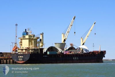
AAL GIBRALTAR
Not available
Current Trip
| Time Travelled | 11 days |
|---|---|
| Remaining Time | --- |
| Distance Travelled | 2015.26 nm |
| Remaining Distance | --- |
| AVG Speed | 11.3 Knots |
| MAX Speed | 13.4 Knots |
| AVG Wind | 7.9 knots |
| MAX Wind | 19.9 knots |
| MIN Temp | 23.3°C / 73.94°F |
| MAX Temp | 30.3°C / 86.54°F |
| Draught | 9 m |
| Position Received | 5 d ago |
Current Position
| Longitude | -79.92468° |
|---|---|
| Latitude | 9.36187° |
| Status | At anchor |
| Speed | |
| Course | 163° |
| Area | North Atlantic Ocean |
| Station | T-AIS |
| Position Received | 5 d ago |
Info
Information
The current position of AAL GIBRALTAR is in North Atlantic Ocean with coordinates 9.36187° / -79.92468° as reported on 2024-05-16 00:52 by AIS to our vessel tracker app. The vessel's current speed is 0 Knots
The vessel AAL GIBRALTAR (MMSI: 212314000) is a Not available It's sailing under the flag of [CY] Cyprus.
In this page you can find informations about the vessels current position, last detected port calls, and current voyage information. If the vessels is not in coverage by AIS you will find the latest position.
The current position of AAL GIBRALTAR is detected by our AIS receivers and we are not responsible for the reliability of the data. The last position was recorded while the vessel was in Coverage by the Ais receivers of our vessel tracking app.
The current draught of AAL GIBRALTAR as reported by AIS is 9 meters
Weather
| Temperature | 28.8°C / 83.84°F |
|---|---|
| Wind Speed | 7 knots |
| Direction | 171° S |
| Pressure | 1007.1 hPa |
| Humidity | 81.9 % |
| Cloud Coverage | 12 % |
Featured Company
Last Port Calls
| Port | Arrival | Departure | Time In Port |
|---|---|---|---|
| 2024-05-09 10:50 | 2024-05-10 00:13 | 13 h | |
| 2024-05-06 02:48 | 2024-05-09 01:34 | 2 d | |
| 2024-05-06 02:17 | 2024-05-06 02:29 | 12 m | |
| 2024-04-30 23:06 | 2024-05-03 01:34 | 2 d | |
| 2024-04-25 07:06 | 2024-04-27 04:22 | 1 d | |
| 2024-04-19 07:17 | 2024-04-22 20:01 | 3 d | |
| 2024-04-16 23:14 | 2024-04-18 13:06 | 1 d |
Most Visited Ports (Last year)
| Port | Arrivals | |
|---|---|---|
| 3 | ||
| 2 | ||
| 2 | ||
| 2 | ||
| 2 | ||
| 2 |
Last Trips
| Origin | Departure | Destination | Arrival | Distance | |
|---|---|---|---|---|---|
| 2024-05-08 21:34 | 2024-05-09 06:50 | 82.33 nm | |||
| 2024-05-05 22:29 | 2024-05-05 22:48 | 0.87 nm | |||
| 2024-05-02 19:34 | 2024-05-05 22:17 | 879.28 nm | |||
| 2024-04-26 23:22 | 2024-04-30 17:06 | 953.59 nm | |||
| 2024-04-22 15:01 | 2024-04-25 02:06 | 446.54 nm | |||
| 2024-04-18 08:06 | 2024-04-19 02:17 | 117.90 nm | |||
| 2024-02-16 20:24 | 2024-04-16 18:14 | 12867.52 nm |
Events
| Time | Event | Details | Position / Dest | Info |
|---|---|---|---|---|
| 2024-05-19 23:18 | START Moving | 9.09 nm, North East of PUERTO JIMENEZ |
8.62500 / -83.17333
BSFPO
|
Speed: 4 kn Course: -1° |
| 2024-05-18 16:18 | STOP Moving | 9.81 nm, North East of PUERTO JIMENEZ |
8.63167 / -83.16333
BSFPO
|
Speed: Course: -1° |
| 2024-05-17 10:50 | START Moving | 2.12 nm, North West of TABOGA |
8.81779 / -79.58318
BSFPO
|
Speed: 3.6 kn Course: 166° |
| 2024-05-16 23:13 | STOP Moving | 2.28 nm, North West of TABOGA |
8.82033 / -79.58462
BSFPO
|
Speed: 0.1 kn Course: 132° |
| 2024-05-16 19:46 | START Moving | 2.33 nm, North of RODMAN |
8.99218 / -79.58698
BSFPO
|
Speed: 4.2 kn Course: 134° |
| 2024-05-16 19:02 | STOP Moving | 2.82 nm, North West of RODMAN |
8.99861 / -79.59329
BSFPO
|
Speed: Course: 136° |
| 2024-05-16 18:26 | START Moving | 3.98 nm, North West of RODMAN |
9.01266 / -79.60820
BSFPO
|
Speed: 3.7 kn Course: 129° |
| 2024-05-16 17:54 | STOP Moving | 4.38 nm, North West of RODMAN |
9.01729 / -79.61343
BSFPO
|
Speed: Course: 133° |
| 2024-05-16 13:22 | START Moving | 5.09 nm, South of CRISTOBAL |
9.26249 / -79.92443
BSFPO
|
Speed: 4.6 kn Course: 186° |
| 2024-05-16 11:42 | STOP Moving | 4.22 nm, South of CRISTOBAL |
9.27667 / -79.92167
BSFPO
|
Speed: Course: -1° |