
ARGENT GERBERA
Oil/Chemical Tanker
Current Trip
| Time Travelled | 11 days |
|---|---|
| Remaining Time | 4 days |
| Distance Travelled | 3943.50 nm |
| Remaining Distance | 1539.68 nm |
| AVG Speed | 14.1 Knots |
| MAX Speed | 18.8 Knots |
| AVG Wind | 15.5 knots |
| MAX Wind | 31 knots |
| MIN Temp | 9.3°C / 48.74°F |
| MAX Temp | 17.6°C / 63.68°F |
| Draught | 11.4 m |
| Position Received | 9 d ago |
Current Position
| Longitude | 141.87058° |
|---|---|
| Latitude | 41.64702° |
| Status | Under way using engine |
| Speed | 15.1 Knots |
| Course | 96° |
| Area | North Pacific Ocean |
| Station | T-AIS |
| Position Received | 9 d ago |
Info
Information
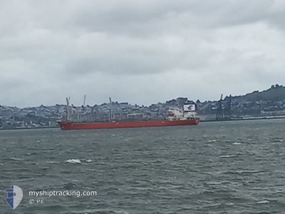
The current position of ARGENT GERBERA is in North Pacific Ocean with coordinates 41.64702° / 141.87058° as reported on 2024-05-27 06:27 by AIS to our vessel tracker app. The vessel's current speed is 15.1 Knots and is heading at the port of LOS ANGELES. The estimated time of arrival as calculated by MyShipTracking vessel tracking app is 2024-06-10 01:42 LT
The vessel ARGENT GERBERA (IMO: 9424596, MMSI: 538003929) is a Oil/Chemical Tanker that was built in 2010 ( 14 years old ). It's sailing under the flag of [MH] Marshall Is.
In this page you can find informations about the vessels current position, last detected port calls, and current voyage information. If the vessels is not in coverage by AIS you will find the latest position.
The current position of ARGENT GERBERA is detected by our AIS receivers and we are not responsible for the reliability of the data. The last position was recorded while the vessel was in Coverage by the Ais receivers of our vessel tracking app.
The current draught of ARGENT GERBERA as reported by AIS is 11.4 meters
Weather
| Temperature | 14.7°C / 58.46°F |
|---|---|
| Wind Speed | 5 knots |
| Direction | 78° ENE |
| Pressure | 1018.9 hPa |
| Humidity | 80.5 % |
| Cloud Coverage | 100 % |
Featured Company
Last Trips
| Origin | Departure | Destination | Arrival | Distance | |
|---|---|---|---|---|---|
| 2024-05-20 09:15 | 2024-05-24 09:19 | 661.83 nm | |||
| 2024-05-11 02:59 | 2024-05-19 18:24 | 1709.37 nm | |||
| 2024-04-15 15:28 | 2024-05-10 09:56 | 5914.47 nm | |||
| 2024-04-10 21:20 | 2024-04-13 19:21 | 360.61 nm | |||
| 2024-03-03 03:39 | 2024-04-09 10:32 | 2059.60 nm |
Events
| Time | Event | Details | Position / Dest | Info |
|---|---|---|---|---|
| 2024-05-27 06:33 | Status Changed | Default Under way using engine |
41.64438 / 141.90102
US LAX
|
Speed: 15.1 kn Course: 96° |
| 2024-05-27 06:27 | OUT of Coverage |
41.64702 / 141.87058
North Pacific Ocean
US LAX
|
Speed: 15.1 kn Course: 96° |
|
| 2024-05-27 04:47 | Change Sea Area | Japanese part of the North Pacific Ocean Japanese part of the Japan Sea |
41.63205 / 141.31170
North Pacific Ocean
US LAX
|
Speed: 15.8 kn Course: 86° |
| 2024-05-27 02:12 | Draught Changed | 11.4 8.8 |
41.39758 / 140.44445
US LAX
|
Speed: 15.5 kn Course: 57° |
| 2024-05-27 02:12 | Destination Changed | US LAX KR USN |
41.39758 / 140.44445
US LAX
|
Speed: 15.5 kn Course: 57° |
| 2024-05-27 02:12 | ETA Changed | 2024/06/13 15:00 2024/05/22 02:00 |
41.39758 / 140.44445
US LAX
|
Speed: 15.5 kn Course: 57° |
| 2024-05-27 00:50 | Status Changed | Under way using engine Default |
41.20745 / 140.06033
KR USN
|
Speed: 14.9 kn Course: 57° |
| 2024-05-27 00:43 | Status Changed | Default Under way using engine |
41.19145 / 140.02562
KR USN
|
Speed: 14.9 kn Course: 57° |
| 2024-05-27 00:21 | Status Changed | Under way using engine Default |
41.14783 / 139.92558
KR USN
|
Speed: 14.7 kn Course: 53° |
| 2024-05-27 00:02 | IN Coverage |
41.14808 / 139.92615
Japan Sea
|
Speed: 14.8 kn Course: 59° |