
Unkown Name
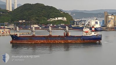
Bulk Carrier
Current Trip
| Trip Time | 23 days |
|---|---|
| Trip Distance | 1466.49 nm |
| AVG Speed | 6 Knots |
| MAX Speed | 11 Knots |
| Draught | 0 m |
| AVG Wind | 17.8 knots |
| MAX Wind | 37.2 knots |
| MIN Temp | 19.1°C / 66.38°F |
| MAX Temp | 28.4°C / 83.12°F |
| Position Received | 7 d ago |
Current Position
| Longitude | --- |
|---|---|
| Latitude | --- |
| Status | Under way using engine |
| Speed | 9 Knots |
| Course | 48.7° |
| Area | Eastern China Sea |
| Station | T-AIS |
| Position Received | 7 d ago |
Info
Information
The current position of Unkown Name is in Eastern China Sea with coordinates 25.83513° / 121.80482° as reported on 2025-12-05 19:21 by AIS to our vessel tracker app. The vessel's current speed is 9 Knots and is currently inside the port of KEELUNG.
The vessel Unkown Name (IMO: 9117375, MMSI: 457446000) is a Bulk Carrier that was built in 1995 ( 30 years old ). It's sailing under the flag of [MN] Mongolia.
In this page you can find informations about the vessels current position, last detected port calls, and current voyage information. If the vessels is not in coverage by AIS you will find the latest position.
The current position of Unkown Name is detected by our AIS receivers and we are not responsible for the reliability of the data. The last position was recorded while the vessel was in Coverage by the Ais receivers of our vessel tracking app.
Weather
| Temperature | 21°C / 69.8°F |
|---|---|
| Wind Speed | 19 knots |
| Direction | 33° NNE |
| Pressure | 1017.9 hPa |
| Humidity | 82.5 % |
| Cloud Coverage | 100 % |
Featured Company
Events
| Time | Event | Details | Position / Dest | Info |
|---|---|---|---|---|
| 2025-12-11 07:48 | STOP Moving |
25.15183 / 121.75200
[TW] KEELUNG
|
Speed: 0.1 kn Course: 149° |
|
| 2025-12-11 07:29 | PORT ARRIVAL |
|
25.15765 / 121.75415
[TW] KEELUNG
|
Speed: 9 kn Course: 134° |
| 2025-12-11 07:16 | START Moving | 2.22 nm, North West of KEELUNG |
25.17908 / 121.73342
KEEP CLEAR TO ME
|
Speed: 8.2 kn Course: 127° |
| 2025-12-09 17:24 | STOP Moving | 2.9 nm, North West of KEELUNG |
25.18913 / 121.72776
KEEP CLEAR TO ME
|
Speed: 0.3 kn Course: -1° |
| 2025-12-09 14:45 | START Moving | 12.95 nm, North West of KEELUNG |
25.33230 / 121.63090
KEEP CLEAR TO ME
|
Speed: 3.6 kn Course: -1° |
| 2025-12-09 05:49 | STOP Moving | 10.81 nm, North West of KEELUNG |
25.29768 / 121.64393
KEEP CLEAR TO ME
|
Speed: 0.3 kn Course: 68° |
| 2025-12-09 05:40 | START Moving | 10.83 nm, North West of KEELUNG |
25.29794 / 121.64385
KEEP CLEAR TO ME
|
Speed: 3.1 kn Course: -1° |
| 2025-12-09 02:11 | STOP Moving | 10.62 nm, North West of KEELUNG |
25.29833 / 121.65166
KEEP CLEAR TO ME
|
Speed: Course: -1° |
| 2025-12-08 08:59 | START Moving |
26.04838 / 122.08079
KEEP CLEAR TO ME
|
Speed: 7.6 kn Course: 211° |
|
| 2025-12-05 22:08 | STOP Moving |
26.05116 / 122.08752
KEEP CLEAR TO ME
|
Speed: 0.1 kn Course: 94° |