
ZODIAC
Sailing
Current Trip
| Trip Time | 3 days |
|---|---|
| Trip Distance | 84.06 nm |
| AVG Speed | 5.6 Knop |
| MAX Speed | 10.1 Knop |
| Djupgående | 4.9 m |
| AVG Wind | 9.7 knots |
| MAX Wind | 19.6 knots |
| MIN Temp | 8.9°C / 48.02°F |
| MAX Temp | 14.4°C / 57.92°F |
| Position mottagen | Nu |
Current Position
| Longitud | -122.51311° |
|---|---|
| Latitude | 48.72208° |
| Status | Under way using engine |
| Fart | |
| Kurs | --- |
| Område | The Coastal Waters of Southeast Alaska and British Columbia |
| Station | T-AIS |
| Position mottagen | Nu |
Info
Information
The current position of ZODIAC is in The Coastal Waters of Southeast Alaska and British Columbia with coordinates 48.72208° / -122.51311° as reported on 2024-04-28 19:44 by AIS to our vessel tracker app. The vessel's current speed is 0 Knop and is currently inside the port of BELLINGHAM.
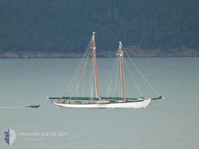
The vessel ZODIAC (IMO: 7937587, MMSI: 366968070) is a Sailing It's sailing under the flag of [US] USA.
In this page you can find informations about the vessels current position, last detected port calls, and current voyage information. If the vessels is not in coverage by AIS you will find the latest position.
The current position of ZODIAC is detected by our AIS receivers and we are not responsible for the reliability of the data. The last position was recorded while the vessel was in Coverage by the Ais receivers of our vessel tracking app.
The current draught of ZODIAC as reported by AIS is 4.9 meters
Weather
| Temperature | 7.1°C / 44.78°F |
|---|---|
| Wind Speed | 3 knots |
| Direction | 188° S |
| Pressure | 1017.2 hPa |
| Humidity | 92.3 % |
| Cloud Coverage | 100 % |
Featured Company
Last Port Calls
| Port | Arrival | Departure | Time In Port |
|---|---|---|---|
| 2024-04-26 19:48 | |||
| 2024-04-05 20:35 | 2024-04-23 18:29 | 17 d | |
| 2024-03-22 21:48 | 2024-04-02 18:08 | 10 d | |
| 2024-03-20 17:45 | 2024-03-20 19:38 | 1 h | |
| 2024-02-19 00:52 | 2024-03-18 18:30 | 28 d | |
| 2024-02-18 16:08 |
Most Visited Ports (Last year)
| Port | Arrivals | |
|---|---|---|
| 94 | ||
| 4 | ||
| 2 | ||
| 1 | ||
| 1 | ||
| 1 |
Last Trips
| Origin | Departure | Destination | Arrival | Distance | |
|---|---|---|---|---|---|
| 2024-04-23 11:29 | 2024-04-26 12:48 | 84.06 nm | |||
| 2024-04-02 11:08 | 2024-04-05 13:35 | 66.05 nm | |||
| 2024-03-20 12:38 | 2024-03-22 14:48 | 59.18 nm | |||
| 2024-03-18 11:30 | 2024-03-20 10:45 | 42.77 nm | |||
| 2024-02-18 08:08 | 2024-02-18 16:52 | 71.74 nm |
Events
| Tid | Event | Detaljer | Position / Dest | Information |
|---|---|---|---|---|
| 2024-04-26 19:57 | STOPPAR förflyttning |
48.72361 / -122.51305
[US] BELLINGHAM
|
Fart: 0.3 kn Kurs: 511° |
|
| 2024-04-26 19:48 | ANLÄNDER HAMN |
|
48.72301 / -122.51951
[US] BELLINGHAM
|
Fart: 5.5 kn Kurs: 49.2° |
| 2024-04-26 17:08 | STARTAR förflyttning | 4.92 nm, South East of ORCAS |
48.54336 / -122.84924
BELLINGHAM
|
Fart: 4 kn Kurs: 22.4° |
| 2024-04-25 22:54 | STOPPAR förflyttning | 4.96 nm, South East of ORCAS |
48.54156 / -122.85021
BELLINGHAM
|
Fart: 0.2 kn Kurs: 511° |
| 2024-04-25 22:40 | STARTAR förflyttning | 4.85 nm, South East of ORCAS |
48.54498 / -122.84952
BELLINGHAM
|
Fart: 3.1 kn Kurs: 208.8° |
| 2024-04-25 22:11 | STOPPAR förflyttning | 5.03 nm, South East of ORCAS |
48.54689 / -122.84135
BELLINGHAM
|
Fart: 0.1 kn Kurs: 511° |
| 2024-04-25 20:09 | STARTAR förflyttning | 3.93 nm, East of ORCAS |
48.59732 / -122.84411
BELLINGHAM
|
Fart: 3.1 kn Kurs: 49.5° |
| 2024-04-25 19:56 | STOPPAR förflyttning | 3.71 nm, East of ORCAS |
48.59694 / -122.84968
BELLINGHAM
|
Fart: 0.2 kn Kurs: 511° |
| 2024-04-25 18:40 | STARTAR förflyttning | 1.98 nm, North East of FRIDAY HARBOR |
48.56245 / -122.98235
BELLINGHAM
|
Fart: 3.7 kn Kurs: 292.6° |
| 2024-04-25 02:12 | STOPPAR förflyttning | 2.04 nm, North East of FRIDAY HARBOR |
48.56211 / -122.97953
BELLINGHAM
|
Fart: 0.1 kn Kurs: 511° |