
ZIM JADE
Cargo
Current Trip
| Time Travelled | --- |
|---|---|
| Remaining Time | --- |
| Distance Travelled | 3714.93 nm |
| Remaining Distance | --- |
| AVG Speed | 12 Knop |
| MAX Speed | 15.6 Knop |
| AVG Wind | 11.1 knots |
| MAX Wind | 18 knots |
| MIN Temp | 0.2°C / 32.36°F |
| MAX Temp | 26.5°C / 79.7°F |
| Djupgående | 13.3 m |
| Position mottagen | 8 d sen |
Current Position
| Longitud | --- |
|---|---|
| Latitude | --- |
| Status | Under way using engine |
| Fart | 11.5 Knop |
| Kurs | 152.8° |
| Område | South China Sea |
| Station | T-AIS |
| Position mottagen | 8 d sen |
Info
Information
The current position of ZIM JADE is in South China Sea with coordinates 22.24978° / 114.11643° as reported on 2025-03-03 14:14 by AIS to our vessel tracker app. The vessel's current speed is 11.5 Knop
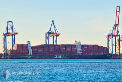
The vessel ZIM JADE (IMO: 9968059, MMSI: 477965700) is a Cargo It's sailing under the flag of [HK] Hong Kong.
In this page you can find informations about the vessels current position, last detected port calls, and current voyage information. If the vessels is not in coverage by AIS you will find the latest position.
The current position of ZIM JADE is detected by our AIS receivers and we are not responsible for the reliability of the data. The last position was recorded while the vessel was in Coverage by the Ais receivers of our vessel tracking app.
The current draught of ZIM JADE as reported by AIS is 13.3 meters
Weather
| Temperature | 21.2°C / 70.16°F |
|---|---|
| Wind Speed | 6 knots |
| Direction | 129° SE |
| Pressure | 1011 hPa |
| Humidity | 92.7 % |
| Cloud Coverage | 45 % |
Featured Company
Last Port Calls
Last Trips
| Origin | Departure | Destination | Arrival | Distance |
|---|
Events
| Tid | Event | Detaljer | Position / Dest | Information |
|---|---|---|---|---|
| 2025-03-03 14:14 | UTANFÖR täckningsområde |
22.24978 / 114.11643
South China Sea
VNTCT
|
Fart: 11.5 kn Kurs: 152.8° |
|
| 2025-03-03 12:02 | Djupgående ändrat | 13.3 12 |
22.49601 / 113.85694
VNTCT
|
Fart: 9.4 kn Kurs: 170° |
| 2025-03-03 12:02 | Destination ändrad | VNTCT CNDCB |
22.49601 / 113.85694
VNTCT
|
Fart: 9.4 kn Kurs: 170° |
| 2025-03-03 12:02 | ETA ändrat | 2025/03/06 01:00 2025/03/02 18:00 |
22.49601 / 113.85694
VNTCT
|
Fart: 9.4 kn Kurs: 170° |
| 2025-03-03 11:27 | I täckningsområde |
22.53603 / 113.85225
South China Sea
|
Fart: 1 kn Kurs: 280.7° |
|
| 2025-03-02 19:09 | UTANFÖR täckningsområde |
22.53605 / 113.85246
South China Sea
CNDCB
|
Fart: 0.9 kn Kurs: 43.5° |
|
| 2025-03-02 16:20 | Djupgående ändrat | 12 12.2 |
22.27586 / 114.10868
CNDCB
|
Fart: 12.3 kn Kurs: 332.5° |
| 2025-03-02 16:20 | Destination ändrad | CNDCB HKHKG ANCH |
22.27586 / 114.10868
CNDCB
|
Fart: 12.3 kn Kurs: 332.5° |
| 2025-03-02 16:20 | ETA ändrat | 2025/03/02 18:00 2025/03/01 07:00 |
22.27586 / 114.10868
CNDCB
|
Fart: 12.3 kn Kurs: 332.5° |
| 2025-03-02 16:15 | I täckningsområde |
22.26617 / 114.11442
South China Sea
|
Fart: 13.7 kn Kurs: 328.1° |