
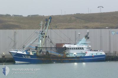
Z510 DENNIS
Fishing
Current Trip
| Time Travelled | 9 h, 0 mins |
|---|---|
| Remaining Time | 15 h, 53 mins |
| Distance Travelled | 54.90 nm |
| Remaining Distance | 121.83 nm |
| AVG Speed | 5.4 Knop |
| MAX Speed | 9.4 Knop |
| AVG Wind | 7 knots |
| MAX Wind | 10.9 knots |
| MIN Temp | 12.6°C / 54.68°F |
| MAX Temp | 15.8°C / 60.44°F |
| Djupgående | 0 m |
| Position mottagen | 1 m sen |
Current Position
| Longitud | 3.20675° |
|---|---|
| Latitude | 51.34376° |
| Status | Under way using engine |
| Fart | 5.3 Knop |
| Kurs | 181.2° |
| Område | North Sea |
| Station | T-AIS |
| Position mottagen | 1 m sen |
Info
Information
The current position of Z510 DENNIS is in North Sea with coordinates 51.34376° / 3.20675° as reported on 2024-05-01 01:05 by AIS to our vessel tracker app. The vessel's current speed is 5.3 Knop and is heading at the port of DEN HELDER. The estimated time of arrival as calculated by MyShipTracking vessel tracking app is 2024-05-01 16:59 LT
The vessel Z510 DENNIS (IMO: 9215969, MMSI: 205246000) is a Fishing It's sailing under the flag of [BE] Belgium.
In this page you can find informations about the vessels current position, last detected port calls, and current voyage information. If the vessels is not in coverage by AIS you will find the latest position.
The current position of Z510 DENNIS is detected by our AIS receivers and we are not responsible for the reliability of the data. The last position was recorded while the vessel was in Coverage by the Ais receivers of our vessel tracking app.
Weather
| Temperature | 13.6°C / 56.48°F |
|---|---|
| Wind Speed | 5 knots |
| Direction | 148° SSE |
| Pressure | 1010.1 hPa |
| Humidity | 95.1 % |
| Cloud Coverage | 100 % |
Featured Company
Last Port Calls
| Port | Arrival | Departure | Time In Port |
|---|---|---|---|
| 2024-04-07 12:15 | 2024-04-30 16:06 | 23 d | |
| 2024-04-01 11:34 | 2024-04-07 04:36 | 5 d |
Last Trips
| Origin | Departure | Destination | Arrival | Distance | |
|---|---|---|---|---|---|
| 2024-04-07 06:36 | 2024-04-07 14:15 | 54.24 nm | |||
| 2024-02-29 19:01 | 2024-04-01 13:34 | 1158.74 nm |
Events
| Tid | Event | Detaljer | Position / Dest | Information |
|---|---|---|---|---|
| 2024-04-30 23:25 | Byter havsområde | Belgian part of the North Sea Dutch part of the North Sea |
51.51009 / 3.15523
North Sea
|
Fart: 8.1 kn Kurs: 222° |
| 2024-04-30 18:08 | STARTAR förflyttning | 4.91 nm, North West of OUDDORP |
51.85442 / 3.83926
FISHING GROUNDS
|
Fart: 4.4 kn Kurs: 245° |
| 2024-04-30 18:07 | STOPPAR förflyttning | 4.86 nm, North West of OUDDORP |
51.85498 / 3.84212
FISHING GROUNDS
|
Fart: Kurs: 0° |
| 2024-04-30 16:06 | AVGÅTT HAMN |
|
51.83197 / 4.03662
FISHING GROUNDS
|
Fart: 5.3 kn Kurs: 42° |
| 2024-04-30 16:02 | STARTAR förflyttning |
51.82697 / 4.03234
[NL] STELLENDAM
|
Fart: 5.1 kn Kurs: 331° |
|
| 2024-04-30 06:34 | STOPPAR förflyttning |
51.82604 / 4.03486
[NL] STELLENDAM
|
Fart: 0.3 kn Kurs: 244° |
|
| 2024-04-30 06:32 | STARTAR förflyttning |
51.82483 / 4.03746
[NL] STELLENDAM
|
Fart: 4.3 kn Kurs: 309° |
|
| 2024-04-30 06:17 | STOPPAR förflyttning |
51.82366 / 4.03973
[NL] STELLENDAM
|
Fart: 0.1 kn Kurs: 304° |
|
| 2024-04-30 06:13 | STARTAR förflyttning |
51.82274 / 4.04142
[NL] STELLENDAM
|
Fart: 3.1 kn Kurs: 313° |