

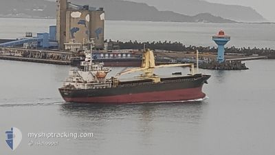
YUSHO STELLA
General Cargo

Current Trip
| Trip Time | 2 days |
|---|---|
| Trip Distance | 341.73 nm |
| AVG Speed | 8.5 Knop |
| MAX Speed | 12.9 Knop |
| Djupgående | 5 m |
| AVG Wind | 19.6 knots |
| MAX Wind | 31 knots |
| MIN Temp | 11.3°C / 52.34°F |
| MAX Temp | 23.2°C / 73.76°F |
| Position mottagen | 17 h, 16 m sen |
Current Position
| Longitud | --- |
|---|---|
| Latitude | --- |
| Status | Under way using engine |
| Fart | 8.9 Knop |
| Kurs | 155° |
| Område | Eastern China Sea |
| Station | T-AIS |
| Position mottagen | 17 h, 16 m sen |
Information
The current position of YUSHO STELLA is in Eastern China Sea with coordinates 25.18860° / 121.74298° as reported on 2025-03-28 23:22 by AIS to our vessel tracker app. The vessel's current speed is 8.9 Knop and is currently inside the port of KEELUNG.
The vessel YUSHO STELLA (IMO: 9364863, MMSI: 416008000) is a General Cargo that was built in 2006 ( 19 År gammal ). It's sailing under the flag of [TW] Taiwan.
In this page you can find informations about the vessels current position, last detected port calls, and current voyage information. If the vessels is not in coverage by AIS you will find the latest position.
The current position of YUSHO STELLA is detected by our AIS receivers and we are not responsible for the reliability of the data. The last position was recorded while the vessel was in Coverage by the Ais receivers of our vessel tracking app.
The current draught of YUSHO STELLA as reported by AIS is 5 meters
Weather
| Temperature | 16.1°C / 60.98°F |
|---|---|
| Wind Speed | 21 knots |
| Direction | 48° NE |
| Pressure | 1023.8 hPa |
| Humidity | 77.9 % |
| Cloud Coverage | 100 % |


Featured Company
Last Port Calls
| Port | Arrival | Departure | Time In Port |
|---|---|---|---|
| 2025-03-29 07:38 | |||
| 2025-03-26 06:34 | 2025-03-26 22:18 | 15 h | |
| 2025-03-25 15:15 | 2025-03-25 21:58 | 6 h | |
| 2025-03-24 07:53 | 2025-03-25 03:15 | 19 h | |
| 2025-03-20 23:49 | 2025-03-21 23:29 | 23 h | |
| 2025-03-20 07:58 | 2025-03-20 15:50 | 7 h | |
| 2025-03-19 02:02 | 2025-03-19 23:04 | 21 h | |
| 2025-03-18 11:26 | 2025-03-18 17:35 | 6 h | |
| 2025-03-16 06:53 | 2025-03-18 02:46 | 1 d | |
| 2025-03-13 05:25 | 2025-03-13 23:02 | 17 h |
Last Trips
| Origin | Departure | Destination | Arrival | Distance | |
|---|---|---|---|---|---|
| 2025-03-26 22:18 | 2025-03-29 07:38 | 341.73 nm | |||
| 2025-03-25 21:58 | 2025-03-26 06:34 | 94.36 nm | |||
| 2025-03-25 03:15 | 2025-03-25 15:15 | 130.05 nm | |||
| 2025-03-21 23:29 | 2025-03-24 07:53 | 301.80 nm | |||
| 2025-03-20 15:50 | 2025-03-20 23:49 | 93.02 nm | |||
| 2025-03-19 23:04 | 2025-03-20 07:58 | 95.47 nm | |||
| 2025-03-18 17:35 | 2025-03-19 02:02 | 94.59 nm | |||
| 2025-03-18 02:46 | 2025-03-18 11:26 | 94.00 nm | |||
| 2025-03-13 23:02 | 2025-03-16 06:53 | 315.98 nm | |||
| 2025-03-10 22:29 | 2025-03-13 05:25 | 313.49 nm |
Events
| Tid | Event | Detaljer | Position / Dest | Information |
|---|---|---|---|---|
| 2025-03-28 23:54 | STOPPAR förflyttning |
25.15330 / 121.74905
[TW] KEELUNG
|
Fart: Kurs: 55° |
|
| 2025-03-28 23:38 | ANLÄNDER HAMN |
|
25.15687 / 121.75510
[TW] KEELUNG
|
Fart: 8.3 kn Kurs: 145° |
| 2025-03-28 23:30 | Status ändrad | Default Under way using engine |
25.17092 / 121.74654
CHANGWAN
|
Fart: 8.9 kn Kurs: 155° |
| 2025-03-28 23:22 | UTANFÖR täckningsområde |
25.18860 / 121.74298
Eastern China Sea
[TW] KEELUNG
|
Fart: 8.9 kn Kurs: 155° |
|
| 2025-03-28 23:17 | Status ändrad | Under way using engine Default |
25.20040 / 121.73688
CHANGWAN
|
Fart: 8.3 kn Kurs: 159° |
| 2025-03-28 22:58 | I täckningsområde |
25.20040 / 121.73688
Eastern China Sea
|
Fart: 8.4 kn Kurs: 149° |
|
| 2025-03-28 00:10 | STARTAR förflyttning | 4.32 nm, South West of NINGDE |
26.74630 / 119.64422
CHANGWAN
|
Fart: 6.1 kn Kurs: 106° |
| 2025-03-27 08:06 | STOPPAR förflyttning | 4.65 nm, South West of NINGDE |
26.74690 / 119.63725
CHANGWAN
|
Fart: 0.3 kn Kurs: 154° |
| 2025-03-26 14:30 | Status ändrad | Default Under way using engine |
25.20478 / 121.76714
CHANGWAN
|
Fart: 11.3 kn Kurs: 23° |
| 2025-03-26 14:22 | UTANFÖR täckningsområde |
25.18115 / 121.75803
Eastern China Sea
CHANGWAN
|
Fart: 11.3 kn Kurs: 23° |