
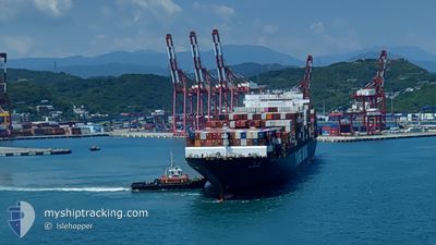
YM UNICORN
Container Ship
Current Trip
| Time Travelled | 12 days |
|---|---|
| Remaining Time | --- |
| Distance Travelled | 3037.86 nm |
| Remaining Distance | --- |
| AVG Speed | 10.7 Knop |
| MAX Speed | 18.7 Knop |
| AVG Wind | 18.4 knots |
| MAX Wind | 41 knots |
| MIN Temp | -5.7°C / 21.74°F |
| MAX Temp | 21.3°C / 70.34°F |
| Djupgående | 13.3 m |
| Position mottagen | 5 d sen |
Current Position
| Longitud | --- |
|---|---|
| Latitude | --- |
| Status | Under way using engine |
| Fart | 10.8 Knop |
| Kurs | 85.7° |
| Område | Japan Sea |
| Station | T-AIS |
| Position mottagen | 5 d sen |
Info
Information
The current position of YM UNICORN is in Japan Sea with coordinates 41.63417° / 141.23467° as reported on 2025-03-05 17:24 by AIS to our vessel tracker app. The vessel's current speed is 10.8 Knop and is heading at the port of TACOMA. The estimated time of arrival as calculated by MyShipTracking vessel tracking app is 2025-03-26 06:00 LT
The vessel YM UNICORN (IMO: 9462732, MMSI: 416464000) is a Container Ship that was built in 2013 ( 12 År gammal ). It's sailing under the flag of [TW] Taiwan.
In this page you can find informations about the vessels current position, last detected port calls, and current voyage information. If the vessels is not in coverage by AIS you will find the latest position.
The current position of YM UNICORN is detected by our AIS receivers and we are not responsible for the reliability of the data. The last position was recorded while the vessel was in Coverage by the Ais receivers of our vessel tracking app.
The current draught of YM UNICORN as reported by AIS is 13.3 meters
Weather
| Temperature | -4.1°C / 24.62°F |
|---|---|
| Wind Speed | 19 knots |
| Direction | 322° NW |
| Pressure | 1015.2 hPa |
| Humidity | 54.3 % |
| Cloud Coverage | 100 % |
Featured Company
Last Port Calls
| Port | Arrival | Departure | Time In Port |
|---|---|---|---|
| 2025-02-26 02:29 | 2025-02-27 04:05 | 1 d | |
| 2025-02-19 12:07 | 2025-02-20 00:43 | 12 h | |
| 2025-02-15 06:25 | 2025-02-16 04:45 | 22 h | |
| 2025-02-11 11:21 | 2025-02-12 08:06 | 20 h |
Most Visited Ports (Last year)
| Port | Arrivals | |
|---|---|---|
| 13 | ||
| 12 | ||
| 7 | ||
| 5 | ||
| 5 | ||
| 1 |
Last Trips
| Origin | Departure | Destination | Arrival | Distance | |
|---|---|---|---|---|---|
| 2025-02-20 07:43 | 2025-02-26 10:29 | 1535.47 nm | |||
| 2025-02-16 11:45 | 2025-02-19 19:07 | 804.86 nm | |||
| 2025-02-12 16:06 | 2025-02-15 13:25 | 824.74 nm | |||
| 2024-12-16 23:25 | 2025-02-11 19:21 | 2309.74 nm |
Events
| Tid | Event | Detaljer | Position / Dest | Information |
|---|---|---|---|---|
| 2025-03-05 17:29 | Status ändrad | Default Under way using engine |
41.63517 / 141.25217
CNYTN > USTIW
|
Fart: 10.8 kn Kurs: 85.7° |
| 2025-03-05 17:24 | UTANFÖR täckningsområde |
41.63417 / 141.23467
Japan Sea
CNYTN > USTIW
|
Fart: 10.8 kn Kurs: 85.7° |
|
| 2025-03-05 16:56 | Status ändrad | Under way using engine Default |
41.62248 / 141.12271
CNYTN > USTIW
|
Fart: 11.8 kn Kurs: 83° |
| 2025-03-05 16:47 | Status ändrad | Default Under way using engine |
41.61883 / 141.08200
CNYTN > USTIW
|
Fart: 11.7 kn Kurs: 84.1° |
| 2025-03-05 14:46 | Status ändrad | Under way using engine Default |
41.45550 / 140.59633
CNYTN > USTIW
|
Fart: 12.8 kn Kurs: 54° |
| 2025-03-05 14:46 | Status ändrad | Default Under way using engine |
41.45383 / 140.59317
CNYTN > USTIW
|
Fart: 12.8 kn Kurs: 54.4° |
| 2025-03-05 14:40 | Status ändrad | Under way using engine Default |
41.44217 / 140.57017
CNYTN > USTIW
|
Fart: 12.8 kn Kurs: 55° |
| 2025-03-05 14:30 | Status ändrad | Default Under way using engine |
41.42233 / 140.52983
CNYTN > USTIW
|
Fart: 12.4 kn Kurs: 59° |
| 2025-03-05 13:57 | Status ändrad | Under way using engine Default |
41.36533 / 140.39250
CNYTN > USTIW
|
Fart: 13 kn Kurs: 54° |
| 2025-03-05 13:33 | Status ändrad | Default Under way using engine |
41.31617 / 140.29849
CNYTN > USTIW
|
Fart: 12.4 kn Kurs: 60.9° |