
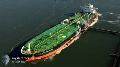
YASA SOUTHERN CROSS
Crude Oil Tanker
Current Trip
| Time Travelled | 1 day |
|---|---|
| Remaining Time | 13 h, 48 mins |
| Distance Travelled | 118.24 nm |
| Remaining Distance | 32.80 nm |
| AVG Speed | 7.4 Knop |
| MAX Speed | 13 Knop |
| AVG Wind | 28 knots |
| MAX Wind | 34 knots |
| MIN Temp | 14.1°C / 57.38°F |
| MAX Temp | 17°C / 62.6°F |
| Djupgående | 13.4 m |
| Position mottagen | Nu |
Current Position
| Longitud | --- |
|---|---|
| Latitude | --- |
| Status | Under way using engine |
| Fart | 1.4 Knop |
| Kurs | 338° |
| Område | English Channel |
| Station | T-AIS |
| Position mottagen | Nu |
Info
Information
The current position of YASA SOUTHERN CROSS is in English Channel with coordinates 50.47879° / -1.03809° as reported on 2024-10-01 01:35 by AIS to our vessel tracker app. The vessel's current speed is 1.4 Knop and is heading at the port of FAWLEY. The estimated time of arrival as calculated by MyShipTracking vessel tracking app is 2024-10-01 16:23 LT
The vessel YASA SOUTHERN CROSS (IMO: 9534030, MMSI: 538009409) is a Crude Oil Tanker that was built in 2012 ( 12 År gammal ). It's sailing under the flag of [MH] Marshall Is.
In this page you can find informations about the vessels current position, last detected port calls, and current voyage information. If the vessels is not in coverage by AIS you will find the latest position.
The current position of YASA SOUTHERN CROSS is detected by our AIS receivers and we are not responsible for the reliability of the data. The last position was recorded while the vessel was in Coverage by the Ais receivers of our vessel tracking app.
The current draught of YASA SOUTHERN CROSS as reported by AIS is 13.4 meters
Weather
| Temperature | 14.2°C / 57.56°F |
|---|---|
| Wind Speed | 21 knots |
| Direction | 288° WNW |
| Pressure | 1010.6 hPa |
| Humidity | 76.4 % |
| Cloud Coverage | --- |
Featured Company
Last Trips
| Origin | Departure | Destination | Arrival | Distance |
|---|
Events
| Tid | Event | Detaljer | Position / Dest | Information |
|---|---|---|---|---|
| 2024-10-01 00:02 | ETA ändrat | 2025/09/29 23:00 2024/09/29 23:00 |
50.44494 / -.94422
GB FAW
|
Fart: 3.8 kn Kurs: 266° |
| 2024-09-30 19:10 | STARTAR förflyttning | 7.01 nm, South East of SANDOWN |
50.56060 / -1.03689
GB FAW
|
Fart: 3.1 kn Kurs: 205° |
| 2024-09-30 16:29 | STOPPAR förflyttning | 6.64 nm, South East of SANDOWN |
50.56617 / -1.04179
GB FAW
|
Fart: 0.3 kn Kurs: 251° |
| 2024-09-30 12:28 | Status ändrad | Under way using engine Default |
50.52699 / -1.22847
GB FAW
|
Fart: 2.6 kn Kurs: 69° |
| 2024-09-30 12:27 | Status ändrad | Default Under way using engine |
50.52669 / -1.22918
GB FAW
|
Fart: 2.6 kn Kurs: 69° |
| 2024-09-30 11:32 | Status ändrad | Under way using engine At anchor |
50.53801 / -1.18840
GB FAW
|
Fart: 3.4 kn Kurs: 270° |
| 2024-09-30 11:15 | STARTAR förflyttning | 6.8 nm, South of SANDOWN |
50.53802 / -1.16376
GB FAW
|
Fart: 3.1 kn Kurs: 271° |
| 2024-09-30 08:22 | STOPPAR förflyttning | 6.2 nm, South East of SANDOWN |
50.55639 / -1.08783
GB FAW
|
Fart: 0.1 kn Kurs: 241° |
| 2024-09-30 07:35 | STARTAR förflyttning | 6.87 nm, South East of SANDOWN |
50.56142 / -1.04143
GB FAW
|
Fart: 3.1 kn Kurs: 250° |
| 2024-09-30 00:32 | Status ändrad | At anchor Default |
50.55576 / -1.07444
GB FAW
|
Fart: Kurs: 107° |