

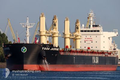
YASA JASMINE
Cargo

Current Trip
| Time Travelled | 1 day |
|---|---|
| Remaining Time | --- |
| Distance Travelled | 392.47 nm |
| Remaining Distance | --- |
| AVG Speed | 9.6 Knop |
| MAX Speed | 13.5 Knop |
| AVG Wind | 15.7 knots |
| MAX Wind | 35 knots |
| MIN Temp | 6.6°C / 43.88°F |
| MAX Temp | 10.7°C / 51.26°F |
| Djupgående | 10.1 m |
| Position mottagen | 1 d sen |
Current Position
| Longitud | --- |
|---|---|
| Latitude | --- |
| Status | Under way using engine |
| Fart | 7.8 Knop |
| Kurs | 268.8° |
| Område | North Pacific Ocean |
| Station | T-AIS |
| Position mottagen | 1 d sen |
Information
The current position of YASA JASMINE is in North Pacific Ocean with coordinates 46.19423° / -125.09222° as reported on 2025-02-22 19:03 by AIS to our vessel tracker app. The vessel's current speed is 7.8 Knop and is heading at the port of KANDLA. The estimated time of arrival as calculated by MyShipTracking vessel tracking app is 2025-03-30 12:00 LT
The vessel YASA JASMINE (IMO: 9955636, MMSI: 538010512) is a Cargo It's sailing under the flag of [MH] Marshall Is.
In this page you can find informations about the vessels current position, last detected port calls, and current voyage information. If the vessels is not in coverage by AIS you will find the latest position.
The current position of YASA JASMINE is detected by our AIS receivers and we are not responsible for the reliability of the data. The last position was recorded while the vessel was in Coverage by the Ais receivers of our vessel tracking app.
The current draught of YASA JASMINE as reported by AIS is 10.1 meters
Weather
| Temperature | 9.1°C / 48.38°F |
|---|---|
| Wind Speed | 29 knots |
| Direction | 236° SW |
| Pressure | 1004.3 hPa |
| Humidity | 82.2 % |
| Cloud Coverage | 20 % |


Featured Company
Last Port Calls
| Port | Arrival | Departure | Time In Port |
|---|---|---|---|
| 2025-02-16 19:42 | 2025-02-22 06:07 | 5 d | |
| 2025-02-05 04:10 | 2025-02-05 23:50 | 19 h | |
| 2025-01-30 23:04 | 2025-02-04 15:33 | 4 d | |
| 2025-01-24 22:11 | 2025-01-27 12:19 | 2 d | |
| 2024-12-27 13:56 | 2025-01-01 15:01 | 5 d | |
| 2024-12-24 21:05 | 2024-12-27 08:24 | 2 d | |
| 2024-12-05 10:36 | 2024-12-07 23:07 | 2 d |
Last Trips
| Origin | Departure | Destination | Arrival | Distance | |
|---|---|---|---|---|---|
| 2025-02-05 15:50 | 2025-02-16 11:42 | 1178.42 nm | |||
| 2025-02-04 07:33 | 2025-02-04 20:10 | 150.14 nm | |||
| 2025-01-27 04:19 | 2025-01-30 15:04 | 1013.92 nm | |||
| 2025-01-02 00:01 | 2025-01-24 14:11 | 5265.53 nm | |||
| 2024-12-27 17:24 | 2024-12-27 22:56 | 46.68 nm | |||
| 2024-12-08 06:07 | 2024-12-25 06:05 | 2165.07 nm | |||
| 2024-11-08 06:31 | 2024-12-05 17:36 | 5645.21 nm |
Events
| Tid | Event | Detaljer | Position / Dest | Information |
|---|---|---|---|---|
| 2025-02-22 19:11 | Status ändrad | Default Under way using engine |
46.19403 / -125.11589
INIXY
|
Fart: 7.8 kn Kurs: 268.8° |
| 2025-02-22 19:03 | UTANFÖR täckningsområde |
46.19423 / -125.09222
North Pacific Ocean
|
Fart: 7.8 kn Kurs: 268.8° |
|
| 2025-02-22 07:29 | Status ändrad | Under way using engine Default |
45.88850 / -122.80130
INIXY
|
Fart: 13 kn Kurs: 331° |
| 2025-02-22 07:19 | I täckningsområde |
45.89543 / -122.80460
North Pacific Ocean
|
Fart: 13.2 kn Kurs: 346.4° |
|
| 2025-02-22 06:28 | Status ändrad | Default Under way using engine |
45.68205 / -122.77478
INIXY
|
Fart: 11.7 kn Kurs: 357.9° |
| 2025-02-22 06:27 | Status ändrad | Under way using engine Default |
45.68033 / -122.77470
INIXY
|
Fart: 11.8 kn Kurs: 341° |
| 2025-02-22 06:27 | UTANFÖR täckningsområde |
45.68033 / -122.77470
North Pacific Ocean
|
Fart: 11.7 kn Kurs: 357.9° |
|
| 2025-02-22 06:12 | I täckningsområde |
45.68033 / -122.77470
North Pacific Ocean
|
Fart: 11.7 kn Kurs: 357.9° |
|
| 2025-02-22 06:07 | AVGÅTT HAMN |
|
45.64201 / -122.72736
INIXY
|
Fart: 7.3 kn Kurs: 299° |
| 2025-02-22 05:59 | STARTAR förflyttning |
45.63443 / -122.70599
[US] VANCOUVER
|
Fart: 6.5 kn Kurs: 300° |