
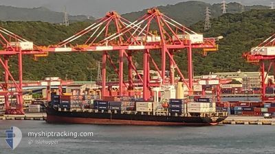
XINDE KEELUNG
Container Ship
Current Trip
| Time Travelled | 1 day |
|---|---|
| Remaining Time | 1 day |
| Distance Travelled | 446.02 nm |
| Remaining Distance | 446.46 nm |
| AVG Speed | 14.2 Knop |
| MAX Speed | 15.3 Knop |
| AVG Wind | 18.3 knots |
| MAX Wind | 23.9 knots |
| MIN Temp | 13.4°C / 56.12°F |
| MAX Temp | 20.6°C / 69.08°F |
| Djupgående | 8.7 m |
| Position mottagen | 1 d sen |
Current Position
| Longitud | --- |
|---|---|
| Latitude | --- |
| Status | Under way using engine |
| Fart | 10.9 Knop |
| Kurs | 15° |
| Område | Eastern China Sea |
| Station | T-AIS |
| Position mottagen | 1 d sen |
Info
Information
The current position of XINDE KEELUNG is in Eastern China Sea with coordinates 25.19095° / 121.76395° as reported on 2024-11-21 09:08 by AIS to our vessel tracker app. The vessel's current speed is 10.9 Knop and is heading at the port of TAICHUNG. The estimated time of arrival as calculated by MyShipTracking vessel tracking app is 2024-11-24 01:42 LT
The vessel XINDE KEELUNG (IMO: 9159854, MMSI: 477314300) is a Container Ship that was built in 1997 ( 27 År gammal ). It's sailing under the flag of [HK] Hong Kong.
In this page you can find informations about the vessels current position, last detected port calls, and current voyage information. If the vessels is not in coverage by AIS you will find the latest position.
The current position of XINDE KEELUNG is detected by our AIS receivers and we are not responsible for the reliability of the data. The last position was recorded while the vessel was in Coverage by the Ais receivers of our vessel tracking app.
The current draught of XINDE KEELUNG as reported by AIS is 8.7 meters
Weather
| Temperature | 13.5°C / 56.3°F |
|---|---|
| Wind Speed | 14 knots |
| Direction | 13° NNE |
| Pressure | 1026.9 hPa |
| Humidity | 56.7 % |
| Cloud Coverage | 68 % |
Featured Company
Last Port Calls
| Port | Arrival | Departure | Time In Port |
|---|---|---|---|
| 2024-11-20 17:20 | 2024-11-21 17:00 | 23 h | |
| 2024-11-19 20:57 | 2024-11-20 07:26 | 10 h | |
| 2024-11-18 23:49 | 2024-11-19 08:16 | 8 h | |
| 2024-11-14 11:00 | 2024-11-14 21:48 | 10 h | |
| 2024-11-12 11:28 | 2024-11-13 00:40 | 13 h | |
| 2024-11-09 08:23 | 2024-11-09 14:25 | 6 h | |
| 2024-11-06 09:25 | 2024-11-07 00:38 | 15 h | |
| 2024-11-05 11:08 | 2024-11-05 23:01 | 11 h | |
| 2024-11-04 08:22 | 2024-11-05 00:28 | 16 h | |
| 2024-10-29 14:33 | 2024-10-30 07:36 | 17 h |
Last Trips
| Origin | Departure | Destination | Arrival | Distance | |
|---|---|---|---|---|---|
| 2024-11-20 07:26 | 2024-11-20 17:20 | 110.74 nm | |||
| 2024-11-19 08:16 | 2024-11-19 20:57 | 124.52 nm | |||
| 2024-11-14 21:48 | 2024-11-18 23:49 | 950.95 nm | |||
| 2024-11-13 00:40 | 2024-11-14 11:00 | 492.22 nm | |||
| 2024-11-09 14:25 | 2024-11-12 11:28 | 788.10 nm | |||
| 2024-11-07 00:38 | 2024-11-09 08:23 | 456.42 nm | |||
| 2024-11-05 23:01 | 2024-11-06 09:25 | 112.78 nm | |||
| 2024-11-05 00:28 | 2024-11-05 11:08 | 122.43 nm | |||
| 2024-10-30 07:36 | 2024-11-04 08:22 | 1003.58 nm | |||
| 2024-10-28 04:19 | 2024-10-29 14:33 | 489.47 nm |
Events
| Tid | Event | Detaljer | Position / Dest | Information |
|---|---|---|---|---|
| 2024-11-21 09:16 | Status ändrad | Default Under way using engine |
25.21620 / 121.77370
TWTXG
|
Fart: 10.9 kn Kurs: 15° |
| 2024-11-21 09:08 | UTANFÖR täckningsområde |
25.19095 / 121.76395
Eastern China Sea
|
Fart: 10.9 kn Kurs: 15° |
|
| 2024-11-21 09:03 | Status ändrad | Under way using engine Default |
25.17733 / 121.75818
TWTXG
|
Fart: 10.4 kn Kurs: 30° |
| 2024-11-21 09:00 | AVGÅTT HAMN |
|
25.17048 / 121.75338
TWTXG
|
Fart: 10.2 kn Kurs: 336° |
| 2024-11-21 08:57 | I täckningsområde |
25.17733 / 121.75818
Eastern China Sea
|
Fart: 10.4 kn Kurs: 32° |
|
| 2024-11-21 08:48 | STARTAR förflyttning |
25.14578 / 121.75587
[TW] KEELUNG
|
Fart: 4.6 kn Kurs: 13° |
|
| 2024-11-20 09:36 | STOPPAR förflyttning |
25.14328 / 121.75098
[TW] KEELUNG
|
Fart: Kurs: 233° |
|
| 2024-11-20 09:20 | ANLÄNDER HAMN |
|
25.15545 / 121.75485
[TW] KEELUNG
|
Fart: 9.8 kn Kurs: 147° |
| 2024-11-20 09:16 | Status ändrad | Default Under way using engine |
25.16583 / 121.74925
TWTXG
|
Fart: 7.7 kn Kurs: 172° |
| 2024-11-20 09:08 | UTANFÖR täckningsområde |
25.18303 / 121.74502
Eastern China Sea
[TW] KEELUNG
|
Fart: 7.7 kn Kurs: 172° |