

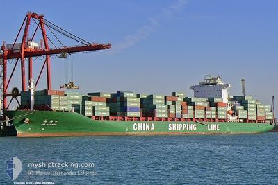
XIN HAI KOU
Container Ship

Current Trip
| Time Travelled | 12 days |
|---|---|
| Remaining Time | 17 h, 5 mins |
| Distance Travelled | 4740.78 nm |
| Remaining Distance | 511.58 nm |
| AVG Speed | 15.8 Knop |
| MAX Speed | 18.6 Knop |
| AVG Wind | 12.8 knots |
| MAX Wind | 27.8 knots |
| MIN Temp | 15.5°C / 59.9°F |
| MAX Temp | 29.3°C / 84.74°F |
| Djupgående | 12.8 m |
| Position mottagen | 4 d sen |
Current Position
| Longitud | --- |
|---|---|
| Latitude | --- |
| Status | Under way using engine |
| Fart | 15.1 Knop |
| Kurs | 294.1° |
| Område | Laccadive Sea |
| Station | T-AIS |
| Position mottagen | 4 d sen |
Information
The current position of XIN HAI KOU is in Laccadive Sea with coordinates 7.73720° / 75.55128° as reported on 2025-03-25 07:54 by AIS to our vessel tracker app. The vessel's current speed is 15.1 Knop and is heading at the port of KHALIFA. The estimated time of arrival as calculated by MyShipTracking vessel tracking app is 2025-03-30 05:13 LT
The vessel XIN HAI KOU (IMO: 9309954, MMSI: 413144000) is a Container Ship that was built in 2005 ( 20 År gammal ). It's sailing under the flag of [CN] China.
In this page you can find informations about the vessels current position, last detected port calls, and current voyage information. If the vessels is not in coverage by AIS you will find the latest position.
The current position of XIN HAI KOU is detected by our AIS receivers and we are not responsible for the reliability of the data. The last position was recorded while the vessel was in Coverage by the Ais receivers of our vessel tracking app.
The current draught of XIN HAI KOU as reported by AIS is 12.8 meters
Weather
| Temperature | 24.2°C / 75.56°F |
|---|---|
| Wind Speed | 2 knots |
| Direction | 117° ESE |
| Pressure | 1014.4 hPa |
| Humidity | 52.4 % |
| Cloud Coverage | --- |


Featured Company
Last Port Calls
| Port | Arrival | Departure | Time In Port |
|---|---|---|---|
| 2025-03-16 08:47 | 2025-03-17 02:56 | 18 h | |
| 2025-03-10 06:05 | 2025-03-10 18:46 | 12 h | |
| 2025-02-14 16:27 | 2025-02-17 00:06 | 2 d | |
| 2025-01-30 09:09 | 2025-01-31 10:41 | 1 d | |
| 2025-01-27 23:37 | 2025-01-29 05:33 | 1 d | |
| 2025-01-11 15:31 | 2025-01-13 00:24 | 1 d | |
| 2025-01-01 22:35 | 2025-01-02 08:17 | 9 h |
Last Trips
| Origin | Departure | Destination | Arrival | Distance | |
|---|---|---|---|---|---|
| 2025-03-10 18:46 | 2025-03-16 08:47 | 399.97 nm | |||
| 2025-02-17 00:06 | 2025-03-10 06:05 | 5955.63 nm | |||
| 2025-01-31 10:41 | 2025-02-14 16:27 | 4856.54 nm | |||
| 2025-01-29 05:33 | 2025-01-30 09:09 | 370.48 nm | |||
| 2025-01-13 00:24 | 2025-01-27 23:37 | 5055.68 nm | |||
| 2025-01-02 08:17 | 2025-01-11 15:31 | 3567.85 nm | |||
| 2024-12-28 13:57 | 2025-01-01 22:35 | 1455.75 nm |
Events
| Tid | Event | Detaljer | Position / Dest | Information |
|---|---|---|---|---|
| 2025-03-25 08:02 | Status ändrad | Default Under way using engine |
7.75068 / 75.52116
AEKHL
|
Fart: 15.1 kn Kurs: 294.1° |
| 2025-03-25 07:54 | Byter havsområde | Indian part of the Laccadive Sea Indonesian part of the Malacca Strait |
7.73720 / 75.55128
Laccadive Sea
AEKHL
|
Fart: 15.1 kn Kurs: 294.1° |
| 2025-03-25 07:54 | UTANFÖR täckningsområde |
7.73720 / 75.55128
Laccadive Sea
AEKHL
|
Fart: 15.1 kn Kurs: 294.1° |
|
| 2025-03-25 07:54 | Status ändrad | Under way using engine Default |
7.73665 / 75.55250
AEKHL
|
Fart: 15 kn Kurs: 298° |
| 2025-03-25 07:54 | I täckningsområde |
7.73720 / 75.55128
Laccadive Sea
AEKHL
|
Fart: 15.1 kn Kurs: 294.1° |
|
| 2025-03-20 16:17 | Status ändrad | Default Under way using engine |
1.26000 / 103.36504
AEKHL
|
Fart: 15.9 kn Kurs: 302.3° |
| 2025-03-20 16:13 | UTANFÖR täckningsområde |
1.24827 / 103.38180
Malacca Strait
AEKHL
|
Fart: 15.9 kn Kurs: 302.3° |
|
| 2025-03-20 16:12 | Status ändrad | Under way using engine Default |
1.24743 / 103.38310
AEKHL
|
Fart: 16 kn Kurs: 302° |
| 2025-03-20 16:02 | Status ändrad | Default Under way using engine |
1.22309 / 103.42486
AEKHL
|
Fart: 16.2 kn Kurs: 285.2° |
| 2025-03-20 15:57 | Byter havsområde | Indonesian part of the Malacca Strait Malaysian part of the Malacca Strait |
1.21434 / 103.44538
Malacca Strait
AEKHL
|
Fart: 16.2 kn Kurs: 285.2° |