
XIAO JIANG
Container Ship
Current Trip
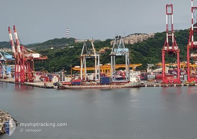
TAICHUNG
| Time Travelled | 1 day |
|---|---|
| Remaining Time | --- |
| Distance Travelled | 415.87 nm |
| Remaining Distance | --- |
| AVG Speed | 10.8 Knop |
| MAX Speed | 13.4 Knop |
| AVG Wind | 10.2 knots |
| MAX Wind | 24.8 knots |
| MIN Temp | 17.2°C / 62.96°F |
| MAX Temp | 25.8°C / 78.44°F |
| Djupgående | 5 m |
| Position mottagen | 2 d sen |
Current Position
| Longitud | 120.07810° |
|---|---|
| Latitude | 22.79714° |
| Status | Moored |
| Fart | 11 Knop |
| Kurs | 336.7° |
| Område | South China Sea |
| Station | T-AIS |
| Position mottagen | 2 d sen |
Info
Information
The current position of XIAO JIANG is in South China Sea with coordinates 22.79714° / 120.07810° as reported on 2024-04-26 01:07 by AIS to our vessel tracker app. The vessel's current speed is 11 Knop
The vessel XIAO JIANG (IMO: 9401269, MMSI: 413690160) is a Container Ship that was built in 2006 ( 18 År gammal ). It's sailing under the flag of [CN] China.
In this page you can find informations about the vessels current position, last detected port calls, and current voyage information. If the vessels is not in coverage by AIS you will find the latest position.
The current position of XIAO JIANG is detected by our AIS receivers and we are not responsible for the reliability of the data. The last position was recorded while the vessel was in Coverage by the Ais receivers of our vessel tracking app.
The current draught of XIAO JIANG as reported by AIS is 5 meters
Weather
| Temperature | 17.2°C / 62.96°F |
|---|---|
| Wind Speed | 16 knots |
| Direction | 134° SE |
| Pressure | 1007.7 hPa |
| Humidity | 99.1 % |
| Cloud Coverage | 100 % |
Featured Company
Last Port Calls
| Port | Arrival | Departure | Time In Port |
|---|---|---|---|
| 2024-04-26 10:24 | 2024-04-26 16:44 | 6 h | |
| 2024-04-25 17:53 | 2024-04-25 23:45 | 5 h | |
| 2024-04-24 12:30 | 2024-04-24 19:14 | 6 h | |
| 2024-04-22 08:00 | 2024-04-22 19:52 | 11 h | |
| 2024-04-20 01:04 | 2024-04-20 08:40 | 7 h | |
| 2024-04-19 08:19 | 2024-04-19 13:42 | 5 h | |
| 2024-04-18 00:32 | 2024-04-18 09:08 | 8 h | |
| 2024-04-15 15:39 | 2024-04-16 05:07 | 13 h | |
| 2024-04-12 18:58 | 2024-04-12 23:38 | 4 h | |
| 2024-04-12 01:14 | 2024-04-12 07:00 | 5 h |
Last Trips
| Origin | Departure | Destination | Arrival | Distance | |
|---|---|---|---|---|---|
| 2024-04-26 07:45 | 2024-04-26 18:24 | 122.21 nm | |||
| 2024-04-25 03:14 | 2024-04-26 01:53 | 230.39 nm | |||
| 2024-04-23 03:52 | 2024-04-24 20:30 | 434.78 nm | |||
| 2024-04-20 16:40 | 2024-04-22 16:00 | 507.68 nm | |||
| 2024-04-19 21:42 | 2024-04-20 09:04 | 123.47 nm | |||
| 2024-04-18 17:08 | 2024-04-19 16:19 | 212.49 nm | |||
| 2024-04-16 13:07 | 2024-04-18 08:32 | 459.88 nm | |||
| 2024-04-13 07:38 | 2024-04-15 23:39 | 513.95 nm | |||
| 2024-04-12 15:00 | 2024-04-13 02:58 | 124.56 nm | |||
| 2024-04-11 09:53 | 2024-04-12 09:14 | 231.92 nm |
Events
| Tid | Event | Detaljer | Position / Dest | Information |
|---|---|---|---|---|
| 2024-04-26 16:44 | AVGÅTT HAMN |
|
24.29338 / 120.49548
TAICHUNG
|
Fart: 8.3 kn Kurs: 294° |
| 2024-04-26 16:31 | STARTAR förflyttning |
24.27938 / 120.52252
[TW] TAICHUNG
|
Fart: 4.8 kn Kurs: 316° |
|
| 2024-04-26 10:43 | STOPPAR förflyttning |
24.27810 / 120.52418
[TW] TAICHUNG
|
Fart: 0.3 kn Kurs: 342° |
|
| 2024-04-26 10:24 | ANLÄNDER HAMN |
|
24.28921 / 120.50719
[TW] TAICHUNG
|
Fart: 8.3 kn Kurs: 94° |
| 2024-04-26 01:15 | Status ändrad | Default Moored |
22.82167 / 120.06747
TAICHUNG
|
Fart: 11 kn Kurs: 336.7° |
| 2024-04-26 01:07 | Status ändrad | Moored Default |
22.79714 / 120.07810
TAICHUNG
|
Fart: 11.6 kn Kurs: 341° |
| 2024-04-26 01:07 | UTANFÖR täckningsområde |
22.79714 / 120.07810
South China Sea
TAICHUNG
|
Fart: 11 kn Kurs: 336.7° |
|
| 2024-04-26 00:49 | Status ändrad | Default Moored |
22.74785 / 120.09739
TAICHUNG
|
Fart: 11.3 kn Kurs: 339.2° |
| 2024-04-25 23:45 | AVGÅTT HAMN |
|
22.62067 / 120.25335
TAICHUNG
|
Fart: 10.9 kn Kurs: 296° |
| 2024-04-25 23:33 | STARTAR förflyttning |
22.61229 / 120.28110
[TW] KAOHSIUNG
|
Fart: 3.2 kn Kurs: 287° |