

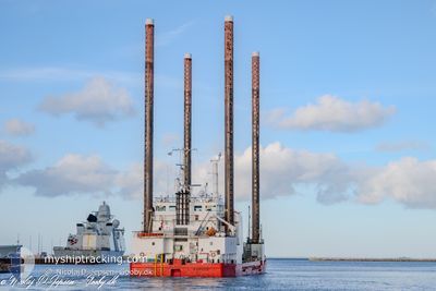
WIND
Crane Jack Up

Current Trip
| Time Travelled | 1 day |
|---|---|
| Remaining Time | --- |
| Distance Travelled | 173.57 nm |
| Remaining Distance | --- |
| AVG Speed | 6 Knop |
| MAX Speed | 8.3 Knop |
| AVG Wind | 9.9 knots |
| MAX Wind | 15 knots |
| MIN Temp | 6.5°C / 43.7°F |
| MAX Temp | 7.7°C / 45.86°F |
| Djupgående | 4.8 m |
| Position mottagen | 2 m sen |
Current Position
| Longitud | --- |
|---|---|
| Latitude | --- |
| Status | Moored |
| Fart | |
| Kurs | 132° |
| Område | North Sea |
| Station | T-AIS |
| Position mottagen | 2 m sen |
Information
The current position of WIND is in North Sea with coordinates 54.69843° / -1.18961° as reported on 2025-03-09 09:56 by AIS to our vessel tracker app. The vessel's current speed is 0 Knop
The vessel WIND (IMO: 9107851, MMSI: 220520000) is a Crane Jack Up that was built in 1996 ( 29 År gammal ). It's sailing under the flag of [DK] Denmark.
In this page you can find informations about the vessels current position, last detected port calls, and current voyage information. If the vessels is not in coverage by AIS you will find the latest position.
The current position of WIND is detected by our AIS receivers and we are not responsible for the reliability of the data. The last position was recorded while the vessel was in Coverage by the Ais receivers of our vessel tracking app.
The current draught of WIND as reported by AIS is 4.8 meters
Weather
| Temperature | 7.2°C / 44.96°F |
|---|---|
| Wind Speed | 4 knots |
| Direction | 38° NE |
| Pressure | 1007.9 hPa |
| Humidity | 86.5 % |
| Cloud Coverage | 72 % |


Featured Company
Last Port Calls
| Port | Arrival | Departure | Time In Port |
|---|---|---|---|
| 2025-03-06 15:34 | 2025-03-08 04:33 | 1 d | |
| 2025-03-04 23:41 | 2025-03-05 11:23 | 11 h | |
| 2025-02-13 15:27 | 2025-02-14 18:33 | 1 d | |
| 2025-02-09 09:03 | 2025-02-11 20:55 | 2 d | |
| 2025-01-23 06:21 | 2025-01-29 04:16 | 5 d | |
| 2025-01-20 06:13 | 2025-01-20 19:49 | 13 h | |
| 2025-01-05 11:51 | 2025-01-10 15:22 | 5 d | |
| 2025-01-05 11:42 |
Last Trips
| Origin | Departure | Destination | Arrival | Distance | |
|---|---|---|---|---|---|
| 2025-03-05 11:23 | 2025-03-06 15:34 | 98.81 nm | |||
| 2025-02-14 18:33 | 2025-03-04 23:41 | 135.04 nm | |||
| 2025-02-11 20:55 | 2025-02-13 15:27 | 148.07 nm | |||
| 2025-01-29 04:16 | 2025-02-09 09:03 | 165.60 nm | |||
| 2025-01-20 19:49 | 2025-01-23 06:21 | 123.69 nm | |||
| 2025-01-10 16:22 | 2025-01-20 06:13 | 460.25 nm | |||
| 2025-01-05 12:42 | 2025-01-05 12:51 | 0.72 nm |
Events
| Tid | Event | Detaljer | Position / Dest | Information |
|---|---|---|---|---|
| 2025-03-09 09:02 | Status ändrad | Moored Under way using engine |
54.69846 / -1.18964
HARTLEPOOL
|
Fart: Kurs: 132° |
| 2025-03-09 08:07 | STOPPAR förflyttning | 0.5 nm, North East of HARTLEPOOL |
54.69696 / -1.19093
HARTLEPOOL
|
Fart: Kurs: 321° |
| 2025-03-09 05:56 | ETA ändrat | 2025/03/09 08:00 2025/03/09 12:00 |
54.67057 / -.90999
HARTLEPOOL
|
Fart: 5.2 kn Kurs: 277.9° |
| 2025-03-09 03:22 | I täckningsområde |
54.58173 / -.57113
North Sea
HARTLEPOOL
|
Fart: 5.6 kn Kurs: 314.1° |
|
| 2025-03-08 22:49 | UTANFÖR täckningsområde |
54.29109 / -.04426
North Sea
HARTLEPOOL
|
Fart: 5.8 kn Kurs: 311.7° |
|
| 2025-03-08 04:33 | AVGÅTT HAMN |
|
52.57259 / 1.74020
HARTLEPOOL
|
Fart: 4.3 kn Kurs: 94° |
| 2025-03-08 04:24 | STARTAR förflyttning |
52.57913 / 1.73223
[GB] GREAT YARMOUTH
|
Fart: 3.8 kn Kurs: 176° |
|
| 2025-03-08 03:48 | Status ändrad | Under way using engine Moored |
52.58092 / 1.73212
[GB] GREAT YARMOUTH
|
Fart: Kurs: 165° |
| 2025-03-08 03:21 | Destination ändrad | HARTLEPOOL GREAT YARMOUTH |
52.58087 / 1.73217
[GB] GREAT YARMOUTH
|
Fart: Kurs: 165° |
| 2025-03-08 03:21 | ETA ändrat | 2025/03/09 12:00 2025/03/06 18:00 |
52.58087 / 1.73217
[GB] GREAT YARMOUTH
|
Fart: Kurs: 165° |