

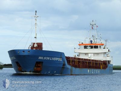
WILSON LIVERPOOL
General Cargo

Current Trip
| Time Travelled | 9 h, 19 mins |
|---|---|
| Remaining Time | --- |
| Distance Travelled | --- |
| Remaining Distance | --- |
| AVG Speed | --- |
| MAX Speed | --- |
| AVG Wind | --- |
| MAX Wind | --- |
| MIN Temp | --- |
| MAX Temp | --- |
| Djupgående | 5.6 m |
| Position mottagen | 9 d sen |
Current Position
| Longitud | --- |
|---|---|
| Latitude | --- |
| Status | Under way using engine |
| Fart | 9.6 Knop |
| Kurs | 342.6° |
| Område | North Sea |
| Station | T-AIS |
| Position mottagen | 9 d sen |
Information
The current position of WILSON LIVERPOOL is in North Sea with coordinates 56.14181° / 0.63367° as reported on 2025-03-19 14:37 by AIS to our vessel tracker app. The vessel's current speed is 9.6 Knop
The vessel WILSON LIVERPOOL (IMO: 9617296, MMSI: 314583000) is a General Cargo that was built in 2011 ( 14 År gammal ). It's sailing under the flag of [BB] Barbados.
In this page you can find informations about the vessels current position, last detected port calls, and current voyage information. If the vessels is not in coverage by AIS you will find the latest position.
The current position of WILSON LIVERPOOL is detected by our AIS receivers and we are not responsible for the reliability of the data. The last position was recorded while the vessel was in Coverage by the Ais receivers of our vessel tracking app.
The current draught of WILSON LIVERPOOL as reported by AIS is 5.6 meters
Weather
| Temperature | -1.9°C / 28.58°F |
|---|---|
| Wind Speed | 7 knots |
| Direction | 71° ENE |
| Pressure | 1001.2 hPa |
| Humidity | 83.3 % |
| Cloud Coverage | 100 % |


Featured Company
Last Port Calls
| Port | Arrival | Departure | Time In Port |
|---|---|---|---|
| 2025-03-26 02:53 | 2025-03-28 20:52 | 2 d | |
| 2025-03-23 17:04 | 2025-03-24 12:09 | 19 h | |
| 2025-03-14 18:49 | 2025-03-18 10:12 | 3 d | |
| 2025-03-09 16:39 | 2025-03-10 23:07 | 1 d | |
| 2025-02-25 21:19 | 2025-03-01 14:39 | 3 d | |
| 2025-02-12 12:28 | 2025-02-12 14:33 | 2 h | |
| 2025-02-10 02:25 | 2025-02-12 07:51 | 2 d | |
| 2025-02-07 10:23 | 2025-02-08 00:33 | 14 h | |
| 2025-02-03 06:58 | 2025-02-04 03:10 | 20 h | |
| 2025-01-17 12:40 | 2025-01-18 18:14 | 1 d |
Last Trips
| Origin | Departure | Destination | Arrival | Distance | |
|---|---|---|---|---|---|
| 2025-03-24 12:09 | 2025-03-26 02:53 | 336.19 nm | |||
| 2025-03-18 10:12 | 2025-03-23 17:04 | 1176.79 nm | |||
| 2025-03-10 23:07 | 2025-03-14 18:49 | 862.30 nm | |||
| 2025-03-01 14:39 | 2025-03-09 16:39 | 878.20 nm | |||
| 2025-02-12 14:33 | 2025-02-25 21:19 | 1801.47 nm | |||
| 2025-02-12 07:51 | 2025-02-12 12:28 | 41.43 nm | |||
| 2025-02-08 00:33 | 2025-02-10 02:25 | 490.37 nm | |||
| 2025-02-04 03:10 | 2025-02-07 10:23 | 525.35 nm | |||
| 2025-01-18 18:14 | 2025-02-03 06:58 | 2315.10 nm | |||
| 2025-01-17 10:21 | 2025-01-17 12:40 | 16.28 nm |
Events
| Tid | Event | Detaljer | Position / Dest | Information |
|---|---|---|---|---|
| 2025-03-28 20:52 | AVGÅTT HAMN |
|
64.18269 / -21.76893
NLAMS > ISAKU
|
Fart: Kurs: 250° |
| 2025-03-26 02:53 | ANLÄNDER HAMN |
|
64.15127 / -21.85798
[IS] REYKJAVIK
|
Fart: 3.5 kn Kurs: 142° |
| 2025-03-24 12:09 | AVGÅTT HAMN |
|
65.77275 / -18.11130
NLAMS > ISAKU
|
Fart: Kurs: 347° |
| 2025-03-23 17:04 | ANLÄNDER HAMN |
|
65.68617 / -18.07420
[IS] AKUREYRI
|
Fart: 9.5 kn Kurs: 183° |
| 2025-03-19 14:43 | Status ändrad | Default Under way using engine |
56.15622 / .62504
NLAMS > ISAKU
|
Fart: 9.6 kn Kurs: 342.6° |
| 2025-03-19 14:37 | Status ändrad | Under way using engine Default |
56.14181 / .63367
NLAMS > ISAKU
|
Fart: 9.6 kn Kurs: 343° |
| 2025-03-19 14:37 | UTANFÖR täckningsområde |
56.14181 / .63367
North Sea
NLAMS > ISAKU
|
Fart: 9.6 kn Kurs: 342.6° |
|
| 2025-03-19 14:27 | Status ändrad | Default Under way using engine |
56.11720 / .64738
NLAMS > ISAKU
|
Fart: 9.6 kn Kurs: 342.2° |
| 2025-03-19 12:49 | Upptäckt i hav | United Kingdom part of the North Sea |
55.85975 / .79687
North Sea
NLAMS > ISAKU
|
Fart: 10.2 kn Kurs: 342.7° |
| 2025-03-19 12:49 | Status ändrad | Under way using engine Default |
55.85975 / .79687
NLAMS > ISAKU
|
Fart: 10.2 kn Kurs: 342° |