
WILDCAT 7
High speed craft
Current Trip
| Trip Time | 8 h, 27 mins |
|---|---|
| Trip Distance | 66.18 nm |
| AVG Speed | 14 Knop |
| MAX Speed | 14 Knop |
| Djupgående | 1.2 m |
| AVG Wind | 12.4 knots |
| MAX Wind | 16.8 knots |
| MIN Temp | 6°C / 42.8°F |
| MAX Temp | 10°C / 50°F |
| Position mottagen | 6 d sen |
Current Position
| Longitud | --- |
|---|---|
| Latitude | --- |
| Status | Moored |
| Fart | |
| Kurs | 341° |
| Område | Irish Sea and St. George's Channel |
| Station | T-AIS |
| Position mottagen | 6 d sen |
Info
Information
The current position of WILDCAT 7 is in Irish Sea and St. George's Channel with coordinates 53.38798° / -2.98308° as reported on 2025-12-04 10:09 by AIS to our vessel tracker app. The vessel's current speed is 0 Knop and is currently inside the port of LIVERPOOL.
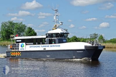
The vessel WILDCAT 7 (MMSI: 235097748) is a High speed craft It's sailing under the flag of [GB] United Kingdom.
In this page you can find informations about the vessels current position, last detected port calls, and current voyage information. If the vessels is not in coverage by AIS you will find the latest position.
The current position of WILDCAT 7 is detected by our AIS receivers and we are not responsible for the reliability of the data. The last position was recorded while the vessel was in Coverage by the Ais receivers of our vessel tracking app.
The current draught of WILDCAT 7 as reported by AIS is 1.2 meters
Weather
| Temperature | 7.2°C / 44.96°F |
|---|---|
| Wind Speed | 14 knots |
| Direction | 128° SE |
| Pressure | 992.7 hPa |
| Humidity | 88.6 % |
| Cloud Coverage | 100 % |
Featured Company
Last Port Calls
| Port | Arrival | Departure | Time In Port |
|---|---|---|---|
| 2025-12-03 19:11 | |||
| 2025-11-22 22:07 | 2025-12-03 10:44 | 10 d | |
| 2025-11-21 21:55 | 2025-11-22 10:33 | 12 h | |
| 2025-11-13 16:43 | 2025-11-21 10:06 | 7 d | |
| 2025-11-12 15:50 | 2025-11-13 06:23 | 14 h | |
| 2025-11-11 14:50 | 2025-11-12 05:17 | 14 h | |
| 2025-11-06 23:30 | 2025-11-11 03:41 | 4 d | |
| 2025-11-05 20:18 | 2025-11-06 11:18 | 15 h | |
| 2025-11-04 19:32 | 2025-11-05 12:06 | 16 h | |
| 2025-10-22 21:56 | 2025-11-04 11:04 | 12 d |
Last Trips
| Origin | Departure | Destination | Arrival | Distance | |
|---|---|---|---|---|---|
| 2025-12-03 10:44 | 2025-12-03 19:11 | 66.18 nm | |||
| 2025-11-22 10:33 | 2025-11-22 22:07 | 51.06 nm | |||
| 2025-11-21 10:06 | 2025-11-21 21:55 | 51.97 nm | |||
| 2025-11-13 06:23 | 2025-11-13 16:43 | 49.22 nm | |||
| 2025-11-12 05:17 | 2025-11-12 15:50 | 44.83 nm | |||
| 2025-11-11 03:41 | 2025-11-11 14:50 | 66.79 nm | |||
| 2025-11-06 11:18 | 2025-11-06 23:30 | 139.70 nm | |||
| 2025-11-05 12:06 | 2025-11-05 20:18 | 26.30 nm | |||
| 2025-11-04 11:04 | 2025-11-04 19:32 | 26.79 nm | |||
| 2025-10-22 13:40 | 2025-10-22 21:56 | 59.92 nm |
Events
| Tid | Event | Detaljer | Position / Dest | Information |
|---|---|---|---|---|
| 2025-12-04 10:09 | UTANFÖR täckningsområde |
53.38798 / -2.98308
Irish Sea and St. George's Channel
[GB] LIVERPOOL
|
Fart: Kurs: 27.7° |
|
| 2025-12-04 09:12 | I täckningsområde |
53.38799 / -2.98309
Irish Sea and St. George's Channel
[GB] LIVERPOOL
|
Fart: Kurs: 251.1° |
|
| 2025-12-03 19:43 | UTANFÖR täckningsområde |
53.38793 / -2.98317
Irish Sea and St. George's Channel
[GB] LIVERPOOL
|
Fart: Kurs: 253.8° |
|
| 2025-12-03 19:34 | Status ändrad | Moored Under way using engine |
53.38796 / -2.98317
[GB] LIVERPOOL
|
Fart: Kurs: 339° |
| 2025-12-03 19:11 | STOPPAR förflyttning |
53.38702 / -2.98404
[GB] LIVERPOOL
|
Fart: Kurs: 9° |
|
| 2025-12-03 19:11 | ANLÄNDER HAMN |
|
53.38702 / -2.98404
[GB] LIVERPOOL
|
Fart: 0.6 kn Kurs: 5° |
| 2025-12-03 19:08 | STARTAR förflyttning | 0.63 nm, East of TRANMERE |
53.38422 / -2.98578
LIVERPOOL MARINA
|
Fart: 3.2 kn Kurs: 11° |
| 2025-12-03 18:33 | STOPPAR förflyttning | 0.45 nm, East of TRANMERE |
53.38292 / -2.99066
LIVERPOOL MARINA
|
Fart: 0.1 kn Kurs: 327° |
| 2025-12-03 17:08 | STARTAR förflyttning | 5.22 nm, West of LIVERPOOL ANCH |
53.49110 / -3.53997
LIVERPOOL MARINA
|
Fart: 4.9 kn Kurs: 43° |
| 2025-12-03 16:55 | STOPPAR förflyttning | 5.35 nm, West of LIVERPOOL ANCH |
53.49080 / -3.54364
LIVERPOOL MARINA
|
Fart: 0.1 kn Kurs: 282° |