
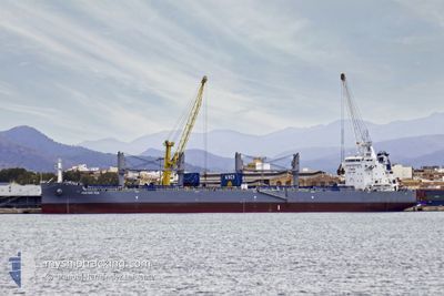
WESTERN FUJI
Cargo
Current Trip
LAST UPDATE TIME
| Time Travelled | 8 days |
|---|---|
| Remaining Time | --- |
| Distance Travelled | 1823.74 nm |
| Remaining Distance | --- |
| AVG Speed | 10.4 Knop |
| MAX Speed | 13.5 Knop |
| AVG Wind | 10 knots |
| MAX Wind | 22 knots |
| MIN Temp | 20.4°C / 68.72°F |
| MAX Temp | 29.6°C / 85.28°F |
| Djupgående | 11.7 m |
| Position mottagen | 23 h, 18 m sen |
Current Position
| Longitud | --- |
|---|---|
| Latitude | --- |
| Status | Under way using engine |
| Fart | 11.6 Knop |
| Kurs | 176.5° |
| Område | North Pacific Ocean |
| Station | T-AIS |
| Position mottagen | 23 h, 18 m sen |
Info
Information
The current position of WESTERN FUJI is in North Pacific Ocean with coordinates 8.61403° / -79.46186° as reported on 2025-02-15 18:45 by AIS to our vessel tracker app. The vessel's current speed is 11.6 Knop
The vessel WESTERN FUJI (IMO: 9856268, MMSI: 374035000) is a Cargo It's sailing under the flag of [PA] Panama.
In this page you can find informations about the vessels current position, last detected port calls, and current voyage information. If the vessels is not in coverage by AIS you will find the latest position.
The current position of WESTERN FUJI is detected by our AIS receivers and we are not responsible for the reliability of the data. The last position was recorded while the vessel was in Coverage by the Ais receivers of our vessel tracking app.
The current draught of WESTERN FUJI as reported by AIS is 11.7 meters
Weather
| Temperature | 27.2°C / 80.96°F |
|---|---|
| Wind Speed | 4 knots |
| Direction | 258° WSW |
| Pressure | 1011 hPa |
| Humidity | 71.1 % |
| Cloud Coverage | 48 % |
Featured Company
Last Port Calls
| Port | Arrival | Departure | Time In Port |
|---|---|---|---|
| 2025-02-03 21:55 | 2025-02-08 15:32 | 4 d | |
| 2025-01-12 19:47 | 2025-01-29 01:07 | 16 d | |
| 2024-12-02 13:12 |
Most Visited Ports (Last year)
| Port | Arrivals | |
|---|---|---|
| 2 | ||
| 2 | ||
| 1 | ||
| 1 | ||
| 1 | ||
| 1 |
Last Trips
| Origin | Departure | Destination | Arrival | Distance | |
|---|---|---|---|---|---|
| 2025-01-28 19:07 | 2025-02-03 15:55 | 745.55 nm | |||
| 2024-12-02 16:12 | 2025-01-12 13:47 | 7419.44 nm |
Events
| Tid | Event | Detaljer | Position / Dest | Information |
|---|---|---|---|---|
| 2025-02-15 18:48 | Status ändrad | Default Under way using engine |
8.60276 / -79.46106
LAST UPDATE TIME
|
Fart: 11.6 kn Kurs: 176.5° |
| 2025-02-15 18:45 | Status ändrad | Under way using engine Default |
8.61403 / -79.46186
LAST UPDATE TIME
|
Fart: 11.2 kn Kurs: 174° |
| 2025-02-15 18:45 | UTANFÖR täckningsområde |
8.61403 / -79.46186
North Pacific Ocean
|
Fart: 11.6 kn Kurs: 176.5° |
|
| 2025-02-15 18:40 | Status ändrad | Default Under way using engine |
8.62940 / -79.46260
LAST UPDATE TIME
|
Fart: 11.5 kn Kurs: 193.7° |
| 2025-02-15 18:34 | Status ändrad | Under way using engine Default |
8.64890 / -79.45887
LAST UPDATE TIME
|
Fart: 11.3 kn Kurs: 184° |
| 2025-02-15 18:03 | Status ändrad | Default Under way using engine |
8.73100 / -79.46319
LAST UPDATE TIME
|
Fart: 8 kn Kurs: 102° |
| 2025-02-15 17:50 | Status ändrad | Under way using engine Default |
8.74093 / -79.49249
LAST UPDATE TIME
|
Fart: 10.1 kn Kurs: 108° |
| 2025-02-15 17:34 | Status ändrad | Default Under way using engine |
8.75483 / -79.53649
LAST UPDATE TIME
|
Fart: 9 kn Kurs: 112° |
| 2025-02-15 16:54 | STARTAR förflyttning | 2.05 nm, North West of TABOGA |
8.81546 / -79.58328
LAST UPDATE TIME
|
Fart: 4 kn Kurs: 154° |
| 2025-02-15 16:48 | Status ändrad | Under way using engine Default |
8.81863 / -79.58481
LAST UPDATE TIME
|
Fart: 0.5 kn Kurs: 83° |