

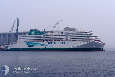
W.B. YEATS
Passenger

Current Trip
| Time Travelled | 16 h, 44 mins |
|---|---|
| Remaining Time | --- |
| Distance Travelled | 83.13 nm |
| Remaining Distance | --- |
| AVG Speed | 5.9 Knop |
| MAX Speed | 17.9 Knop |
| AVG Wind | 24.1 knots |
| MAX Wind | 31.5 knots |
| MIN Temp | 10.8°C / 51.44°F |
| MAX Temp | 16°C / 60.8°F |
| Djupgående | 6.1 m |
| Position mottagen | 1 m sen |
Current Position
| Longitud | --- |
|---|---|
| Latitude | --- |
| Status | Under way using engine |
| Fart | 6.6 Knop |
| Kurs | 283.3° |
| Område | Irish Sea and St. George's Channel |
| Station | T-AIS |
| Position mottagen | 1 m sen |
Information
The current position of W.B. YEATS is in Irish Sea and St. George's Channel with coordinates 53.43178° / -5.89761° as reported on 2025-06-03 07:05 by AIS to our vessel tracker app. The vessel's current speed is 6.6 Knop
The vessel W.B. YEATS (IMO: 9809679, MMSI: 209146000) is a Passenger It's sailing under the flag of [CY] Cyprus.
In this page you can find informations about the vessels current position, last detected port calls, and current voyage information. If the vessels is not in coverage by AIS you will find the latest position.
The current position of W.B. YEATS is detected by our AIS receivers and we are not responsible for the reliability of the data. The last position was recorded while the vessel was in Coverage by the Ais receivers of our vessel tracking app.
The current draught of W.B. YEATS as reported by AIS is 6.1 meters
Weather
| Temperature | 11°C / 51.8°F |
|---|---|
| Wind Speed | 22 knots |
| Direction | 253° WSW |
| Pressure | 999.3 hPa |
| Humidity | 80.7 % |
| Cloud Coverage | 1 % |


Featured Company
Last Port Calls
| Port | Arrival | Departure | Time In Port |
|---|---|---|---|
| 2025-06-02 13:15 | 2025-06-02 14:23 | 1 h | |
| 2025-06-02 09:32 | 2025-06-02 11:46 | 2 h | |
| 2025-06-01 10:04 | 2025-06-01 14:44 | 4 h | |
| 2025-05-31 13:26 | 2025-05-31 15:45 | 2 h | |
| 2025-05-31 08:54 | 2025-05-31 11:31 | 2 h | |
| 2025-05-30 09:32 | 2025-05-30 14:35 | 5 h | |
| 2025-05-29 08:53 | 2025-05-29 15:11 | 6 h | |
| 2025-05-28 09:48 | 2025-05-28 14:44 | 4 h | |
| 2025-05-27 13:06 | 2025-05-27 15:03 | 1 h | |
| 2025-05-27 07:17 | 2025-05-27 11:29 | 4 h |
Last Trips
| Origin | Departure | Destination | Arrival | Distance | |
|---|---|---|---|---|---|
| 2025-06-02 12:46 | 2025-06-02 14:15 | 14.42 nm | |||
| 2025-06-01 16:44 | 2025-06-02 10:32 | 377.36 nm | |||
| 2025-05-31 16:45 | 2025-06-01 12:04 | 386.97 nm | |||
| 2025-05-31 12:31 | 2025-05-31 14:26 | 16.39 nm | |||
| 2025-05-30 16:35 | 2025-05-31 09:54 | 380.32 nm | |||
| 2025-05-29 16:11 | 2025-05-30 11:32 | 383.71 nm | |||
| 2025-05-28 16:44 | 2025-05-29 09:53 | 378.92 nm | |||
| 2025-05-27 16:03 | 2025-05-28 11:48 | 387.85 nm | |||
| 2025-05-27 12:29 | 2025-05-27 14:06 | 12.27 nm | |||
| 2025-05-26 12:24 | 2025-05-27 08:17 | 70.15 nm |
Events
| Tid | Event | Detaljer | Position / Dest | Information |
|---|---|---|---|---|
| 2025-06-03 01:13 | Status ändrad | Under way using engine Default |
53.55640 / -5.75921
DUBLIN
|
Fart: 6.2 kn Kurs: 167° |
| 2025-06-03 01:13 | Status ändrad | Default Under way using engine |
53.55788 / -5.75975
DUBLIN
|
Fart: 7.5 kn Kurs: 165.6° |
| 2025-06-02 14:23 | AVGÅTT HAMN |
|
53.34332 / -6.17484
DUBLIN
|
Fart: 10.1 kn Kurs: 84° |
| 2025-06-02 14:19 | STARTAR förflyttning |
53.34346 / -6.19131
[IE] DUBLIN
|
Fart: 5.1 kn Kurs: 104° |
|
| 2025-06-02 14:12 | Djupgående ändrat | 6.1 6.2 |
53.34493 / -6.19356
[IE] DUBLIN
|
Fart: Kurs: 87° |
| 2025-06-02 14:12 | ETA ändrat | 2025/06/03 08:00 2025/06/02 13:30 |
53.34493 / -6.19356
[IE] DUBLIN
|
Fart: Kurs: 87° |
| 2025-06-02 14:06 | Status ändrad | Under way using engine Moored |
53.34494 / -6.19355
[IE] DUBLIN
|
Fart: Kurs: 87° |
| 2025-06-02 13:30 | Status ändrad | Moored Under way using engine |
53.34495 / -6.19339
[IE] DUBLIN
|
Fart: 0.2 kn Kurs: 88° |
| 2025-06-02 13:29 | STOPPAR förflyttning |
53.34492 / -6.19329
[IE] DUBLIN
|
Fart: 0.3 kn Kurs: 89° |
|
| 2025-06-02 13:15 | ANLÄNDER HAMN |
|
53.34388 / -6.17776
[IE] DUBLIN
|
Fart: 8.4 kn Kurs: 271.2° |