
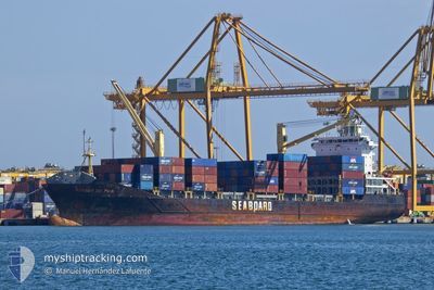
WARNOW DOLPHIN
Container Ship
Current Trip
| Time Travelled | 6 h, 54 mins |
|---|---|
| Remaining Time | 1 day |
| Distance Travelled | 75.95 nm |
| Remaining Distance | 313.29 nm |
| AVG Speed | 11.5 Knop |
| MAX Speed | 13.9 Knop |
| AVG Wind | 10.3 knots |
| MAX Wind | 18.9 knots |
| MIN Temp | 27.1°C / 80.78°F |
| MAX Temp | 31.8°C / 89.24°F |
| Djupgående | 6.6 m |
| Position mottagen | 5 h, 47 m sen |
Current Position
| Longitud | -61.74201° |
|---|---|
| Latitude | 10.61702° |
| Status | Under way using engine |
| Fart | 12 Knop |
| Kurs | 292.4° |
| Område | Caribbean Sea |
| Station | T-AIS |
| Position mottagen | 5 h, 47 m sen |
Info
Information
The current position of WARNOW DOLPHIN is in Caribbean Sea with coordinates 10.61702° / -61.74201° as reported on 2024-04-29 15:40 by AIS to our vessel tracker app. The vessel's current speed is 12 Knop and is heading at the port of GEORGETOWN. The estimated time of arrival as calculated by MyShipTracking vessel tracking app is 2024-05-01 00:32 LT
The vessel WARNOW DOLPHIN (IMO: 9395070, MMSI: 210159000) is a Container Ship that was built in 2007 ( 17 År gammal ). It's sailing under the flag of [CY] Cyprus.
In this page you can find informations about the vessels current position, last detected port calls, and current voyage information. If the vessels is not in coverage by AIS you will find the latest position.
The current position of WARNOW DOLPHIN is detected by our AIS receivers and we are not responsible for the reliability of the data. The last position was recorded while the vessel was in Coverage by the Ais receivers of our vessel tracking app.
The current draught of WARNOW DOLPHIN as reported by AIS is 6.6 meters
Weather
| Temperature | 27.7°C / 81.86°F |
|---|---|
| Wind Speed | 13 knots |
| Direction | 90° E |
| Pressure | 1010.1 hPa |
| Humidity | 75.4 % |
| Cloud Coverage | 8 % |
Featured Company
Last Port Calls
| Port | Arrival | Departure | Time In Port |
|---|---|---|---|
| 2024-04-28 18:56 | 2024-04-29 14:34 | 19 h | |
| 2024-04-25 16:01 | 2024-04-26 13:28 | 21 h | |
| 2024-04-22 13:18 | 2024-04-23 14:18 | 1 d | |
| 2024-04-17 18:47 | 2024-04-18 03:27 | 8 h | |
| 2024-04-16 02:08 | 2024-04-16 13:45 | 11 h | |
| 2024-04-12 10:56 | 2024-04-13 23:04 | 1 d | |
| 2024-04-10 20:55 | 2024-04-11 09:56 | 13 h | |
| 2024-04-08 16:55 | 2024-04-09 05:55 | 13 h | |
| 2024-04-04 19:56 | 2024-04-05 14:35 | 18 h | |
| 2024-04-01 14:47 | 2024-04-02 12:59 | 22 h |
Most Visited Ports (Last year)
| Port | Arrivals | |
|---|---|---|
| 33 | ||
| 32 | ||
| 18 | ||
| 18 | ||
| 17 |
Last Trips
| Origin | Departure | Destination | Arrival | Distance | |
|---|---|---|---|---|---|
| 2024-04-26 09:28 | 2024-04-28 14:56 | 666.72 nm | |||
| 2024-04-23 09:18 | 2024-04-25 12:01 | 461.34 nm | |||
| 2024-04-17 23:27 | 2024-04-22 08:18 | 1025.13 nm | |||
| 2024-04-16 09:45 | 2024-04-17 14:47 | 388.57 nm | |||
| 2024-04-13 20:04 | 2024-04-15 22:08 | 230.58 nm | |||
| 2024-04-11 05:56 | 2024-04-12 07:56 | 230.76 nm | |||
| 2024-04-09 01:55 | 2024-04-10 16:55 | 417.76 nm | |||
| 2024-04-05 10:35 | 2024-04-08 12:55 | 674.81 nm | |||
| 2024-04-02 07:59 | 2024-04-04 15:56 | 450.40 nm | |||
| 2024-03-29 17:52 | 2024-04-01 09:47 | 1003.06 nm |
Events
| Tid | Event | Detaljer | Position / Dest | Information |
|---|---|---|---|---|
| 2024-04-29 15:46 | Status ändrad | Default Under way using engine |
10.62498 / -61.76103
GYGEO
|
Fart: 12 kn Kurs: 292.4° |
| 2024-04-29 15:40 | UTANFÖR täckningsområde |
10.61702 / -61.74201
Caribbean Sea
GYGEO
|
Fart: 12 kn Kurs: 292.4° |
|
| 2024-04-29 15:38 | Djupgående ändrat | 6.6 7.9 |
10.61163 / -61.72970
GYGEO
|
Fart: 11.8 kn Kurs: 283.4° |
| 2024-04-29 15:38 | Destination ändrad | GYGEO TTPOS |
10.61163 / -61.72970
GYGEO
|
Fart: 11.8 kn Kurs: 283.4° |
| 2024-04-29 15:38 | ETA ändrat | 2024/05/01 07:45 2024/04/29 04:00 |
10.61163 / -61.72970
GYGEO
|
Fart: 11.8 kn Kurs: 283.4° |
| 2024-04-29 15:34 | Status ändrad | Under way using engine Default |
10.61080 / -61.72070
TTPOS
|
Fart: 12.1 kn Kurs: 271° |
| 2024-04-29 15:26 | Status ändrad | Default Under way using engine |
10.61036 / -61.69503
TTPOS
|
Fart: 12 kn Kurs: 269.8° |
| 2024-04-29 15:20 | Status ändrad | Under way using engine Default |
10.61027 / -61.67373
TTPOS
|
Fart: 12.1 kn Kurs: 269° |
| 2024-04-29 15:18 | I täckningsområde |
10.61027 / -61.67373
Caribbean Sea
|
Fart: 12 kn Kurs: 269.8° |
|
| 2024-04-29 14:34 | STARTAR förflyttning | 0.97 nm, West of PORT OF SPAIN |
10.64843 / -61.53342
TTPOS
|
Fart: 9.4 kn Kurs: 241° |