
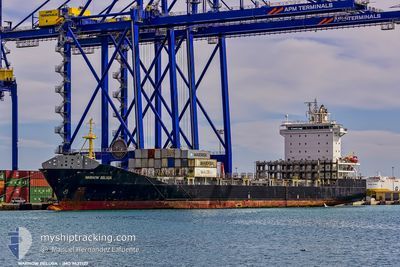
WARNOW BELUGA
Container Ship
Current Trip
| Time Travelled | 1 day |
|---|---|
| Remaining Time | 15 mins |
| Distance Travelled | 329.78 nm |
| Remaining Distance | 14.96 nm |
| AVG Speed | 14.2 Knop |
| MAX Speed | 20.5 Knop |
| AVG Wind | 7.9 knots |
| MAX Wind | 13.5 knots |
| MIN Temp | 17.4°C / 63.32°F |
| MAX Temp | 24.1°C / 75.38°F |
| Djupgående | 7.1 m |
| Position mottagen | 9 m sen |
Current Position
| Longitud | --- |
|---|---|
| Latitude | --- |
| Status | Under way using engine |
| Fart | 10.4 Knop |
| Kurs | 253.5° |
| Område | North Atlantic Ocean |
| Station | T-AIS |
| Position mottagen | 9 m sen |
Info
Information
The current position of WARNOW BELUGA is in North Atlantic Ocean with coordinates 30.39097° / -81.49302° as reported on 2026-01-08 07:52 by AIS to our vessel tracker app. The vessel's current speed is 10.4 Knop and is heading at the port of JACKSONVILLE. The estimated time of arrival as calculated by MyShipTracking vessel tracking app is 2026-01-08 03:17 LT
The vessel WARNOW BELUGA (IMO: 9437127, MMSI: 305258000) is a Container Ship that was built in 2008 ( 18 År gammal ). It's sailing under the flag of [AG] Antigua Barbuda.
In this page you can find informations about the vessels current position, last detected port calls, and current voyage information. If the vessels is not in coverage by AIS you will find the latest position.
The current position of WARNOW BELUGA is detected by our AIS receivers and we are not responsible for the reliability of the data. The last position was recorded while the vessel was in Coverage by the Ais receivers of our vessel tracking app.
The current draught of WARNOW BELUGA as reported by AIS is 7.1 meters
Weather
| Temperature | 17.6°C / 63.68°F |
|---|---|
| Wind Speed | 4 knots |
| Direction | 242° WSW |
| Pressure | 1017.8 hPa |
| Humidity | 92 % |
| Cloud Coverage | 100 % |
Featured Company
Last Port Calls
| Port | Arrival | Departure | Time In Port |
|---|---|---|---|
| 2026-01-06 06:37 | 2026-01-06 18:49 | 12 h | |
| 2026-01-06 06:13 | 2026-01-06 06:22 | 8 m | |
| 2025-12-31 18:10 | 2026-01-01 07:50 | 13 h | |
| 2025-12-26 18:06 | 2025-12-27 03:33 | 9 h | |
| 2025-12-26 17:49 | 2025-12-26 17:57 | 8 m | |
| 2025-12-24 13:40 | 2025-12-24 19:56 | 6 h | |
| 2025-12-23 07:12 | 2025-12-23 16:44 | 9 h | |
| 2025-12-23 06:48 | 2025-12-23 06:56 | 8 m | |
| 2025-12-17 18:10 | 2025-12-18 06:23 | 12 h | |
| 2025-12-12 04:21 | 2025-12-12 17:43 | 13 h |
Most Visited Ports (Last year)
| Port | Arrivals | |
|---|---|---|
| 54 | ||
| 52 | ||
| 23 | ||
| 23 | ||
| 1 | ||
| 1 |
Last Trips
| Origin | Departure | Destination | Arrival | Distance | |
|---|---|---|---|---|---|
| 2026-01-06 06:22 | 2026-01-06 06:37 | 0.79 nm | |||
| 2026-01-01 07:50 | 2026-01-06 06:13 | 1475.62 nm | |||
| 2025-12-27 03:33 | 2025-12-31 18:10 | 1479.26 nm | |||
| 2025-12-26 17:57 | 2025-12-26 18:06 | 0.86 nm | |||
| 2025-12-24 19:56 | 2025-12-26 17:49 | 316.10 nm | |||
| 2025-12-23 16:44 | 2025-12-24 13:40 | 311.25 nm | |||
| 2025-12-23 06:56 | 2025-12-23 07:12 | 0.90 nm | |||
| 2025-12-18 06:23 | 2025-12-23 06:48 | 1481.99 nm | |||
| 2025-12-12 17:43 | 2025-12-17 18:10 | 1479.54 nm | |||
| 2025-12-12 04:02 | 2025-12-12 04:21 | 0.97 nm |
Events
| Tid | Event | Detaljer | Position / Dest | Information |
|---|---|---|---|---|
| 2026-01-08 08:00 | Status ändrad | Under way using engine Default |
30.39165 / -81.51493
USJAX
|
Fart: 8.6 kn Kurs: 265° |
| 2026-01-08 07:59 | Status ändrad | Default Under way using engine |
30.39199 / -81.51125
USJAX
|
Fart: 8.5 kn Kurs: 266.7° |
| 2026-01-08 07:47 | Status ändrad | Under way using engine Default |
30.39454 / -81.47822
USJAX
|
Fart: 11 kn Kurs: 288° |
| 2026-01-08 07:47 | Status ändrad | Default Under way using engine |
30.39395 / -81.47533
USJAX
|
Fart: 11 kn Kurs: 294.7° |
| 2026-01-08 07:37 | Status ändrad | Under way using engine Default |
30.38132 / -81.45043
USJAX
|
Fart: 10 kn Kurs: 240° |
| 2026-01-08 07:35 | Status ändrad | Default Under way using engine |
30.38251 / -81.44372
USJAX
|
Fart: 9.9 kn Kurs: 233.7° |
| 2026-01-08 07:34 | Status ändrad | Under way using engine Default |
30.38355 / -81.44183
USJAX
|
Fart: 9.1 kn Kurs: 205° |
| 2026-01-08 07:31 | Status ändrad | Default Under way using engine |
30.39109 / -81.43579
USJAX
|
Fart: 8.1 kn Kurs: 259.9° |
| 2026-01-08 06:48 | Status ändrad | Under way using engine Default |
30.37912 / -81.30374
USJAX
|
Fart: 7.8 kn Kurs: 309° |
| 2026-01-08 06:47 | Status ändrad | Default Under way using engine |
30.37781 / -81.30185
USJAX
|
Fart: 5.7 kn Kurs: 308.8° |