

WAGON B
General Cargo

Current Trip
| Time Travelled | 5 days |
|---|---|
| Remaining Time | --- |
| Distance Travelled | 566.41 nm |
| Remaining Distance | --- |
| AVG Speed | 7.1 Knop |
| MAX Speed | 11.9 Knop |
| AVG Wind | 9.6 knots |
| MAX Wind | 22.7 knots |
| MIN Temp | 3.6°C / 38.48°F |
| MAX Temp | 9.8°C / 49.64°F |
| Djupgående | 4 m |
| Position mottagen | 3 h, 5 m sen |
Current Position
| Longitud | --- |
|---|---|
| Latitude | --- |
| Status | Under way using engine |
| Fart | |
| Kurs | 121° |
| Område | English Channel |
| Station | T-AIS |
| Position mottagen | 3 h, 5 m sen |
Information
The current position of WAGON B is in English Channel with coordinates 50.34645° / -4.63704° as reported on 2025-03-02 05:39 by AIS to our vessel tracker app. The vessel's current speed is 0 Knop and is heading at the port of FOWEY.
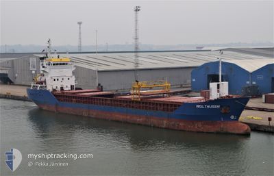
The vessel WAGON B (IMO: 9115925, MMSI: 305748000) is a General Cargo that was built in 1995 ( 30 År gammal ). It's sailing under the flag of [AG] Antigua Barbuda.
In this page you can find informations about the vessels current position, last detected port calls, and current voyage information. If the vessels is not in coverage by AIS you will find the latest position.
The current position of WAGON B is detected by our AIS receivers and we are not responsible for the reliability of the data. The last position was recorded while the vessel was in Coverage by the Ais receivers of our vessel tracking app.
The current draught of WAGON B as reported by AIS is 4 meters
Weather
| Temperature | 5.5°C / 41.9°F |
|---|---|
| Wind Speed | 8 knots |
| Direction | 71° ENE |
| Pressure | 1035 hPa |
| Humidity | 74.9 % |
| Cloud Coverage | 100 % |


Featured Company
Last Port Calls
| Port | Arrival | Departure | Time In Port |
|---|---|---|---|
| 2025-02-17 17:50 | 2025-02-24 22:05 | 7 d | |
| 2025-02-17 17:27 | 2025-02-17 17:40 | 12 m | |
| 2025-02-10 14:15 | 2025-02-12 01:42 | 1 d | |
| 2025-01-26 17:00 | 2025-01-30 17:53 | 4 d | |
| 2025-01-13 05:21 | 2025-01-16 11:50 | 3 d | |
| 2025-01-04 00:23 | 2025-01-08 05:40 | 4 d |
Most Visited Ports (Last year)
| Port | Arrivals | |
|---|---|---|
| 3 | ||
| 2 | ||
| 2 | ||
| 2 | ||
| 2 | ||
| 2 |
Last Trips
| Origin | Departure | Destination | Arrival | Distance | |
|---|---|---|---|---|---|
| 2025-02-17 17:40 | 2025-02-17 17:50 | 1.16 nm | |||
| 2025-02-12 02:42 | 2025-02-17 17:27 | 1142.31 nm | |||
| 2025-01-30 18:53 | 2025-02-10 15:15 | 362.92 nm | |||
| 2025-01-16 14:50 | 2025-01-26 18:00 | 1862.63 nm | |||
| 2025-01-08 07:40 | 2025-01-13 08:21 | 540.21 nm | |||
| 2024-12-29 13:25 | 2025-01-04 02:23 | 429.31 nm |
Events
| Tid | Event | Detaljer | Position / Dest | Information |
|---|---|---|---|---|
| 2025-03-02 05:48 | Status ändrad | Default Under way using engine |
50.34647 / -4.63706
GBFOY
|
Fart: Kurs: 121° |
| 2025-03-02 05:39 | UTANFÖR täckningsområde |
50.34645 / -4.63704
English Channel
|
Fart: Kurs: 172.4° |
|
| 2025-03-02 05:37 | Status ändrad | Under way using engine Default |
50.34646 / -4.63704
GBFOY
|
Fart: Kurs: 121° |
| 2025-03-02 05:12 | Status ändrad | Default Under way using engine |
50.34645 / -4.63704
GBFOY
|
Fart: Kurs: 121° |
| 2025-03-02 04:33 | Status ändrad | Under way using engine Default |
50.34646 / -4.63704
GBFOY
|
Fart: Kurs: 121° |
| 2025-03-02 04:21 | Status ändrad | Default Under way using engine |
50.34646 / -4.63704
GBFOY
|
Fart: Kurs: 121° |
| 2025-03-02 03:49 | Status ändrad | Under way using engine Default |
50.34648 / -4.63702
GBFOY
|
Fart: Kurs: 121° |
| 2025-03-02 03:00 | Status ändrad | Default Under way using engine |
50.34646 / -4.63701
GBFOY
|
Fart: Kurs: 120° |
| 2025-03-02 02:45 | Status ändrad | Under way using engine Default |
50.34646 / -4.63703
GBFOY
|
Fart: Kurs: 120° |
| 2025-03-02 02:40 | Status ändrad | Default Under way using engine |
50.34648 / -4.63704
GBFOY
|
Fart: Kurs: 120° |