
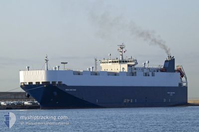
POLARIS LIBERTY
Vehicles Carrier
Current Trip
| Time Travelled | 7 days |
|---|---|
| Remaining Time | 1 day |
| Distance Travelled | 2644.25 nm |
| Remaining Distance | 509.71 nm |
| AVG Speed | 15.1 Knop |
| MAX Speed | 18 Knop |
| AVG Wind | 12.7 knots |
| MAX Wind | 24.9 knots |
| MIN Temp | 11.5°C / 52.7°F |
| MAX Temp | 20.3°C / 68.54°F |
| Djupgående | 5.7 m |
| Position mottagen | 12 h, 9 m sen |
Current Position
| Longitud | -9.63934° |
|---|---|
| Latitude | 43.39545° |
| Status | Under way using engine |
| Fart | 15.4 Knop |
| Kurs | 24.2° |
| Område | North Atlantic Ocean |
| Station | T-AIS |
| Position mottagen | 12 h, 9 m sen |
Info
Information
The current position of POLARIS LIBERTY is in North Atlantic Ocean with coordinates 43.39545° / -9.63934° as reported on 2024-05-01 13:19 by AIS to our vessel tracker app. The vessel's current speed is 15.4 Knop and is heading at the port of CALAIS. The estimated time of arrival as calculated by MyShipTracking vessel tracking app is 2024-05-03 11:48 LT
The vessel POLARIS LIBERTY (IMO: 9407689, MMSI: 538009722) is a Vehicles Carrier that was built in 2010 ( 14 År gammal ). It's sailing under the flag of [MH] Marshall Is.
In this page you can find informations about the vessels current position, last detected port calls, and current voyage information. If the vessels is not in coverage by AIS you will find the latest position.
The current position of POLARIS LIBERTY is detected by our AIS receivers and we are not responsible for the reliability of the data. The last position was recorded while the vessel was in Coverage by the Ais receivers of our vessel tracking app.
The current draught of POLARIS LIBERTY as reported by AIS is 5.7 meters
Weather
| Temperature | 11.6°C / 52.88°F |
|---|---|
| Wind Speed | 13 knots |
| Direction | 269° W |
| Pressure | 1010.8 hPa |
| Humidity | 73.1 % |
| Cloud Coverage | 25 % |
Featured Company
Last Port Calls
| Port | Arrival | Departure | Time In Port |
|---|---|---|---|
| 2024-04-24 04:52 | 2024-04-24 18:20 | 13 h | |
| 2024-04-14 22:39 | 2024-04-15 15:38 | 16 h | |
| 2024-04-12 13:32 | 2024-04-13 10:48 | 21 h | |
| 2024-04-06 15:17 | 2024-04-06 23:55 | 8 h | |
| 2024-04-01 15:23 | 2024-04-02 03:47 | 12 h | |
| 2024-03-31 15:56 | 2024-04-01 08:59 | 17 h | |
| 2024-03-18 12:22 | 2024-03-21 11:30 | 2 d | |
| 2024-03-14 22:08 | 2024-03-16 19:58 | 1 d | |
| 2024-03-07 03:06 | 2024-03-08 22:45 | 1 d |
Last Trips
| Origin | Departure | Destination | Arrival | Distance | |
|---|---|---|---|---|---|
| 2024-04-15 17:38 | 2024-04-24 07:52 | 2925.77 nm | |||
| 2024-04-13 12:48 | 2024-04-15 00:39 | 542.83 nm | |||
| 2024-04-07 01:55 | 2024-04-12 15:32 | 1992.76 nm | |||
| 2024-04-02 06:47 | 2024-04-06 17:17 | 1501.40 nm | |||
| 2024-04-01 11:59 | 2024-04-01 18:23 | 68.34 nm | |||
| 2024-03-21 12:30 | 2024-03-31 18:56 | 2882.62 nm | |||
| 2024-03-16 19:58 | 2024-03-18 13:22 | 452.16 nm | |||
| 2024-03-08 23:45 | 2024-03-14 22:08 | 595.87 nm | |||
| 2024-02-23 21:56 | 2024-03-07 04:06 | 3115.14 nm |
Events
| Tid | Event | Detaljer | Position / Dest | Information |
|---|---|---|---|---|
| 2024-05-01 13:30 | Status ändrad | Default Under way using engine |
43.43733 / -9.61338
FR CQF
|
Fart: 15.4 kn Kurs: 24.2° |
| 2024-05-01 13:19 | UTANFÖR täckningsområde |
43.39545 / -9.63934
North Atlantic Ocean
FR CQF
|
Fart: 15.4 kn Kurs: 24.2° |
|
| 2024-05-01 13:04 | Status ändrad | Under way using engine Default |
43.33958 / -9.67670
FR CQF
|
Fart: 15 kn Kurs: 28° |
| 2024-05-01 12:46 | I täckningsområde |
43.33958 / -9.67670
North Atlantic Ocean
FR CQF
|
Fart: 15.8 kn Kurs: 27.1° |
|
| 2024-05-01 07:28 | Status ändrad | Default Under way using engine |
41.97167 / -9.79500
FR CQF
|
Fart: 14.8 kn Kurs: 5.9° |
| 2024-05-01 07:18 | Byter havsområde | Spanish part of the North Atlantic Ocean Portuguese part of the North Atlantic Ocean |
41.91838 / -9.80429
North Atlantic Ocean
FR CQF
|
Fart: 14.8 kn Kurs: 5.9° |
| 2024-05-01 07:18 | Status ändrad | Under way using engine Default |
41.91838 / -9.80429
FR CQF
|
Fart: 14 kn Kurs: 5° |
| 2024-05-01 07:18 | UTANFÖR täckningsområde |
41.91838 / -9.80429
North Atlantic Ocean
FR CQF
|
Fart: 14.8 kn Kurs: 5.9° |
|
| 2024-05-01 07:10 | I täckningsområde |
41.91838 / -9.80429
North Atlantic Ocean
FR CQF
|
Fart: 14.8 kn Kurs: 5.9° |
|
| 2024-05-01 06:07 | UTANFÖR täckningsområde |
41.64210 / -9.81238
North Atlantic Ocean
FR CQF
|
Fart: 13.9 kn Kurs: 358.3° |