

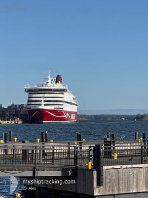
VIKING CINDERELLA
Ro-Ro/Passenger Ship

Current Trip
| Time Travelled | 54 mins |
|---|---|
| Remaining Time | 3 h, 23 mins |
| Distance Travelled | 13.20 nm |
| Remaining Distance | 64.76 nm |
| AVG Speed | 18.4 Knop |
| MAX Speed | 18.6 Knop |
| AVG Wind | 8.6 knots |
| MAX Wind | 9 knots |
| MIN Temp | 1.1°C / 33.98°F |
| MAX Temp | 1.2°C / 34.16°F |
| Djupgående | 6.7 m |
| Position mottagen | Nu |
Current Position
| Longitud | --- |
|---|---|
| Latitude | --- |
| Status | Under way using engine |
| Fart | 18.4 Knop |
| Kurs | 220.4° |
| Område | Gulf of Bothnia |
| Station | T-AIS |
| Position mottagen | Nu |
Information
The current position of VIKING CINDERELLA is in Gulf of Bothnia with coordinates 59.88036° / 19.62506° as reported on 2025-03-01 03:30 by AIS to our vessel tracker app. The vessel's current speed is 18.4 Knop and is heading at the port of STOCKHOLM. The estimated time of arrival as calculated by MyShipTracking vessel tracking app is 2025-03-01 06:53 LT
The vessel VIKING CINDERELLA (IMO: 8719188, MMSI: 230713000) is a Ro-Ro/Passenger Ship that was built in 1989 ( 36 År gammal ). It's sailing under the flag of [FI] Finland.
In this page you can find informations about the vessels current position, last detected port calls, and current voyage information. If the vessels is not in coverage by AIS you will find the latest position.
The current position of VIKING CINDERELLA is detected by our AIS receivers and we are not responsible for the reliability of the data. The last position was recorded while the vessel was in Coverage by the Ais receivers of our vessel tracking app.
The current draught of VIKING CINDERELLA as reported by AIS is 6.7 meters
Weather
| Temperature | 1.1°C / 33.98°F |
|---|---|
| Wind Speed | 9 knots |
| Direction | 256° WSW |
| Pressure | 1022.2 hPa |
| Humidity | 87.8 % |
| Cloud Coverage | 6 % |


Featured Company
Last Port Calls
| Port | Arrival | Departure | Time In Port |
|---|---|---|---|
| 2025-03-01 02:18 | 2025-03-01 02:36 | 18 m | |
| 2025-02-28 08:11 | 2025-02-28 15:15 | 7 h | |
| 2025-02-27 21:00 | 2025-02-27 21:24 | 23 m | |
| 2025-02-27 08:30 | 2025-02-27 15:34 | 7 h | |
| 2025-02-27 02:18 | 2025-02-27 02:37 | 19 m | |
| 2025-02-26 07:47 | 2025-02-26 15:16 | 7 h | |
| 2025-02-25 21:02 | 2025-02-25 21:27 | 24 m | |
| 2025-02-25 08:29 | 2025-02-25 15:36 | 7 h | |
| 2025-02-25 02:17 | 2025-02-25 02:37 | 19 m | |
| 2025-02-24 08:01 | 2025-02-24 15:13 | 7 h |
Last Trips
| Origin | Departure | Destination | Arrival | Distance | |
|---|---|---|---|---|---|
| 2025-02-28 17:15 | 2025-03-01 04:18 | 182.92 nm | |||
| 2025-02-27 23:24 | 2025-02-28 10:11 | 184.72 nm | |||
| 2025-02-27 16:34 | 2025-02-27 23:00 | 77.84 nm | |||
| 2025-02-27 04:37 | 2025-02-27 09:30 | 78.59 nm | |||
| 2025-02-26 17:16 | 2025-02-27 04:18 | 183.14 nm | |||
| 2025-02-25 23:27 | 2025-02-26 09:47 | 183.21 nm | |||
| 2025-02-25 16:36 | 2025-02-25 23:02 | 77.85 nm | |||
| 2025-02-25 04:37 | 2025-02-25 09:29 | 78.77 nm | |||
| 2025-02-24 17:13 | 2025-02-25 04:17 | 183.73 nm | |||
| 2025-02-23 23:27 | 2025-02-24 10:01 | 184.83 nm |
Events
| Tid | Event | Detaljer | Position / Dest | Information |
|---|---|---|---|---|
| 2025-03-01 02:36 | AVGÅTT HAMN |
|
60.08562 / 19.92888
FIHEL<>FIMHQ<>SESTO
|
Fart: 7.6 kn Kurs: 186° |
| 2025-03-01 02:36 | STARTAR förflyttning |
60.08692 / 19.92911
[FI] MARIEHAMN
|
Fart: 6.3 kn Kurs: 184° |
|
| 2025-03-01 02:22 | STOPPAR förflyttning |
60.08873 / 19.92977
[FI] MARIEHAMN
|
Fart: 0.2 kn Kurs: 179° |
|
| 2025-03-01 02:18 | ANLÄNDER HAMN |
|
60.08740 / 19.92905
[FI] MARIEHAMN
|
Fart: 2.7 kn Kurs: 189° |
| 2025-03-01 00:34 | Byter havsområde | Finnish part of the Gulf of Bothnia Finnish part of the Baltic Sea |
59.76564 / 20.33933
Gulf of Bothnia
FIHEL<>FIMHQ<>SESTO
|
Fart: 16.4 kn Kurs: 297.8° |
| 2025-02-28 21:26 | I täckningsområde |
59.55127 / 21.96935
Baltic Sea
FIHEL<>FIMHQ<>SESTO
|
Fart: 16.8 kn Kurs: 261.6° |
|
| 2025-02-28 19:46 | UTANFÖR täckningsområde |
59.63461 / 22.89328
Baltic Sea
FIHEL<>FIMHQ<>SESTO
|
Fart: 17 kn Kurs: 259.1° |
|
| 2025-02-28 19:31 | Byter havsområde | Finnish part of the Baltic Sea Finnish part of the Gulf of Finland |
59.64777 / 23.02663
Baltic Sea
FIHEL<>FIMHQ<>SESTO
|
Fart: 17 kn Kurs: 259° |
| 2025-02-28 18:56 | Djupgående ändrat | 6.7 25.5 |
59.68100 / 23.35104
FIHEL<>FIMHQ<>SESTO
|
Fart: 16.8 kn Kurs: 256.2° |
| 2025-02-28 18:56 | Destination ändrad | FIHEL<>FIMHQ<>SESTO 0 |
59.68100 / 23.35104
FIHEL<>FIMHQ<>SESTO
|
Fart: 16.8 kn Kurs: 256.2° |