

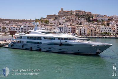
VENTUM MARIS
Yacht

Current Trip
| Time Travelled | 17 days |
|---|---|
| Remaining Time | --- |
| Distance Travelled | 359.40 nm |
| Remaining Distance | --- |
| AVG Speed | 9.5 Knop |
| MAX Speed | 13.7 Knop |
| AVG Wind | 16.8 knots |
| MAX Wind | 23 knots |
| MIN Temp | 25.5°C / 77.9°F |
| MAX Temp | 26.9°C / 80.42°F |
| Djupgående | 3.8 m |
| Position mottagen | 3 m sen |
Current Position
| Longitud | --- |
|---|---|
| Latitude | --- |
| Status | At anchor |
| Fart | 0.2 Knop |
| Kurs | 91° |
| Område | Caribbean Sea |
| Station | T-AIS |
| Position mottagen | 3 m sen |
Information
The current position of VENTUM MARIS is in Caribbean Sea with coordinates 18.03265° / -63.10919° as reported on 2025-02-02 21:39 by AIS to our vessel tracker app. The vessel's current speed is 0.2 Knop
The vessel VENTUM MARIS (IMO: 1010117, MMSI: 229140000) is a Yacht that was built in 2011 ( 14 År gammal ). It's sailing under the flag of [MT] Malta.
In this page you can find informations about the vessels current position, last detected port calls, and current voyage information. If the vessels is not in coverage by AIS you will find the latest position.
The current position of VENTUM MARIS is detected by our AIS receivers and we are not responsible for the reliability of the data. The last position was recorded while the vessel was in Coverage by the Ais receivers of our vessel tracking app.
The current draught of VENTUM MARIS as reported by AIS is 3.8 meters
Weather
| Temperature | 26.2°C / 79.16°F |
|---|---|
| Wind Speed | 17 knots |
| Direction | 81° E |
| Pressure | 1015.1 hPa |
| Humidity | 73.6 % |
| Cloud Coverage | --- |


Featured Company
Last Port Calls
| Port | Arrival | Departure | Time In Port |
|---|---|---|---|
| 2025-01-07 21:22 | 2025-01-16 20:10 | 8 d | |
| 2024-12-02 13:45 | 2024-12-17 20:17 | 15 d |
Most Visited Ports (Last year)
| Port | Arrivals | |
|---|---|---|
| 5 | ||
| 2 | ||
| 2 | ||
| 2 | ||
| 2 | ||
| 2 |
Last Trips
| Origin | Departure | Destination | Arrival | Distance | |
|---|---|---|---|---|---|
| 2024-12-17 16:17 | 2025-01-07 17:22 | 530.31 nm | |||
| 2024-11-20 00:09 | 2024-12-02 09:45 | 3415.80 nm |
Events
| Tid | Event | Detaljer | Position / Dest | Information |
|---|---|---|---|---|
| 2025-02-02 20:26 | Status ändrad | At anchor Under way using engine |
18.03307 / -63.10948
SXM
|
Fart: 0.2 kn Kurs: 73° |
| 2025-02-02 20:13 | STOPPAR förflyttning | 1.05 nm, West of ST MAARTEN |
18.03323 / -63.11017
SXM
|
Fart: 0.3 kn Kurs: 17° |
| 2025-02-02 19:23 | Byter havsområde | Sint-Maarten part of the Caribbean Sea Saint-Martin part of the Caribbean Sea |
17.95144 / -63.02443
Caribbean Sea
SXM
|
Fart: 11.8 kn Kurs: 286.2° |
| 2025-02-02 18:59 | Destination ändrad | SXM ST BARTHS |
17.92944 / -62.94554
SXM
|
Fart: 11.7 kn Kurs: 289° |
| 2025-02-02 18:59 | ETA ändrat | 2025/02/02 16:00 2026/01/31 08:00 |
17.92944 / -62.94554
SXM
|
Fart: 11.7 kn Kurs: 289° |
| 2025-02-02 18:38 | STARTAR förflyttning | 1.56 nm, North West of GUSTAVIA |
17.91470 / -62.87625
ST BARTHS
|
Fart: 9.8 kn Kurs: 265.6° |
| 2025-02-02 18:29 | Status ändrad | Under way using engine At anchor |
17.91428 / -62.87378
ST BARTHS
|
Fart: 0.1 kn Kurs: 86° |
| 2025-02-01 15:24 | I täckningsområde |
17.91495 / -62.87364
Caribbean Sea
|
Fart: Kurs: 69.1° |
|
| 2025-02-01 13:53 | UTANFÖR täckningsområde |
17.91409 / -62.87367
Caribbean Sea
|
Fart: 0.4 kn Kurs: 146.4° |
|
| 2025-02-01 10:16 | ETA ändrat | 2026/01/31 08:00 2025/01/31 08:00 |
17.91466 / -62.87377
ST BARTHS
|
Fart: 0.2 kn Kurs: 127° |