
VELA PRIME
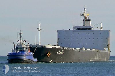
Bulk Carrier
Current Trip
| Time Travelled | 22 days |
|---|---|
| Remaining Time | --- |
| Distance Travelled | 1702.61 nm |
| Remaining Distance | --- |
| AVG Speed | 8.2 Knop |
| MAX Speed | 11.1 Knop |
| AVG Wind | 12 knots |
| MAX Wind | 23.9 knots |
| MIN Temp | 25.5°C / 77.9°F |
| MAX Temp | 29.2°C / 84.56°F |
| Djupgående | 13.1 m |
| Position mottagen | 5 d sen |
Current Position
| Longitud | -59.55482° |
|---|---|
| Latitude | 10.17873° |
| Status | Under way using engine |
| Fart | 7.7 Knop |
| Kurs | 122° |
| Område | North Atlantic Ocean |
| Station | T-AIS |
| Position mottagen | 5 d sen |
Info
Information
The current position of VELA PRIME is in North Atlantic Ocean with coordinates 10.17873° / -59.55482° as reported on 2024-05-15 14:27 by AIS to our vessel tracker app. The vessel's current speed is 7.7 Knop and is heading at the port of QINZHOU. The estimated time of arrival as calculated by MyShipTracking vessel tracking app is 2024-07-08 12:00 LT
The vessel VELA PRIME (IMO: 9218272, MMSI: 357071000) is a Bulk Carrier that was built in 2001 ( 23 År gammal ). It's sailing under the flag of [PA] Panama.
In this page you can find informations about the vessels current position, last detected port calls, and current voyage information. If the vessels is not in coverage by AIS you will find the latest position.
The current position of VELA PRIME is detected by our AIS receivers and we are not responsible for the reliability of the data. The last position was recorded while the vessel was in Coverage by the Ais receivers of our vessel tracking app.
The current draught of VELA PRIME as reported by AIS is 13.1 meters
Weather
| Temperature | 28.1°C / 82.58°F |
|---|---|
| Wind Speed | 14 knots |
| Direction | 85° E |
| Pressure | 1012.4 hPa |
| Humidity | 78 % |
| Cloud Coverage | 21 % |
Featured Company
Last Port Calls
| Port | Arrival | Departure | Time In Port |
|---|---|---|---|
| 2024-04-16 14:06 | 2024-04-28 22:04 | 12 d | |
| 2024-03-31 16:38 | 2024-04-07 14:27 | 6 d |
Most Visited Ports (Last year)
| Port | Arrivals | |
|---|---|---|
| 4 | ||
| 1 | ||
| 1 |
Last Trips
| Origin | Departure | Destination | Arrival | Distance | |
|---|---|---|---|---|---|
| 2024-04-07 10:27 | 2024-04-16 10:06 | 23.43 nm | |||
| 2024-01-08 16:29 | 2024-03-31 12:38 | 9711.16 nm |
Events
| Tid | Event | Detaljer | Position / Dest | Information |
|---|---|---|---|---|
| 2024-05-15 14:38 | Status ändrad | Default Under way using engine |
10.16595 / -59.53420
CN QZH
|
Fart: 7.7 kn Kurs: 122° |
| 2024-05-15 14:27 | Upptäckt i hav | Trinidad and Tobago part of the North Atlantic Ocean |
10.17873 / -59.55482
North Atlantic Ocean
|
Fart: 7.7 kn Kurs: 122° |
| 2024-05-15 14:27 | Status ändrad | Under way using engine Default |
10.17873 / -59.55482
CN QZH
|
Fart: 7.7 kn Kurs: 121° |
| 2024-05-15 14:27 | UTANFÖR täckningsområde |
10.17873 / -59.55482
North Atlantic Ocean
|
Fart: 7.7 kn Kurs: 122° |
|
| 2024-05-15 14:08 | I täckningsområde |
10.17873 / -59.55482
North Atlantic Ocean
|
Fart: 7.7 kn Kurs: 122° |
|
| 2024-05-14 21:07 | Status ändrad | Default Under way using engine |
10.68740 / -61.78057
CN QZH
|
Fart: 10.2 kn Kurs: 9° |
| 2024-05-14 21:00 | Status ändrad | Under way using engine Default |
10.66908 / -61.78515
CN QZH
|
Fart: 10.2 kn Kurs: 350° |
| 2024-05-14 21:00 | UTANFÖR täckningsområde |
10.66908 / -61.78515
Caribbean Sea
|
Fart: 10.2 kn Kurs: 9° |
|
| 2024-05-14 20:58 | Status ändrad | Default Under way using engine |
10.66383 / -61.78563
CN QZH
|
Fart: 9.6 kn Kurs: 303° |
| 2024-05-14 20:43 | Status ändrad | Under way using engine Default |
10.64455 / -61.75250
CN QZH
|
Fart: 10.1 kn Kurs: 275° |