

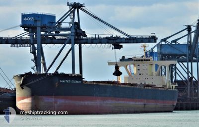
UNITED ETERNITY
Cargo

Current Trip
| Time Travelled | 4 days |
|---|---|
| Remaining Time | --- |
| Distance Travelled | 627.11 nm |
| Remaining Distance | --- |
| AVG Speed | 9.7 Knop |
| MAX Speed | 13 Knop |
| AVG Wind | 17.9 knots |
| MAX Wind | 29 knots |
| MIN Temp | 12.3°C / 54.14°F |
| MAX Temp | 20.8°C / 69.44°F |
| Djupgående | 15.4 m |
| Position mottagen | 2 d sen |
Current Position
| Longitud | --- |
|---|---|
| Latitude | --- |
| Status | Under way using engine |
| Fart | 10.2 Knop |
| Kurs | 247.7° |
| Område | Philippine Sea |
| Station | T-AIS |
| Position mottagen | 2 d sen |
Information
The current position of UNITED ETERNITY is in Philippine Sea with coordinates 33.79367° / 137.18565° as reported on 2025-03-25 09:08 by AIS to our vessel tracker app. The vessel's current speed is 10.2 Knop
The vessel UNITED ETERNITY (IMO: 9802102, MMSI: 374580000) is a Cargo It's sailing under the flag of [PA] Panama.
In this page you can find informations about the vessels current position, last detected port calls, and current voyage information. If the vessels is not in coverage by AIS you will find the latest position.
The current position of UNITED ETERNITY is detected by our AIS receivers and we are not responsible for the reliability of the data. The last position was recorded while the vessel was in Coverage by the Ais receivers of our vessel tracking app.
The current draught of UNITED ETERNITY as reported by AIS is 15.4 meters
Weather
| Temperature | 11.9°C / 53.42°F |
|---|---|
| Wind Speed | 14 knots |
| Direction | 332° NNW |
| Pressure | 1009.6 hPa |
| Humidity | 79.2 % |
| Cloud Coverage | 100 % |


Featured Company
Last Port Calls
| Port | Arrival | Departure | Time In Port |
|---|---|---|---|
| 2025-03-22 07:33 | 2025-03-24 14:46 | 2 d | |
| 2025-03-07 08:22 | 2025-03-08 18:08 | 1 d | |
| 2025-03-05 20:31 | 2025-03-05 22:04 | 1 h | |
| 2025-02-03 18:24 | 2025-02-04 10:34 | 16 h | |
| 2025-01-09 15:48 | 2025-01-14 07:29 | 4 d |
Most Visited Ports (Last year)
| Port | Arrivals | |
|---|---|---|
| 2 | ||
| 2 | ||
| 2 | ||
| 1 | ||
| 1 | ||
| 1 |
Last Trips
| Origin | Departure | Destination | Arrival | Distance | |
|---|---|---|---|---|---|
| 2025-03-08 18:08 | 2025-03-22 07:33 | 3602.56 nm | |||
| 2025-03-05 22:04 | 2025-03-07 08:22 | 17.20 nm | |||
| 2025-02-04 10:34 | 2025-03-05 20:31 | 1102.44 nm | |||
| 2025-01-14 07:29 | 2025-02-03 18:24 | 4477.58 nm | |||
| 2024-12-24 02:29 | 2025-01-09 15:48 | 3617.81 nm |
Events
| Tid | Event | Detaljer | Position / Dest | Information |
|---|---|---|---|---|
| 2025-03-28 05:02 | STOPPAR förflyttning | 4.08 nm, East of OITA |
33.27714 / 131.74524
JP OIT
|
Fart: 0.3 kn Kurs: 351° |
| 2025-03-27 21:13 | STARTAR förflyttning | 18.36 nm, South East of KAMAE |
32.61867 / 132.21632
JP OIT
|
Fart: 3.1 kn Kurs: 350° |
| 2025-03-27 18:06 | STOPPAR förflyttning | 18.01 nm, South East of KAMAE |
32.63309 / 132.21950
JP OIT
|
Fart: 0.3 kn Kurs: 238° |
| 2025-03-27 05:32 | STARTAR förflyttning | 21.28 nm, South East of SHIMAURAMACHI |
32.52061 / 132.19321
JP OIT
|
Fart: 3.9 kn Kurs: 178° |
| 2025-03-26 17:14 | STOPPAR förflyttning |
32.44416 / 132.21256
JP OIT
|
Fart: 0.3 kn Kurs: 157° |
|
| 2025-03-25 09:14 | Status ändrad | Default Under way using engine |
33.78664 / 137.16553
JP OIT
|
Fart: 10.2 kn Kurs: 247.7° |
| 2025-03-25 09:08 | Status ändrad | Under way using engine Default |
33.79367 / 137.18565
JP OIT
|
Fart: 10.2 kn Kurs: 248° |
| 2025-03-25 09:08 | UTANFÖR täckningsområde |
33.79367 / 137.18565
Philippine Sea
JP OIT
|
Fart: 10.2 kn Kurs: 247.7° |
|
| 2025-03-25 09:02 | Status ändrad | Default Under way using engine |
33.79984 / 137.20342
JP OIT
|
Fart: 10.1 kn Kurs: 246.8° |
| 2025-03-25 07:08 | Status ändrad | Under way using engine Default |
33.94375 / 137.54962
JP OIT
|
Fart: 10.4 kn Kurs: 254° |