
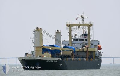
UNION WIN
General Cargo
Current Trip
VN DAD
| Time Travelled | 18 h, 46 mins |
|---|---|
| Remaining Time | --- |
| Distance Travelled | 157.03 nm |
| Remaining Distance | --- |
| AVG Speed | 10.5 Knop |
| MAX Speed | 11.2 Knop |
| AVG Wind | 8.6 knots |
| MAX Wind | 11 knots |
| MIN Temp | 29.1°C / 84.38°F |
| MAX Temp | 30.1°C / 86.18°F |
| Djupgående | 5.8 m |
| Position mottagen | 18 d sen |
Current Position
| Longitud | 119.88177° |
|---|---|
| Latitude | 23.72503° |
| Status | Under way using engine |
| Fart | 7.5 Knop |
| Kurs | 177° |
| Område | South China Sea |
| Station | T-AIS |
| Position mottagen | 18 d sen |
Info
Information
The current position of UNION WIN is in South China Sea with coordinates 23.72503° / 119.88177° as reported on 2024-04-22 02:05 by AIS to our vessel tracker app. The vessel's current speed is 7.5 Knop
The vessel UNION WIN (IMO: 9550931, MMSI: 357242000) is a General Cargo that was built in 2010 ( 14 År gammal ). It's sailing under the flag of [PA] Panama.
In this page you can find informations about the vessels current position, last detected port calls, and current voyage information. If the vessels is not in coverage by AIS you will find the latest position.
The current position of UNION WIN is detected by our AIS receivers and we are not responsible for the reliability of the data. The last position was recorded while the vessel was in Coverage by the Ais receivers of our vessel tracking app.
The current draught of UNION WIN as reported by AIS is 5.8 meters
Weather
| Temperature | 30°C / 86°F |
|---|---|
| Wind Speed | 9 knots |
| Direction | 137° SE |
| Pressure | 1007.4 hPa |
| Humidity | 73.1 % |
| Cloud Coverage | 26 % |
Featured Company
Last Port Calls
| Port | Arrival | Departure | Time In Port |
|---|---|---|---|
| 2024-05-06 03:28 | 2024-05-09 12:44 | 3 d | |
| 2024-04-27 05:29 | 2024-04-30 15:44 | 3 d | |
| 2024-04-14 13:26 | |||
| 2024-04-06 04:37 | 2024-04-08 00:21 | 1 d | |
| 2024-03-19 15:04 | 2024-03-20 15:32 | 1 d | |
| 2024-03-14 15:34 | 2024-03-18 20:34 | 4 d | |
| 2024-03-09 02:44 | 2024-03-09 14:06 | 11 h |
Last Trips
| Origin | Departure | Destination | Arrival | Distance | |
|---|---|---|---|---|---|
| 2024-04-30 23:44 | 2024-05-06 11:28 | 600.28 nm | |||
| 2024-04-08 07:21 | 2024-04-14 21:26 | 1612.90 nm | |||
| 2024-03-20 23:32 | 2024-04-06 11:37 | 2423.74 nm | |||
| 2024-03-19 04:34 | 2024-03-19 23:04 | 194.52 nm | |||
| 2024-03-09 21:06 | 2024-03-14 23:34 | 1358.32 nm | |||
| 2024-02-25 08:15 | 2024-03-09 09:44 | 1363.14 nm |
Events
| Tid | Event | Detaljer | Position / Dest | Information |
|---|---|---|---|---|
| 2024-05-09 12:44 | AVGÅTT HAMN |
|
3.96035 / 103.44965
VN DAD
|
Fart: 8.2 kn Kurs: 130° |
| 2024-05-09 12:33 | STARTAR förflyttning |
3.97332 / 103.43003
[MY] KUANTAN
|
Fart: 3.2 kn Kurs: 83° |
|
| 2024-05-06 04:10 | STOPPAR förflyttning |
3.97147 / 103.42744
[MY] KUANTAN
|
Fart: Kurs: 73° |
|
| 2024-05-06 03:28 | ANLÄNDER HAMN |
|
3.96815 / 103.44100
[MY] KUANTAN
|
Fart: 6.6 kn Kurs: 306° |
| 2024-05-06 03:04 | STARTAR förflyttning | 2.79 nm, East of KUANTAN |
3.96213 / 103.47897
VN DAD
|
Fart: 3.4 kn Kurs: 232° |
| 2024-05-02 18:28 | STOPPAR förflyttning | 2.93 nm, East of KUANTAN |
3.96617 / 103.48210
VN DAD
|
Fart: 0.3 kn Kurs: 211° |
| 2024-04-30 16:01 | STARTAR förflyttning | 3.04 nm, North West of SAMALAJU |
3.61093 / 113.28100
VN DAD
|
Fart: 11.3 kn Kurs: 310° |
| 2024-04-30 15:44 | AVGÅTT HAMN |
|
3.61093 / 113.28100
VN DAD
|
Fart: 2.2 kn Kurs: 330° |