
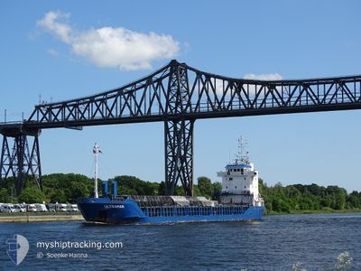
ULTRAMAR
General Cargo
Current Trip
| Time Travelled | 3 days |
|---|---|
| Remaining Time | --- |
| Distance Travelled | 207.60 nm |
| Remaining Distance | --- |
| AVG Speed | 9.8 Knop |
| MAX Speed | 14.3 Knop |
| AVG Wind | 10 knots |
| MAX Wind | 19 knots |
| MIN Temp | 0.2°C / 32.36°F |
| MAX Temp | 4°C / 39.2°F |
| Djupgående | 3.8 m |
| Position mottagen | 4 m sen |
Current Position
| Longitud | --- |
|---|---|
| Latitude | --- |
| Status | At anchor |
| Fart | |
| Kurs | 83° |
| Område | North Sea |
| Station | T-AIS |
| Position mottagen | 4 m sen |
Info
Information
The current position of ULTRAMAR is in North Sea with coordinates 52.46113° / 4.10065° as reported on 2025-02-18 14:33 by AIS to our vessel tracker app. The vessel's current speed is 0 Knop
The vessel ULTRAMAR (IMO: 9167320, MMSI: 209662000) is a General Cargo that was built in 1997 ( 28 År gammal ). It's sailing under the flag of [CY] Cyprus.
In this page you can find informations about the vessels current position, last detected port calls, and current voyage information. If the vessels is not in coverage by AIS you will find the latest position.
The current position of ULTRAMAR is detected by our AIS receivers and we are not responsible for the reliability of the data. The last position was recorded while the vessel was in Coverage by the Ais receivers of our vessel tracking app.
The current draught of ULTRAMAR as reported by AIS is 3.8 meters
Weather
| Temperature | 2.9°C / 37.22°F |
|---|---|
| Wind Speed | 16 knots |
| Direction | 118° ESE |
| Pressure | 1024.9 hPa |
| Humidity | 50.9 % |
| Cloud Coverage | 69 % |
Featured Company
Last Port Calls
| Port | Arrival | Departure | Time In Port |
|---|---|---|---|
| 2025-02-12 07:21 | 2025-02-14 18:40 | 2 d | |
| 2025-01-28 01:44 | 2025-01-28 14:01 | 12 h | |
| 2025-01-26 22:05 | 2025-01-27 19:18 | 21 h | |
| 2025-01-23 08:08 | 2025-01-23 08:11 | 3 m | |
| 2025-01-20 09:29 | 2025-01-22 12:12 | 2 d | |
| 2025-01-16 19:32 | 2025-01-18 20:37 | 2 d | |
| 2025-01-13 15:29 | 2025-01-14 14:33 | 23 h | |
| 2025-01-03 04:42 | 2025-01-09 00:28 | 5 d | |
| 2025-01-01 11:09 | 2025-01-02 12:09 | 1 d | |
| 2024-12-29 07:34 | 2024-12-31 17:20 | 2 d |
Last Trips
| Origin | Departure | Destination | Arrival | Distance | |
|---|---|---|---|---|---|
| 2025-01-28 16:01 | 2025-02-12 07:21 | 1729.72 nm | |||
| 2025-01-27 21:18 | 2025-01-28 03:44 | 64.30 nm | |||
| 2025-01-23 09:11 | 2025-01-27 00:05 | 681.11 nm | |||
| 2025-01-22 13:12 | 2025-01-23 09:08 | 147.14 nm | |||
| 2025-01-18 20:37 | 2025-01-20 10:29 | 345.69 nm | |||
| 2025-01-14 14:33 | 2025-01-16 19:32 | 157.04 nm | |||
| 2025-01-09 02:28 | 2025-01-13 15:29 | 1124.87 nm | |||
| 2025-01-02 13:09 | 2025-01-03 06:42 | 142.72 nm | |||
| 2024-12-31 19:20 | 2025-01-01 12:09 | 145.53 nm | |||
| 2024-12-27 21:08 | 2024-12-29 09:34 | 378.28 nm |
Events
| Tid | Event | Detaljer | Position / Dest | Information |
|---|---|---|---|---|
| 2025-02-18 14:30 | Status ändrad | At anchor Default |
52.46113 / 4.10066
NLIJM
|
Fart: Kurs: 88° |
| 2025-02-18 14:27 | Status ändrad | Default At anchor |
52.46114 / 4.10066
NLIJM
|
Fart: 0.2 kn Kurs: 83° |
| 2025-02-18 14:15 | Status ändrad | At anchor Default |
52.46104 / 4.10065
NLIJM
|
Fart: 0.2 kn Kurs: 83° |
| 2025-02-18 14:12 | Status ändrad | Default At anchor |
52.46107 / 4.10068
NLIJM
|
Fart: 0.1 kn Kurs: 84° |
| 2025-02-18 13:48 | Status ändrad | At anchor Default |
52.46099 / 4.10067
NLIJM
|
Fart: 0.3 kn Kurs: 83° |
| 2025-02-18 13:42 | Status ändrad | Default At anchor |
52.46099 / 4.10067
NLIJM
|
Fart: Kurs: 78° |
| 2025-02-18 13:33 | Status ändrad | At anchor Default |
52.46100 / 4.10063
NLIJM
|
Fart: Kurs: 81° |
| 2025-02-18 13:27 | Status ändrad | Default At anchor |
52.46100 / 4.10063
NLIJM
|
Fart: 0.1 kn Kurs: 77° |
| 2025-02-18 13:09 | Status ändrad | At anchor Default |
52.46092 / 4.10065
NLIJM
|
Fart: Kurs: 77° |
| 2025-02-18 13:03 | Status ändrad | Default At anchor |
52.46084 / 4.10069
NLIJM
|
Fart: Kurs: 77° |