
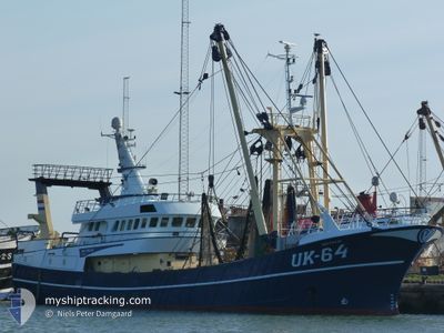
UK64 MATTANJA
Trawler
Current Trip
| Trip Time | 4 days |
|---|---|
| Trip Distance | 758.42 nm |
| AVG Speed | 6.8 Knop |
| MAX Speed | 12.2 Knop |
| Djupgående | 5.1 m |
| AVG Wind | 17.6 knots |
| MAX Wind | 30.8 knots |
| MIN Temp | 8.6°C / 47.48°F |
| MAX Temp | 11.1°C / 51.98°F |
| Position mottagen | Nu |
Current Position
| Longitud | 5.41714° |
|---|---|
| Latitude | 53.18078° |
| Status | Engaged in Fishing |
| Fart | |
| Kurs | 295° |
| Område | North Sea |
| Station | T-AIS |
| Position mottagen | Nu |
Info
Information
The current position of UK64 MATTANJA is in North Sea with coordinates 53.18078° / 5.41714° as reported on 2024-05-05 02:54 by AIS to our vessel tracker app. The vessel's current speed is 0 Knop and is currently inside the port of HARLINGEN.
The vessel UK64 MATTANJA (IMO: 8985165, MMSI: 245265000) is a Trawler that was built in 2004 ( 20 År gammal ). It's sailing under the flag of [NL] Netherlands.
In this page you can find informations about the vessels current position, last detected port calls, and current voyage information. If the vessels is not in coverage by AIS you will find the latest position.
The current position of UK64 MATTANJA is detected by our AIS receivers and we are not responsible for the reliability of the data. The last position was recorded while the vessel was in Coverage by the Ais receivers of our vessel tracking app.
The current draught of UK64 MATTANJA as reported by AIS is 5.1 meters
Weather
| Temperature | 10.5°C / 50.9°F |
|---|---|
| Wind Speed | 12 knots |
| Direction | 36° NE |
| Pressure | 1006.2 hPa |
| Humidity | 95.9 % |
| Cloud Coverage | 100 % |
Featured Company
Last Port Calls
| Port | Arrival | Departure | Time In Port |
|---|---|---|---|
| 2024-05-04 04:05 | |||
| 2024-04-26 12:16 | 2024-04-29 09:15 | 2 d | |
| 2024-04-18 23:29 | 2024-04-22 07:16 | 3 d | |
| 2024-04-11 19:33 | 2024-04-15 07:32 | 3 d | |
| 2024-04-06 20:21 | 2024-04-07 21:35 | 1 d | |
| 2024-03-29 05:20 | 2024-04-02 17:14 | 4 d | |
| 2024-03-22 00:42 | 2024-03-25 07:17 | 3 d | |
| 2024-03-14 23:54 | 2024-03-18 07:29 | 3 d | |
| 2024-03-08 11:36 | 2024-03-11 08:11 | 2 d | |
| 2024-03-01 15:45 | 2024-03-04 01:02 | 2 d |
Last Trips
| Origin | Departure | Destination | Arrival | Distance | |
|---|---|---|---|---|---|
| 2024-04-29 11:15 | 2024-05-04 06:05 | 758.42 nm | |||
| 2024-04-22 09:16 | 2024-04-26 14:16 | 188.78 nm | |||
| 2024-04-15 09:32 | 2024-04-19 01:29 | 308.83 nm | |||
| 2024-04-07 23:35 | 2024-04-11 21:33 | 257.09 nm | |||
| 2024-04-02 19:14 | 2024-04-06 22:21 | 184.42 nm | |||
| 2024-03-25 08:17 | 2024-03-29 06:20 | 286.06 nm | |||
| 2024-03-18 08:29 | 2024-03-22 01:42 | 248.29 nm | |||
| 2024-03-11 09:11 | 2024-03-15 00:54 | 246.92 nm | |||
| 2024-03-04 02:02 | 2024-03-08 12:36 | 408.62 nm | |||
| 2024-02-26 01:50 | 2024-03-01 16:45 | 795.07 nm |
Events
| Tid | Event | Detaljer | Position / Dest | Information |
|---|---|---|---|---|
| 2024-05-05 01:25 | Status ändrad | Engaged in Fishing Under way using engine |
53.18081 / 5.41714
[NL] HARLINGEN
|
Fart: 44.8 kn Kurs: 293° |
| 2024-05-05 01:25 | Status ändrad | Under way using engine Engaged in Fishing |
53.18081 / 5.41714
[NL] HARLINGEN
|
Fart: Kurs: 293° |
| 2024-05-04 04:05 | STOPPAR förflyttning |
53.18071 / 5.41621
[NL] HARLINGEN
|
Fart: 0.1 kn Kurs: 229° |
|
| 2024-05-04 04:05 | ANLÄNDER HAMN |
|
53.18071 / 5.41621
[NL] HARLINGEN
|
Fart: 0.6 kn Kurs: 222° |
| 2024-05-04 00:38 | Upptäckt i hav | Dutch part of the North Sea |
53.54523 / 4.90971
North Sea
|
Fart: 10.7 kn Kurs: 170.4° |
| 2024-05-04 00:38 | I täckningsområde |
53.54523 / 4.90971
North Sea
|
Fart: 10.7 kn Kurs: 170.4° |
|
| 2024-05-03 13:54 | UTANFÖR täckningsområde |
55.31813 / 5.70464
North Sea
|
Fart: 10.3 kn Kurs: 191° |
|
| 2024-05-03 13:16 | Byter havsområde | German part of the North Sea Danish part of the North Sea |
55.42538 / 5.74616
North Sea
|
Fart: 10.1 kn Kurs: 191° |
| 2024-05-03 13:15 | I täckningsområde |
55.42538 / 5.74616
North Sea
|
Fart: 10.1 kn Kurs: 191° |
|
| 2024-05-03 08:47 | UTANFÖR täckningsområde |
56.16958 / 6.07163
North Sea
|
Fart: 10.4 kn Kurs: 193° |