
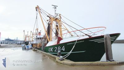
UK284 CORNELISZEEMAN
Reserved
Current Trip
Unknown
| Time Travelled | 1 day |
|---|---|
| Remaining Time | --- |
| Distance Travelled | 86.90 nm |
| Remaining Distance | --- |
| AVG Speed | 11 Knop |
| MAX Speed | 13.4 Knop |
| AVG Wind | 14.6 knots |
| MAX Wind | 15 knots |
| MIN Temp | 12.3°C / 54.14°F |
| MAX Temp | 13.9°C / 57.02°F |
| Djupgående | 5 m |
| Position mottagen | 1 d sen |
Current Position
| Longitud | 3.24320° |
|---|---|
| Latitude | 53.08915° |
| Status | Under way using engine |
| Fart | 6.4 Knop |
| Kurs | 184.2° |
| Område | North Sea |
| Station | T-AIS |
| Position mottagen | 1 d sen |
Info
Information
The current position of UK284 CORNELISZEEMAN is in North Sea with coordinates 53.08915° / 3.24320° as reported on 2024-05-13 13:01 by AIS to our vessel tracker app. The vessel's current speed is 6.4 Knop
The vessel UK284 CORNELISZEEMAN (IMO: 9039200, MMSI: 245876000) is a Reserved It's sailing under the flag of [NL] Netherlands.
In this page you can find informations about the vessels current position, last detected port calls, and current voyage information. If the vessels is not in coverage by AIS you will find the latest position.
The current position of UK284 CORNELISZEEMAN is detected by our AIS receivers and we are not responsible for the reliability of the data. The last position was recorded while the vessel was in Coverage by the Ais receivers of our vessel tracking app.
The current draught of UK284 CORNELISZEEMAN as reported by AIS is 5 meters
Weather
| Temperature | 12.3°C / 54.14°F |
|---|---|
| Wind Speed | 10 knots |
| Direction | 194° SSW |
| Pressure | 1009.5 hPa |
| Humidity | 89 % |
| Cloud Coverage | 15 % |
Featured Company
Last Port Calls
| Port | Arrival | Departure | Time In Port |
|---|---|---|---|
| 2024-05-10 13:48 | 2024-05-12 23:34 | 2 d | |
| 2024-05-03 14:44 | 2024-05-05 23:26 | 2 d | |
| 2024-04-26 16:44 | 2024-04-28 23:28 | 2 d | |
| 2024-04-20 08:52 | 2024-04-22 00:15 | 1 d | |
| 2024-04-08 10:03 | 2024-04-20 08:23 | 11 d | |
| 2024-04-06 03:41 | 2024-04-08 08:37 | 2 d | |
| 2024-03-29 01:40 | 2024-04-01 17:42 | 3 d | |
| 2024-03-22 05:39 | 2024-03-25 13:07 | 3 d | |
| 2024-03-15 11:34 | 2024-03-18 01:08 | 2 d | |
| 2024-03-08 02:36 | 2024-03-11 09:16 | 3 d |
Last Trips
| Origin | Departure | Destination | Arrival | Distance | |
|---|---|---|---|---|---|
| 2024-05-06 01:26 | 2024-05-10 15:48 | 186.30 nm | |||
| 2024-04-29 01:28 | 2024-05-03 16:44 | 115.57 nm | |||
| 2024-04-22 02:15 | 2024-04-26 18:44 | 117.01 nm | |||
| 2024-04-20 10:23 | 2024-04-20 10:52 | 4.58 nm | |||
| 2024-04-08 10:37 | 2024-04-08 12:03 | 13.54 nm | |||
| 2024-04-01 19:42 | 2024-04-06 05:41 | 197.60 nm | |||
| 2024-03-25 14:07 | 2024-03-29 02:40 | 157.28 nm | |||
| 2024-03-18 02:08 | 2024-03-22 06:39 | 407.00 nm | |||
| 2024-03-11 10:16 | 2024-03-15 12:34 | 279.82 nm | |||
| 2024-03-04 02:09 | 2024-03-08 03:36 | 248.79 nm |
Events
| Tid | Event | Detaljer | Position / Dest | Information |
|---|---|---|---|---|
| 2024-05-13 13:01 | UTANFÖR täckningsområde |
53.08915 / 3.24320
North Sea
|
Fart: 6.4 kn Kurs: 184.2° |
|
| 2024-05-13 12:52 | I täckningsområde |
53.10457 / 3.24761
North Sea
|
Fart: 6.5 kn Kurs: 221.5° |
|
| 2024-05-13 01:59 | UTANFÖR täckningsområde |
53.29839 / 4.83858
North Sea
|
Fart: 11.8 kn Kurs: 246.3° |
|
| 2024-05-12 23:34 | AVGÅTT HAMN |
|
53.17729 / 5.40036
|
Fart: 7.3 kn Kurs: 287° |
| 2024-05-12 23:28 | STARTAR förflyttning |
53.17711 / 5.41192
[NL] HARLINGEN
|
Fart: 5.5 kn Kurs: 217° |
|
| 2024-05-10 13:58 | STOPPAR förflyttning |
53.17898 / 5.41411
[NL] HARLINGEN
|
Fart: 0.3 kn Kurs: 117° |
|
| 2024-05-10 13:48 | ANLÄNDER HAMN |
|
53.17624 / 5.40353
[NL] HARLINGEN
|
Fart: 6.5 kn Kurs: 108.6° |
| 2024-05-10 10:09 | I täckningsområde |
53.29580 / 4.76480
North Sea
|
Fart: 11.2 kn Kurs: 72° |
|
| 2024-05-09 17:21 | UTANFÖR täckningsområde |
53.11089 / 3.31262
North Sea
|
Fart: 6.6 kn Kurs: 95.8° |
|
| 2024-05-09 16:49 | I täckningsområde |
53.08104 / 3.25780
North Sea
|
Fart: 6.7 kn Kurs: 4.3° |