

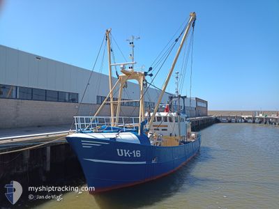
UK16 ORION
Fishing

Current Trip
| Trip Time | 3 days |
|---|---|
| Trip Distance | 348.54 nm |
| AVG Speed | 3.7 Knop |
| MAX Speed | 9.1 Knop |
| Djupgående | 0 m |
| AVG Wind | 5.2 knots |
| MAX Wind | 19 knots |
| MIN Temp | 3.4°C / 38.12°F |
| MAX Temp | 7.7°C / 45.86°F |
| Position mottagen | 1 m sen |
Current Position
| Longitud | --- |
|---|---|
| Latitude | --- |
| Status | Under way using engine |
| Fart | |
| Kurs | 74° |
| Område | North Sea |
| Station | T-AIS |
| Position mottagen | 1 m sen |
Information
The current position of UK16 ORION is in North Sea with coordinates 53.41034° / 6.21085° as reported on 2025-03-29 04:04 by AIS to our vessel tracker app. The vessel's current speed is 0 Knop and is currently inside the port of LAUWERSOOG.
The vessel UK16 ORION (IMO: 8509519, MMSI: 244634000) is a Fishing It's sailing under the flag of [NL] Netherlands.
In this page you can find informations about the vessels current position, last detected port calls, and current voyage information. If the vessels is not in coverage by AIS you will find the latest position.
The current position of UK16 ORION is detected by our AIS receivers and we are not responsible for the reliability of the data. The last position was recorded while the vessel was in Coverage by the Ais receivers of our vessel tracking app.
Weather
| Temperature | 6.8°C / 44.24°F |
|---|---|
| Wind Speed | 9 knots |
| Direction | 313° NW |
| Pressure | 1014.5 hPa |
| Humidity | 79.5 % |
| Cloud Coverage | 97 % |


Featured Company
Last Port Calls
| Port | Arrival | Departure | Time In Port |
|---|---|---|---|
| 2025-03-20 15:42 | |||
| 2025-03-12 11:52 | 2025-03-17 08:13 | 4 d | |
| 2025-03-05 08:51 | 2025-03-10 07:52 | 4 d | |
| 2025-02-26 11:19 | 2025-03-03 08:13 | 4 d | |
| 2025-02-20 03:35 | 2025-02-24 08:02 | 4 d | |
| 2025-02-06 12:36 | 2025-02-17 15:24 | 11 d | |
| 2025-01-29 22:50 | 2025-02-03 11:34 | 4 d | |
| 2025-01-23 18:03 | 2025-01-27 12:09 | 3 d | |
| 2025-01-17 03:12 | 2025-01-20 10:10 | 3 d | |
| 2025-01-13 00:48 |
Most Visited Ports (Last year)
| Port | Arrivals | |
|---|---|---|
| 44 | ||
| 3 | ||
| 2 | ||
| 1 | ||
| 1 |
Last Trips
| Origin | Departure | Destination | Arrival | Distance | |
|---|---|---|---|---|---|
| 2025-03-17 09:13 | 2025-03-20 16:42 | 348.54 nm | |||
| 2025-03-10 08:52 | 2025-03-12 12:52 | 163.35 nm | |||
| 2025-03-03 09:13 | 2025-03-05 09:51 | 143.18 nm | |||
| 2025-02-24 09:02 | 2025-02-26 12:19 | 169.44 nm | |||
| 2025-02-17 16:24 | 2025-02-20 04:35 | 69.02 nm | |||
| 2025-02-03 12:34 | 2025-02-06 13:36 | 217.16 nm | |||
| 2025-01-27 13:09 | 2025-01-29 23:50 | 196.58 nm | |||
| 2025-01-20 11:10 | 2025-01-23 19:03 | 249.71 nm | |||
| 2025-01-13 01:48 | 2025-01-17 04:12 | 379.61 nm |
Events
| Tid | Event | Detaljer | Position / Dest | Information |
|---|---|---|---|---|
| 2025-03-24 13:09 | STOPPAR förflyttning |
53.41031 / 6.21088
[NL] LAUWERSOOG
|
Fart: 0.2 kn Kurs: 87° |
|
| 2025-03-24 13:07 | STARTAR förflyttning |
53.40931 / 6.20789
[NL] LAUWERSOOG
|
Fart: 4 kn Kurs: 55° |
|
| 2025-03-20 15:42 | STOPPAR förflyttning |
53.40836 / 6.20474
[NL] LAUWERSOOG
|
Fart: 0.3 kn Kurs: 238° |
|
| 2025-03-20 15:42 | ANLÄNDER HAMN |
|
53.40836 / 6.20474
[NL] LAUWERSOOG
|
Fart: 0.7 kn Kurs: 229° |
| 2025-03-20 13:10 | Upptäckt i hav | Dutch part of the North Sea |
53.60373 / 6.30541
North Sea
|
Fart: 8.5 kn Kurs: 239.2° |
| 2025-03-20 13:10 | I täckningsområde |
53.60373 / 6.30541
North Sea
|
Fart: 8.5 kn Kurs: 239.2° |
|
| 2025-03-20 08:58 | UTANFÖR täckningsområde |
53.93397 / 6.99374
North Sea
|
Fart: 8.5 kn Kurs: 228° |
|
| 2025-03-20 08:50 | I täckningsområde |
53.94754 / 7.01992
North Sea
|
Fart: 8.9 kn Kurs: 226.8° |
|
| 2025-03-20 02:29 | UTANFÖR täckningsområde |
54.35933 / 7.77975
North Sea
|
Fart: 2.9 kn Kurs: 190.3° |
|
| 2025-03-20 02:04 | STOPPAR förflyttning | 13.26 nm, North of HELGOLAND |
54.38292 / 7.77890
FISHING GROUNDS
|
Fart: 0.2 kn Kurs: 175° |