
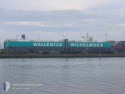
TURANDOT
Vehicles Carrier
Current Trip
| Time Travelled | 4 days |
|---|---|
| Remaining Time | --- |
| Distance Travelled | 1687.11 nm |
| Remaining Distance | --- |
| AVG Speed | 15.6 Knop |
| MAX Speed | 19 Knop |
| AVG Wind | 11.1 knots |
| MAX Wind | 24 knots |
| MIN Temp | 13.4°C / 56.12°F |
| MAX Temp | 28.5°C / 83.3°F |
| Djupgående | 7.9 m |
| Position mottagen | 13 h, 3 m sen |
Current Position
| Longitud | --- |
|---|---|
| Latitude | --- |
| Status | Under way using engine |
| Fart | 16 Knop |
| Kurs | 33.9° |
| Område | Bali Sea |
| Station | T-AIS |
| Position mottagen | 13 h, 3 m sen |
Info
Information
The current position of TURANDOT is in Bali Sea with coordinates -8.30592° / 115.91728° as reported on 2024-09-27 21:23 by AIS to our vessel tracker app. The vessel's current speed is 16 Knop and is heading at the port of SHANGHAI. The estimated time of arrival as calculated by MyShipTracking vessel tracking app is 2024-10-04 20:00 LT
The vessel TURANDOT (IMO: 9070450, MMSI: 257269000) is a Vehicles Carrier that was built in 1995 ( 29 År gammal ). It's sailing under the flag of [NO] Norway.
In this page you can find informations about the vessels current position, last detected port calls, and current voyage information. If the vessels is not in coverage by AIS you will find the latest position.
The current position of TURANDOT is detected by our AIS receivers and we are not responsible for the reliability of the data. The last position was recorded while the vessel was in Coverage by the Ais receivers of our vessel tracking app.
The current draught of TURANDOT as reported by AIS is 7.9 meters
Weather
| Temperature | 28.3°C / 82.94°F |
|---|---|
| Wind Speed | 12 knots |
| Direction | 117° ESE |
| Pressure | 1008.6 hPa |
| Humidity | 76.3 % |
| Cloud Coverage | 6 % |
Featured Company
Last Port Calls
| Port | Arrival | Departure | Time In Port |
|---|---|---|---|
| 2024-09-22 13:15 | 2024-09-24 00:23 | 1 d | |
| 2024-09-12 14:17 | 2024-09-16 05:22 | 3 d | |
| 2024-09-09 22:18 | 2024-09-11 00:53 | 1 d | |
| 2024-09-07 00:09 | 2024-09-07 22:11 | 22 h | |
| 2024-08-25 20:33 | 2024-08-26 20:21 | 23 h | |
| 2024-08-22 21:12 | 2024-08-23 07:26 | 10 h | |
| 2024-07-31 19:59 | 2024-08-04 08:25 | 3 d | |
| 2024-07-30 11:11 | 2024-07-31 01:45 | 14 h | |
| 2024-07-12 08:34 | 2024-07-13 20:14 | 1 d |
Most Visited Ports (Last year)
| Port | Arrivals | |
|---|---|---|
| 6 | ||
| 5 | ||
| 4 | ||
| 4 | ||
| 3 | ||
| 2 |
Last Trips
| Origin | Departure | Destination | Arrival | Distance | |
|---|---|---|---|---|---|
| 2024-09-16 15:22 | 2024-09-22 21:15 | 1871.52 nm | |||
| 2024-09-11 10:53 | 2024-09-13 00:17 | 562.77 nm | |||
| 2024-09-08 08:11 | 2024-09-10 08:18 | 597.54 nm | |||
| 2024-08-27 04:21 | 2024-09-07 10:09 | 4143.60 nm | |||
| 2024-08-23 16:26 | 2024-08-26 04:33 | 489.68 nm | |||
| 2024-08-04 12:25 | 2024-08-23 06:12 | 6522.68 nm | |||
| 2024-07-31 05:45 | 2024-07-31 23:59 | 268.01 nm | |||
| 2024-07-14 04:14 | 2024-07-30 15:11 | 5574.55 nm | |||
| 2024-06-28 13:57 | 2024-07-12 16:34 | 5187.09 nm |
Events
| Tid | Event | Detaljer | Position / Dest | Information |
|---|---|---|---|---|
| 2024-09-27 21:28 | Status ändrad | Default Under way using engine |
-8.28882 / 115.92841
CN SHG
|
Fart: 16 kn Kurs: 33.9° |
| 2024-09-27 21:23 | Status ändrad | Under way using engine Default |
-8.30592 / 115.91728
CN SHG
|
Fart: 15.8 kn Kurs: 32° |
| 2024-09-27 21:23 | UTANFÖR täckningsområde |
-8.30592 / 115.91728
Bali Sea
CN SHG
|
Fart: 16 kn Kurs: 33.9° |
|
| 2024-09-27 21:18 | Status ändrad | Default Under way using engine |
-8.32520 / 115.90417
CN SHG
|
Fart: 15.9 kn Kurs: 18.4° |
| 2024-09-27 21:01 | Upptäckt i hav | Indonesian part of the Bali Sea |
-8.39796 / 115.87790
Bali Sea
CN SHG
|
Fart: 15.8 kn Kurs: 17.3° |
| 2024-09-27 21:00 | Status ändrad | Under way using engine Default |
-8.39967 / 115.87735
CN SHG
|
Fart: 15.1 kn Kurs: 16° |
| 2024-09-27 21:00 | I täckningsområde |
-8.39796 / 115.87790
Bali Sea
CN SHG
|
Fart: 15.8 kn Kurs: 17.3° |
|
| 2024-09-24 02:02 | Status ändrad | Default Under way using engine |
-31.83628 / 115.40898
CN SHG
|
Fart: 15.9 kn Kurs: 288.2° |
| 2024-09-24 01:58 | Status ändrad | Under way using engine Default |
-31.84188 / 115.42642
CN SHG
|
Fart: 16.3 kn Kurs: 292° |
| 2024-09-24 01:58 | UTANFÖR täckningsområde |
-31.84188 / 115.42642
Indian Ocean
CN SHG
|
Fart: 15.9 kn Kurs: 288.2° |