

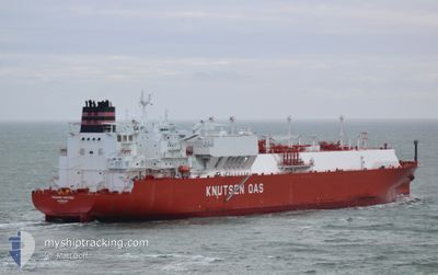
TRAIANO KNUTSEN
Tanker

Current Trip
| Time Travelled | 10 days |
|---|---|
| Remaining Time | 4 days |
| Distance Travelled | 2247.73 nm |
| Remaining Distance | 1224.26 nm |
| AVG Speed | 11.2 Knop |
| MAX Speed | 17.1 Knop |
| AVG Wind | 10.1 knots |
| MAX Wind | 26 knots |
| MIN Temp | 12°C / 53.6°F |
| MAX Temp | 17.6°C / 63.68°F |
| Djupgående | 9.6 m |
| Position mottagen | 4 d sen |
Current Position
| Longitud | --- |
|---|---|
| Latitude | --- |
| Status | Under way using engine |
| Fart | 12.5 Knop |
| Kurs | 274.4° |
| Område | Strait of Gibraltar |
| Station | T-AIS |
| Position mottagen | 4 d sen |
Information
The current position of TRAIANO KNUTSEN is in Strait of Gibraltar with coordinates 35.96646° / -5.68468° as reported on 2025-02-28 14:11 by AIS to our vessel tracker app. The vessel's current speed is 12.5 Knop and is heading at the port of ALGECIRAS. The estimated time of arrival as calculated by MyShipTracking vessel tracking app is 2025-03-09 02:09 LT
The vessel TRAIANO KNUTSEN (IMO: 9854765, MMSI: 257575000) is a Tanker It's sailing under the flag of [NO] Norway.
In this page you can find informations about the vessels current position, last detected port calls, and current voyage information. If the vessels is not in coverage by AIS you will find the latest position.
The current position of TRAIANO KNUTSEN is detected by our AIS receivers and we are not responsible for the reliability of the data. The last position was recorded while the vessel was in Coverage by the Ais receivers of our vessel tracking app.
The current draught of TRAIANO KNUTSEN as reported by AIS is 9.6 meters
Weather
| Temperature | 17.5°C / 63.5°F |
|---|---|
| Wind Speed | 10 knots |
| Direction | 25° NNE |
| Pressure | 1024.1 hPa |
| Humidity | 68.5 % |
| Cloud Coverage | 82 % |


Featured Company
Most Visited Ports (Last year)
| Port | Arrivals | |
|---|---|---|
| 4 | ||
| 2 | ||
| 1 | ||
| 1 |
Last Trips
| Origin | Departure | Destination | Arrival | Distance |
|---|
Events
| Tid | Event | Detaljer | Position / Dest | Information |
|---|---|---|---|---|
| 2025-02-28 14:19 | Status ändrad | Default Under way using engine |
35.96863 / -5.72002
ESALG
|
Fart: 12.5 kn Kurs: 274.4° |
| 2025-02-28 14:11 | UTANFÖR täckningsområde |
35.96646 / -5.68468
Strait of Gibraltar
ESALG
|
Fart: 12.5 kn Kurs: 274.4° |
|
| 2025-02-28 12:45 | STARTAR förflyttning | 5.38 nm, South of ALGECIRAS |
36.05056 / -5.38928
ESALG
|
Fart: 3.1 kn Kurs: 162° |
| 2025-02-28 12:35 | STOPPAR förflyttning | 5.27 nm, South of ALGECIRAS |
36.05242 / -5.38954
ESALG
|
Fart: 0.3 kn Kurs: 230° |
| 2025-02-28 11:29 | Byter havsområde | Spanish part of the Strait of Gibraltar Gibraltarian part of the Strait of Gibraltar |
36.08700 / -5.38436
Strait of Gibraltar
ESALG
|
Fart: 6.9 kn Kurs: 213.5° |
| 2025-02-28 11:12 | Destination ändrad | ESALG GIGIB |
36.11374 / -5.36606
ESALG
|
Fart: 4.1 kn Kurs: 204° |
| 2025-02-28 11:12 | ETA ändrat | 2025/02/28 12:30 2025/02/27 14:00 |
36.11374 / -5.36606
ESALG
|
Fart: 4.1 kn Kurs: 204° |
| 2025-02-28 11:09 | STARTAR förflyttning | 1.9 nm, South of GIBRALTAR |
36.11581 / -5.36459
GIGIB
|
Fart: 3.1 kn Kurs: 204° |
| 2025-02-28 11:05 | Status ändrad | Under way using engine At anchor |
36.11777 / -5.36355
GIGIB
|
Fart: 0.6 kn Kurs: 193° |
| 2025-02-27 18:31 | STOPPAR förflyttning | 1.96 nm, South of GIBRALTAR |
36.11485 / -5.36062
GIGIB
|
Fart: 0.2 kn Kurs: 293° |