
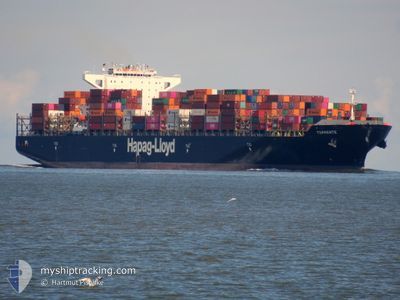
TORRENTE
Container Ship
Current Trip
| Time Travelled | 8 days |
|---|---|
| Remaining Time | 4 h, 51 mins |
| Distance Travelled | 590.95 nm |
| Remaining Distance | 165.14 nm |
| AVG Speed | 11.6 Knop |
| MAX Speed | 22.5 Knop |
| AVG Wind | 14.2 knots |
| MAX Wind | 23.8 knots |
| MIN Temp | 5.6°C / 42.08°F |
| MAX Temp | 14.5°C / 58.1°F |
| Djupgående | 8.9 m |
| Position mottagen | 10 h, 53 m sen |
Current Position
| Longitud | 6.21858° |
|---|---|
| Latitude | 54.95754° |
| Status | Under way using engine |
| Fart | 10.2 Knop |
| Kurs | 157.5° |
| Område | North Sea |
| Station | T-AIS |
| Position mottagen | 10 h, 53 m sen |
Info
Information
The current position of TORRENTE is in North Sea with coordinates 54.95754° / 6.21858° as reported on 2024-05-04 20:42 by AIS to our vessel tracker app. The vessel's current speed is 10.2 Knop and is heading at the port of HAMBURG. The estimated time of arrival as calculated by MyShipTracking vessel tracking app is 2024-05-05 12:26 LT
The vessel TORRENTE (IMO: 9447914, MMSI: 636092782) is a Container Ship that was built in 2011 ( 13 År gammal ). It's sailing under the flag of [LR] Liberia.
In this page you can find informations about the vessels current position, last detected port calls, and current voyage information. If the vessels is not in coverage by AIS you will find the latest position.
The current position of TORRENTE is detected by our AIS receivers and we are not responsible for the reliability of the data. The last position was recorded while the vessel was in Coverage by the Ais receivers of our vessel tracking app.
The current draught of TORRENTE as reported by AIS is 8.9 meters
Weather
| Temperature | 10.4°C / 50.72°F |
|---|---|
| Wind Speed | 24 knots |
| Direction | 31° NNE |
| Pressure | 1003.8 hPa |
| Humidity | 96.6 % |
| Cloud Coverage | 100 % |
Featured Company
Last Port Calls
| Port | Arrival | Departure | Time In Port |
|---|---|---|---|
| 2024-04-04 09:16 | 2024-04-26 11:15 | 22 d | |
| 2024-03-31 03:55 | 2024-04-01 15:43 | 1 d | |
| 2024-03-20 20:40 | 2024-03-21 23:30 | 1 d | |
| 2024-03-16 20:23 | 2024-03-17 06:10 | 9 h | |
| 2024-03-13 19:20 | 2024-03-15 21:32 | 2 d | |
| 2024-03-02 15:36 |
Most Visited Ports (Last year)
| Port | Arrivals | |
|---|---|---|
| 10 | ||
| 9 | ||
| 9 | ||
| 9 | ||
| 9 | ||
| 9 |
Last Trips
| Origin | Departure | Destination | Arrival | Distance | |
|---|---|---|---|---|---|
| 2024-04-01 17:43 | 2024-04-04 11:16 | 633.61 nm | |||
| 2024-03-21 19:30 | 2024-03-31 05:55 | 4115.88 nm | |||
| 2024-03-17 02:10 | 2024-03-20 16:40 | 260.78 nm | |||
| 2024-03-15 17:32 | 2024-03-16 16:23 | 239.61 nm | |||
| 2024-03-02 16:36 | 2024-03-13 15:20 | 4131.27 nm |
Events
| Tid | Event | Detaljer | Position / Dest | Information |
|---|---|---|---|---|
| 2024-05-04 20:46 | Status ändrad | Default Under way using engine |
54.94696 / 6.22998
DEHAM
|
Fart: 10.2 kn Kurs: 157.5° |
| 2024-05-04 20:42 | UTANFÖR täckningsområde |
54.95754 / 6.21858
North Sea
DEHAM
|
Fart: 10.2 kn Kurs: 157.5° |
|
| 2024-05-04 18:07 | Byter havsområde | German part of the North Sea Danish part of the North Sea |
55.41763 / 6.21993
North Sea
DEHAM
|
Fart: 11.3 kn Kurs: 178.5° |
| 2024-05-04 17:17 | Status ändrad | Under way using engine Default |
55.57517 / 6.22186
DEHAM
|
Fart: 11.3 kn Kurs: 181° |
| 2024-05-04 17:06 | Status ändrad | Default Under way using engine |
55.61077 / 6.22297
DEHAM
|
Fart: 11.3 kn Kurs: 181° |
| 2024-05-04 17:04 | Status ändrad | Under way using engine Default |
55.61710 / 6.22317
DEHAM
|
Fart: 11.3 kn Kurs: 181° |
| 2024-05-04 16:56 | Status ändrad | Default Under way using engine |
55.64218 / 6.22382
DEHAM
|
Fart: 11.3 kn Kurs: 180.9° |
| 2024-05-04 05:17 | Byter havsområde | Danish part of the North Sea Danish part of the Skaggerak |
57.37401 / 8.13784
North Sea
DEHAM
|
Fart: 10.7 kn Kurs: 235° |
| 2024-05-03 20:35 | Byter havsområde | Danish part of the Skaggerak Danish part of the Kattegat |
57.76962 / 10.79515
Skaggerak
DEHAM
|
Fart: 8.7 kn Kurs: 355.3° |
| 2024-05-03 18:47 | Byter havsområde | Danish part of the Kattegat Danish part of the Skaggerak |
57.76891 / 10.79721
Kattegat
DEHAM
|
Fart: 10.2 kn Kurs: 134.8° |