
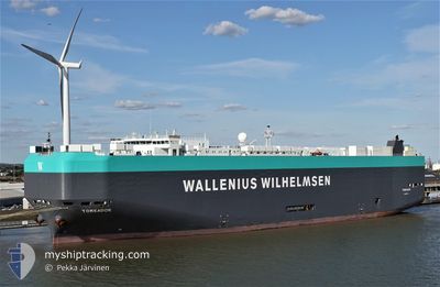
TOREADOR
Vehicles Carrier
Current Trip
| Time Travelled | 7 days |
|---|---|
| Remaining Time | --- |
| Distance Travelled | 2460.10 nm |
| Remaining Distance | --- |
| AVG Speed | 12.9 Knop |
| MAX Speed | 18.2 Knop |
| AVG Wind | 13.5 knots |
| MAX Wind | 27.5 knots |
| MIN Temp | 3.7°C / 38.66°F |
| MAX Temp | 20.9°C / 69.62°F |
| Djupgående | 10.7 m |
| Position mottagen | 7 d sen |
Current Position
| Longitud | 142.62926° |
|---|---|
| Latitude | 35.17010° |
| Status | Under way using engine |
| Fart | 15.1 Knop |
| Kurs | 78.8° |
| Område | North Pacific Ocean |
| Station | T-AIS |
| Position mottagen | 7 d sen |
Info
Information
The current position of TOREADOR is in North Pacific Ocean with coordinates 35.17010° / 142.62926° as reported on 2024-04-28 19:42 by AIS to our vessel tracker app. The vessel's current speed is 15.1 Knop and is heading at the port of TACOMA. The estimated time of arrival as calculated by MyShipTracking vessel tracking app is 2024-05-10 18:00 LT
The vessel TOREADOR (IMO: 9375288, MMSI: 248910000) is a Vehicles Carrier that was built in 2008 ( 16 År gammal ). It's sailing under the flag of [MT] Malta.
In this page you can find informations about the vessels current position, last detected port calls, and current voyage information. If the vessels is not in coverage by AIS you will find the latest position.
The current position of TOREADOR is detected by our AIS receivers and we are not responsible for the reliability of the data. The last position was recorded while the vessel was in Coverage by the Ais receivers of our vessel tracking app.
The current draught of TOREADOR as reported by AIS is 10.7 meters
Weather
| Temperature | 4°C / 39.2°F |
|---|---|
| Wind Speed | 26 knots |
| Direction | 97° E |
| Pressure | 1010.5 hPa |
| Humidity | 94.4 % |
| Cloud Coverage | 100 % |
Featured Company
Last Port Calls
| Port | Arrival | Departure | Time In Port |
|---|---|---|---|
| 2024-04-27 21:32 | 2024-04-28 07:23 | 9 h | |
| 2024-04-25 21:59 | 2024-04-26 08:00 | 10 h | |
| 2024-04-22 15:26 | 2024-04-23 08:11 | 16 h | |
| 2024-04-19 21:33 | 2024-04-21 07:41 | 1 d | |
| 2024-04-16 03:12 | 2024-04-19 08:20 | 3 d | |
| 2024-04-03 03:35 | 2024-04-03 11:29 | 7 h | |
| 2024-03-30 06:01 | 2024-03-31 02:24 | 20 h | |
| 2024-03-26 00:08 | 2024-03-28 11:45 | 2 d | |
| 2024-03-18 05:00 | 2024-03-21 07:35 | 3 d | |
| 2024-03-01 19:37 | 2024-03-02 21:10 | 1 d |
Most Visited Ports (Last year)
| Port | Arrivals | |
|---|---|---|
| 4 | ||
| 4 | ||
| 4 | ||
| 3 | ||
| 3 | ||
| 2 |
Last Trips
| Origin | Departure | Destination | Arrival | Distance | |
|---|---|---|---|---|---|
| 2024-04-26 17:00 | 2024-04-28 06:32 | 378.93 nm | |||
| 2024-04-23 17:11 | 2024-04-26 06:59 | 993.31 nm | |||
| 2024-04-21 16:41 | 2024-04-23 00:26 | 497.48 nm | |||
| 2024-04-19 17:20 | 2024-04-20 06:33 | 104.01 nm | |||
| 2024-04-03 22:29 | 2024-04-16 12:12 | 4239.19 nm | |||
| 2024-03-31 13:24 | 2024-04-03 14:35 | 1101.58 nm | |||
| 2024-03-28 22:45 | 2024-03-30 17:01 | 589.68 nm | |||
| 2024-03-21 15:35 | 2024-03-26 11:08 | 1717.65 nm | |||
| 2024-03-02 23:10 | 2024-03-18 13:00 | 4371.16 nm | |||
| 2024-02-29 07:03 | 2024-03-01 21:37 | 312.87 nm |
Events
| Tid | Event | Detaljer | Position / Dest | Information |
|---|---|---|---|---|
| 2024-04-28 19:43 | Status ändrad | Default Under way using engine |
35.17074 / 142.63325
US TIW
|
Fart: 15.1 kn Kurs: 78.8° |
| 2024-04-28 19:42 | UTANFÖR täckningsområde |
35.17010 / 142.62926
North Pacific Ocean
US TIW
|
Fart: 15.1 kn Kurs: 78.8° |
|
| 2024-04-28 19:37 | Status ändrad | Under way using engine Default |
35.16565 / 142.60083
US TIW
|
Fart: 15.9 kn Kurs: 80° |
| 2024-04-28 19:21 | I täckningsområde |
35.16565 / 142.60083
North Pacific Ocean
US TIW
|
Fart: 15.3 kn Kurs: 77.4° |
|
| 2024-04-28 18:36 | Status ändrad | Default Under way using engine |
35.12018 / 142.28113
US TIW
|
Fart: 15.6 kn Kurs: 81.1° |
| 2024-04-28 18:29 | UTANFÖR täckningsområde |
35.11580 / 142.24610
North Pacific Ocean
US TIW
|
Fart: 15.6 kn Kurs: 81.1° |
|
| 2024-04-28 17:04 | Status ändrad | Under way using engine Default |
35.05953 / 141.79414
US TIW
|
Fart: 16 kn Kurs: 81° |
| 2024-04-28 17:01 | Status ändrad | Default Under way using engine |
35.05742 / 141.77756
US TIW
|
Fart: 16.1 kn Kurs: 80.8° |
| 2024-04-28 15:56 | Status ändrad | Under way using engine Default |
35.00767 / 141.44151
US TIW
|
Fart: 14.9 kn Kurs: 81° |
| 2024-04-28 15:48 | Status ändrad | Default Under way using engine |
35.00277 / 141.40245
US TIW
|
Fart: 15.1 kn Kurs: 82° |