

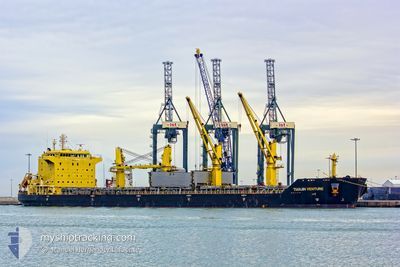
TIANJIN VENTURE
Bulk Carrier

Current Trip
| Time Travelled | 14 days |
|---|---|
| Remaining Time | --- |
| Distance Travelled | 3132.63 nm |
| Remaining Distance | --- |
| AVG Speed | 10.3 Knop |
| MAX Speed | 16.3 Knop |
| AVG Wind | 11.7 knots |
| MAX Wind | 20 knots |
| MIN Temp | 12.2°C / 53.96°F |
| MAX Temp | 30.8°C / 87.44°F |
| Djupgående | 11.1 m |
| Position mottagen | 6 m sen |
Current Position
| Longitud | --- |
|---|---|
| Latitude | --- |
| Status | At anchor |
| Fart | 0.1 Knop |
| Kurs | 46° |
| Område | North Atlantic Ocean |
| Station | T-AIS |
| Position mottagen | 6 m sen |
Information
The current position of TIANJIN VENTURE is in North Atlantic Ocean with coordinates 28.09760° / -15.38997° as reported on 2025-03-07 11:54 by AIS to our vessel tracker app. The vessel's current speed is 0.1 Knop
The vessel TIANJIN VENTURE (IMO: 9457294, MMSI: 477559900) is a Bulk Carrier that was built in 2009 ( 16 År gammal ). It's sailing under the flag of [HK] Hong Kong.
In this page you can find informations about the vessels current position, last detected port calls, and current voyage information. If the vessels is not in coverage by AIS you will find the latest position.
The current position of TIANJIN VENTURE is detected by our AIS receivers and we are not responsible for the reliability of the data. The last position was recorded while the vessel was in Coverage by the Ais receivers of our vessel tracking app.
The current draught of TIANJIN VENTURE as reported by AIS is 11.1 meters
Weather
| Temperature | 16.7°C / 62.06°F |
|---|---|
| Wind Speed | 2 knots |
| Direction | 4° N |
| Pressure | 1017.6 hPa |
| Humidity | 61.9 % |
| Cloud Coverage | 23 % |


Featured Company
Last Port Calls
| Port | Arrival | Departure | Time In Port |
|---|---|---|---|
| 2025-02-19 18:46 | 2025-02-21 08:32 | 1 d | |
| 2025-02-01 10:42 | 2025-02-10 09:14 | 8 d | |
| 2025-01-09 13:50 | 2025-01-14 20:58 | 5 d |
Most Visited Ports (Last year)
| Port | Arrivals | |
|---|---|---|
| 2 | ||
| 1 | ||
| 1 | ||
| 1 | ||
| 1 | ||
| 1 |
Last Trips
| Origin | Departure | Destination | Arrival | Distance | |
|---|---|---|---|---|---|
| 2025-02-10 09:14 | 2025-02-19 18:46 | 870.17 nm | |||
| 2025-01-14 20:58 | 2025-02-01 10:42 | 3488.93 nm |
Events
| Tid | Event | Detaljer | Position / Dest | Information |
|---|---|---|---|---|
| 2025-03-07 11:57 | Status ändrad | Default At anchor |
28.09768 / -15.39007
ES LPA
|
Fart: 0.1 kn Kurs: 46° |
| 2025-03-07 11:18 | Status ändrad | At anchor Default |
28.09737 / -15.38953
ES LPA
|
Fart: Kurs: 25° |
| 2025-03-07 11:12 | Status ändrad | Default At anchor |
28.09723 / -15.38950
ES LPA
|
Fart: Kurs: 25° |
| 2025-03-07 10:51 | Status ändrad | At anchor Default |
28.09708 / -15.38945
ES LPA
|
Fart: Kurs: 17° |
| 2025-03-07 10:45 | Status ändrad | Default At anchor |
28.09708 / -15.38943
ES LPA
|
Fart: Kurs: 15° |
| 2025-03-07 08:36 | Status ändrad | At anchor Default |
28.09713 / -15.38885
ES LPA
|
Fart: 0.1 kn Kurs: 354° |
| 2025-03-07 08:30 | Status ändrad | Default At anchor |
28.09710 / -15.38877
ES LPA
|
Fart: Kurs: 349° |
| 2025-03-07 07:33 | Status ändrad | At anchor Under way using engine |
28.09822 / -15.38735
ES LPA
|
Fart: 0.7 kn Kurs: 270° |
| 2025-03-07 07:27 | STOPPAR förflyttning | 2.25 nm, South East of LAS PALMAS |
28.09925 / -15.38702
ES LPA
|
Fart: 0.3 kn Kurs: 273° |
| 2025-03-07 04:23 | Status ändrad | Under way using engine Default |
27.74573 / -15.41497
ES LPA
|
Fart: 11.3 kn Kurs: 51° |