

THAMES GUARDIAN
Law Enforcement

Current Trip
| Trip Time | 3 h, 50 mins |
|---|---|
| Trip Distance | 49.86 nm |
| AVG Speed | 14 Knop |
| MAX Speed | 16.9 Knop |
| Djupgående | 1.3 m |
| AVG Wind | 12.3 knots |
| MAX Wind | 15.3 knots |
| MIN Temp | 9.6°C / 49.28°F |
| MAX Temp | 11.8°C / 53.24°F |
| Position mottagen | Nu |
Current Position
| Longitud | --- |
|---|---|
| Latitude | --- |
| Status | Under way using engine |
| Fart | |
| Kurs | --- |
| Område | North Sea |
| Station | T-AIS |
| Position mottagen | Nu |
Information
The current position of THAMES GUARDIAN is in North Sea with coordinates 51.32882° / 1.42062° as reported on 2025-03-07 01:08 by AIS to our vessel tracker app. The vessel's current speed is 0 Knop and is currently inside the port of RAMSGATE.
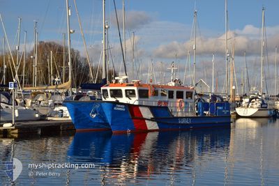
The vessel THAMES GUARDIAN (MMSI: 235089286) is a Law Enforcement It's sailing under the flag of [GB] United Kingdom.
In this page you can find informations about the vessels current position, last detected port calls, and current voyage information. If the vessels is not in coverage by AIS you will find the latest position.
The current position of THAMES GUARDIAN is detected by our AIS receivers and we are not responsible for the reliability of the data. The last position was recorded while the vessel was in Coverage by the Ais receivers of our vessel tracking app.
The current draught of THAMES GUARDIAN as reported by AIS is 1.3 meters
Weather
| Temperature | 9.5°C / 49.1°F |
|---|---|
| Wind Speed | 10 knots |
| Direction | 184° S |
| Pressure | 1013.9 hPa |
| Humidity | 88.8 % |
| Cloud Coverage | 100 % |


Featured Company
Last Port Calls
| Port | Arrival | Departure | Time In Port |
|---|---|---|---|
| 2025-03-06 13:50 | |||
| 2025-03-05 18:19 | 2025-03-06 10:00 | 15 h | |
| 2025-03-05 17:35 | 2025-03-05 17:37 | 2 m | |
| 2025-03-04 21:32 | 2025-03-05 11:19 | 13 h | |
| 2025-03-04 16:13 | 2025-03-04 17:58 | 1 h | |
| 2025-03-04 13:53 | 2025-03-04 13:57 | 3 m | |
| 2025-03-03 16:06 | 2025-03-04 13:46 | 21 h | |
| 2025-03-02 17:12 | 2025-03-03 10:24 | 17 h | |
| 2025-02-18 17:59 | 2025-03-02 15:01 | 11 d | |
| 2025-02-17 09:44 | 2025-02-18 12:52 | 1 d |
Last Trips
| Origin | Departure | Destination | Arrival | Distance | |
|---|---|---|---|---|---|
| 2025-03-06 10:00 | 2025-03-06 13:50 | 49.86 nm | |||
| 2025-03-05 17:37 | 2025-03-05 18:19 | 6.77 nm | |||
| 2025-03-05 11:19 | 2025-03-05 17:35 | 43.71 nm | |||
| 2025-03-04 17:58 | 2025-03-04 21:32 | 32.84 nm | |||
| 2025-03-04 13:57 | 2025-03-04 16:13 | 16.76 nm | |||
| 2025-03-04 13:46 | 2025-03-04 13:53 | 1.06 nm | |||
| 2025-03-03 10:24 | 2025-03-03 16:06 | 43.68 nm | |||
| 2025-03-02 15:01 | 2025-03-02 17:12 | 29.65 nm | |||
| 2025-02-18 12:52 | 2025-02-18 17:59 | 46.17 nm | |||
| 2025-02-17 06:46 | 2025-02-17 09:44 | 6.26 nm |
Events
| Tid | Event | Detaljer | Position / Dest | Information |
|---|---|---|---|---|
| 2025-03-06 13:54 | STOPPAR förflyttning |
51.32932 / 1.42021
[GB] RAMSGATE
|
Fart: 0.2 kn Kurs: 511° |
|
| 2025-03-06 13:50 | ANLÄNDER HAMN |
|
51.32522 / 1.42402
[GB] RAMSGATE
|
Fart: 12.1 kn Kurs: 275.2° |
| 2025-03-06 13:42 | STARTAR förflyttning | 1.9 nm, East of RAMSGATE |
51.32507 / 1.47175
SURVEY
|
Fart: 10.8 kn Kurs: 263.2° |
| 2025-03-06 13:39 | STOPPAR förflyttning | 2.01 nm, East of RAMSGATE |
51.32595 / 1.47472
SURVEY
|
Fart: 0.3 kn Kurs: 511° |
| 2025-03-06 13:17 | STARTAR förflyttning | 5.06 nm, North of RAMSGATE |
51.40941 / 1.43524
SURVEY
|
Fart: 12.4 kn Kurs: 127° |
| 2025-03-06 13:15 | STOPPAR förflyttning | 5.12 nm, North of RAMSGATE |
51.41063 / 1.43301
SURVEY
|
Fart: 0.3 kn Kurs: 511° |
| 2025-03-06 12:12 | STARTAR förflyttning | 8.36 nm, North of WHITSTABLE |
51.49745 / 1.08890
SURVEY
|
Fart: 13.4 kn Kurs: 103.7° |
| 2025-03-06 12:10 | STOPPAR förflyttning | 8.35 nm, North of WHITSTABLE |
51.49787 / 1.08548
SURVEY
|
Fart: 0.2 kn Kurs: 511° |
| 2025-03-06 11:44 | STARTAR förflyttning | 6.54 nm, North West of WHITSTABLE |
51.46056 / .94482
SURVEY
|
Fart: 12.3 kn Kurs: 61° |
| 2025-03-06 11:42 | STOPPAR förflyttning | 6.53 nm, North West of WHITSTABLE |
51.45951 / .94215
SURVEY
|
Fart: 0.3 kn Kurs: 511° |