

THALIS
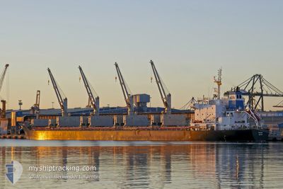
Bulk Carrier

Current Trip
| Time Travelled | 29 days |
|---|---|
| Remaining Time | 1 day |
| Distance Travelled | 5931.64 nm |
| Remaining Distance | 346.81 nm |
| AVG Speed | 12.2 Knop |
| MAX Speed | 15.9 Knop |
| AVG Wind | 12.7 knots |
| MAX Wind | 35 knots |
| MIN Temp | 14°C / 57.2°F |
| MAX Temp | 31.9°C / 89.42°F |
| Djupgående | 9.3 m |
| Position mottagen | 2 h, 39 m sen |
Current Position
| Longitud | --- |
|---|---|
| Latitude | --- |
| Status | Under way using engine |
| Fart | 10.9 Knop |
| Kurs | 35° |
| Område | Mediterranean Sea - Western Basin |
| Station | T-AIS |
| Position mottagen | 2 h, 39 m sen |
Information
The current position of THALIS is in Mediterranean Sea - Western Basin with coordinates 38.61573° / 0.39561° as reported on 2025-03-22 00:52 by AIS to our vessel tracker app. The vessel's current speed is 10.9 Knop and is heading at the port of FOS. The estimated time of arrival as calculated by MyShipTracking vessel tracking app is 2025-03-23 06:16 LT
The vessel THALIS (IMO: 9616747, MMSI: 538008283) is a Bulk Carrier that was built in 2012 ( 13 År gammal ). It's sailing under the flag of [MH] Marshall Is.
In this page you can find informations about the vessels current position, last detected port calls, and current voyage information. If the vessels is not in coverage by AIS you will find the latest position.
The current position of THALIS is detected by our AIS receivers and we are not responsible for the reliability of the data. The last position was recorded while the vessel was in Coverage by the Ais receivers of our vessel tracking app.
The current draught of THALIS as reported by AIS is 9.3 meters
Weather
| Temperature | 15.2°C / 59.36°F |
|---|---|
| Wind Speed | 13 knots |
| Direction | 210° SSW |
| Pressure | 1008.9 hPa |
| Humidity | 83.7 % |
| Cloud Coverage | 46 % |


Featured Company
Last Port Calls
| Port | Arrival | Departure | Time In Port |
|---|---|---|---|
| 2025-02-15 10:04 | 2025-02-20 22:16 | 5 d | |
| 2025-01-04 14:58 |
Most Visited Ports (Last year)
| Port | Arrivals | |
|---|---|---|
| 2 | ||
| 2 | ||
| 1 | ||
| 1 | ||
| 1 | ||
| 1 |
Last Trips
| Origin | Departure | Destination | Arrival | Distance | |
|---|---|---|---|---|---|
| 2025-01-04 15:58 | 2025-02-15 07:04 | 4383.49 nm |
Events
| Tid | Event | Detaljer | Position / Dest | Information |
|---|---|---|---|---|
| 2025-03-22 00:58 | Status ändrad | Default Under way using engine |
38.63171 / .41012
FRFZS
|
Fart: 10.9 kn Kurs: 35° |
| 2025-03-22 00:52 | UTANFÖR täckningsområde |
38.61573 / .39561
Mediterranean Sea - Western Basin
FRFZS
|
Fart: 10.9 kn Kurs: 35° |
|
| 2025-03-22 00:46 | Status ändrad | Under way using engine Default |
38.59980 / .38118
FRFZS
|
Fart: 12.1 kn Kurs: 35° |
| 2025-03-22 00:38 | I täckningsområde |
38.59980 / .38118
Mediterranean Sea - Western Basin
FRFZS
|
Fart: 11.9 kn Kurs: 35° |
|
| 2025-03-21 23:50 | Status ändrad | Default Under way using engine |
38.44306 / .24276
FRFZS
|
Fart: 11.9 kn Kurs: 33° |
| 2025-03-21 23:42 | UTANFÖR täckningsområde |
38.42131 / .22361
Mediterranean Sea - Western Basin
FRFZS
|
Fart: 11.9 kn Kurs: 33° |
|
| 2025-03-21 22:56 | Status ändrad | Under way using engine Default |
38.28872 / .11229
FRFZS
|
Fart: 12.3 kn Kurs: 34° |
| 2025-03-21 22:54 | Status ändrad | Default Under way using engine |
38.28107 / .10578
FRFZS
|
Fart: 11.9 kn Kurs: 33° |
| 2025-03-21 22:48 | Status ändrad | Under way using engine Default |
38.26434 / .09172
FRFZS
|
Fart: 12.4 kn Kurs: 33° |
| 2025-03-21 22:38 | Status ändrad | Default Under way using engine |
38.23534 / .06743
FRFZS
|
Fart: 11.9 kn Kurs: 33° |