
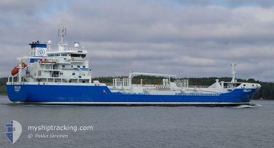
TELLUS
Oil/Chemical Tanker
Current Trip
| Time Travelled | 3 days |
|---|---|
| Remaining Time | --- |
| Distance Travelled | 644.09 nm |
| Remaining Distance | --- |
| AVG Speed | 11.3 Knop |
| MAX Speed | 14.6 Knop |
| AVG Wind | 8.6 knots |
| MAX Wind | 19 knots |
| MIN Temp | -6.9°C / 19.58°F |
| MAX Temp | -0.7°C / 30.74°F |
| Djupgående | 6.4 m |
| Position mottagen | 6 m sen |
Current Position
| Longitud | --- |
|---|---|
| Latitude | --- |
| Status | At anchor |
| Fart | 0.1 Knop |
| Kurs | 344° |
| Område | Gulf of Finland |
| Station | T-AIS |
| Position mottagen | 6 m sen |
Info
Information
The current position of TELLUS is in Gulf of Finland with coordinates 60.02680° / 25.52720° as reported on 2025-02-17 22:31 by AIS to our vessel tracker app. The vessel's current speed is 0.1 Knop
The vessel TELLUS (IMO: 9321615, MMSI: 266471000) is a Oil/Chemical Tanker that was built in 2006 ( 19 År gammal ). It's sailing under the flag of [SE] Sweden.
In this page you can find informations about the vessels current position, last detected port calls, and current voyage information. If the vessels is not in coverage by AIS you will find the latest position.
The current position of TELLUS is detected by our AIS receivers and we are not responsible for the reliability of the data. The last position was recorded while the vessel was in Coverage by the Ais receivers of our vessel tracking app.
The current draught of TELLUS as reported by AIS is 6.4 meters
Weather
| Temperature | -4.3°C / 24.26°F |
|---|---|
| Wind Speed | 9 knots |
| Direction | 306° NW |
| Pressure | 1016.9 hPa |
| Humidity | 77.7 % |
| Cloud Coverage | 22 % |
Featured Company
Last Port Calls
| Port | Arrival | Departure | Time In Port |
|---|---|---|---|
| 2025-02-14 05:29 | 2025-02-14 18:03 | 12 h | |
| 2025-02-11 19:30 | 2025-02-11 20:17 | 46 m | |
| 2025-02-11 00:17 | 2025-02-11 14:55 | 14 h | |
| 2025-02-10 10:05 | 2025-02-10 20:05 | 9 h | |
| 2025-02-08 17:43 | 2025-02-09 09:51 | 16 h | |
| 2025-02-05 18:37 | 2025-02-05 19:22 | 45 m | |
| 2025-02-05 00:29 | 2025-02-05 14:17 | 13 h | |
| 2025-02-04 19:55 | 2025-02-04 20:21 | 25 m | |
| 2025-02-04 01:32 | 2025-02-04 08:26 | 6 h | |
| 2025-02-02 05:06 | 2025-02-02 20:56 | 15 h |
Last Trips
| Origin | Departure | Destination | Arrival | Distance | |
|---|---|---|---|---|---|
| 2025-02-11 21:17 | 2025-02-14 07:29 | 302.37 nm | |||
| 2025-02-11 15:55 | 2025-02-11 20:30 | 47.82 nm | |||
| 2025-02-10 21:05 | 2025-02-11 01:17 | 48.60 nm | |||
| 2025-02-09 11:51 | 2025-02-10 11:05 | 299.69 nm | |||
| 2025-02-05 20:22 | 2025-02-08 19:43 | 305.13 nm | |||
| 2025-02-05 15:17 | 2025-02-05 19:37 | 48.56 nm | |||
| 2025-02-04 21:21 | 2025-02-05 01:29 | 48.78 nm | |||
| 2025-02-04 09:26 | 2025-02-04 20:55 | 105.54 nm | |||
| 2025-02-02 22:56 | 2025-02-04 02:32 | 336.04 nm | |||
| 2025-01-28 02:08 | 2025-02-02 07:06 | 666.51 nm |
Events
| Tid | Event | Detaljer | Position / Dest | Information |
|---|---|---|---|---|
| 2025-02-17 22:10 | Status ändrad | At anchor Default |
60.02677 / 25.52658
PORVOO
|
Fart: 0.1 kn Kurs: 353° |
| 2025-02-17 22:07 | Status ändrad | Default At anchor |
60.02678 / 25.52667
PORVOO
|
Fart: 0.1 kn Kurs: 349° |
| 2025-02-17 21:58 | Status ändrad | At anchor Default |
60.02678 / 25.52687
PORVOO
|
Fart: Kurs: 352° |
| 2025-02-17 21:55 | Status ändrad | Default At anchor |
60.02680 / 25.52678
PORVOO
|
Fart: Kurs: 353° |
| 2025-02-17 20:04 | Status ändrad | At anchor Default |
60.02680 / 25.52722
PORVOO
|
Fart: Kurs: 344° |
| 2025-02-17 20:01 | Status ändrad | Default At anchor |
60.02682 / 25.52717
PORVOO
|
Fart: 0.1 kn Kurs: 330° |
| 2025-02-17 19:10 | Status ändrad | At anchor Default |
60.02718 / 25.52738
PORVOO
|
Fart: Kurs: 330° |
| 2025-02-17 19:07 | Status ändrad | Default At anchor |
60.02718 / 25.52735
PORVOO
|
Fart: 0.1 kn Kurs: 323° |
| 2025-02-17 18:46 | Status ändrad | At anchor Default |
60.02727 / 25.52745
PORVOO
|
Fart: 0.1 kn Kurs: 322° |
| 2025-02-17 18:43 | Status ändrad | Default At anchor |
60.02730 / 25.52748
PORVOO
|
Fart: 0.1 kn Kurs: 316° |