
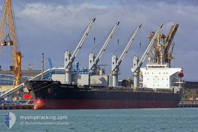
TANAIS DREAM
Bulk Carrier
Current Trip
| Time Travelled | 36 days |
|---|---|
| Remaining Time | --- |
| Distance Travelled | 8885.77 nm |
| Remaining Distance | --- |
| AVG Speed | 10.8 Knop |
| MAX Speed | 13.8 Knop |
| AVG Wind | 10.7 knots |
| MAX Wind | 27 knots |
| MIN Temp | 13.5°C / 56.3°F |
| MAX Temp | 29.6°C / 85.28°F |
| Djupgående | 10.2 m |
| Position mottagen | 1 d sen |
Current Position
| Longitud | -17.83356° |
|---|---|
| Latitude | 23.17351° |
| Status | Under way using engine |
| Fart | 10.9 Knop |
| Kurs | 19.1° |
| Område | North Atlantic Ocean |
| Station | T-AIS |
| Position mottagen | 1 d sen |
Info
Information
The current position of TANAIS DREAM is in North Atlantic Ocean with coordinates 23.17351° / -17.83356° as reported on 2024-04-25 14:54 by AIS to our vessel tracker app. The vessel's current speed is 10.9 Knop and is heading at the port of BEJAIA. The estimated time of arrival as calculated by MyShipTracking vessel tracking app is 2024-05-01 22:00 LT
The vessel TANAIS DREAM (IMO: 9283899, MMSI: 312124000) is a Bulk Carrier that was built in 2003 ( 21 År gammal ). It's sailing under the flag of [BZ] Belize.
In this page you can find informations about the vessels current position, last detected port calls, and current voyage information. If the vessels is not in coverage by AIS you will find the latest position.
The current position of TANAIS DREAM is detected by our AIS receivers and we are not responsible for the reliability of the data. The last position was recorded while the vessel was in Coverage by the Ais receivers of our vessel tracking app.
The current draught of TANAIS DREAM as reported by AIS is 10.2 meters
Weather
| Temperature | 19.6°C / 67.28°F |
|---|---|
| Wind Speed | 15 knots |
| Direction | 46° NE |
| Pressure | 1012.4 hPa |
| Humidity | 70.7 % |
| Cloud Coverage | --- |
Featured Company
Last Port Calls
| Port | Arrival | Departure | Time In Port |
|---|---|---|---|
| 2024-03-21 10:34 | |||
| 2024-02-20 10:43 | 2024-02-22 21:23 | 2 d | |
| 2024-02-02 20:59 |
Last Trips
| Origin | Departure | Destination | Arrival | Distance | |
|---|---|---|---|---|---|
| 2024-02-02 21:59 | 2024-02-20 13:43 | 2425.97 nm |
Events
| Tid | Event | Detaljer | Position / Dest | Information |
|---|---|---|---|---|
| 2024-04-25 14:57 | Status ändrad | Default Under way using engine |
23.18167 / -17.83000
DZ BJA
|
Fart: 10.9 kn Kurs: 19.1° |
| 2024-04-25 14:54 | Status ändrad | Under way using engine Default |
23.17351 / -17.83356
DZ BJA
|
Fart: 10.8 kn Kurs: 19° |
| 2024-04-25 14:54 | UTANFÖR täckningsområde |
23.17351 / -17.83356
North Atlantic Ocean
DZ BJA
|
Fart: 10.9 kn Kurs: 19.1° |
|
| 2024-04-25 14:30 | Status ändrad | Default Under way using engine |
23.10500 / -17.85833
DZ BJA
|
Fart: 10.7 kn Kurs: 17.6° |
| 2024-04-25 13:25 | Byter havsområde | Western Saharan part of the North Atlantic Ocean Argentinean part of the Rio de La Plata |
22.92210 / -17.92562
North Atlantic Ocean
DZ BJA
|
Fart: 11.2 kn Kurs: 18.6° |
| 2024-04-25 13:24 | Destination ändrad | DZ BJA DZ ALG |
22.91820 / -17.92704
DZ BJA
|
Fart: 11.1 kn Kurs: 18.8° |
| 2024-04-25 13:24 | ETA ändrat | 2024/05/01 22:00 2024/05/01 18:00 |
22.91820 / -17.92704
DZ BJA
|
Fart: 11.1 kn Kurs: 18.8° |
| 2024-04-25 13:23 | Status ändrad | Under way using engine Default |
22.91613 / -17.92781
DZ ALG
|
Fart: 11.2 kn Kurs: 20° |
| 2024-04-25 13:21 | I täckningsområde |
22.92210 / -17.92562
North Atlantic Ocean
DZ BJA
|
Fart: 11.2 kn Kurs: 18.6° |
|
| 2024-04-22 06:21 | STARTAR förflyttning |
9.22500 / -22.74500
DZ ALG
|
Fart: 4 kn Kurs: -1° |