
EOS
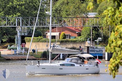
Pleasure Craft
Current Trip
EOS is out of coverage. Learn how you can join the community and extend the coverage to your area by clicking here!
Unknown
Destination Port
ETA*
---
| Time Travelled | 1 day |
|---|---|
| Remaining Time | --- |
| Distance Travelled | 24.72 nm |
| Remaining Distance | --- |
| AVG Speed | 5.9 Knop |
| MAX Speed | 6.6 Knop |
| AVG Wind | 3.5 knots |
| MAX Wind | 5 knots |
| MIN Temp | 13.4°C / 56.12°F |
| MAX Temp | 19.2°C / 66.56°F |
| Djupgående | --- |
| Position mottagen | 1 d sen |
Current Position
| Longitud | -8.89605° |
|---|---|
| Latitude | 43.32879° |
| Status | Default |
| Fart | 5.7 Knop |
| Kurs | 245° |
| Område | North Atlantic Ocean |
| Station | T-AIS |
| Position mottagen | 1 d sen |
Info
info
Information
The current position of EOS is in North Atlantic Ocean with coordinates 43.32879° / -8.89605° as reported on 2024-05-11 10:56 by AIS to our vessel tracker app. The vessel's current speed is 5.7 Knop
The vessel EOS (MMSI: 203246646) is a Pleasure Craft It's sailing under the flag of [AT] Austria.
In this page you can find informations about the vessels current position, last detected port calls, and current voyage information. If the vessels is not in coverage by AIS you will find the latest position.
The current position of EOS is detected by our AIS receivers and we are not responsible for the reliability of the data. The last position was recorded while the vessel was in Coverage by the Ais receivers of our vessel tracking app.
Weather
| Temperature | 15.9°C / 60.62°F |
|---|---|
| Wind Speed | 4 knots |
| Direction | 347° NNW |
| Pressure | 1017 hPa |
| Humidity | 80.5 % |
| Cloud Coverage | 4 % |
Featured Company
Limited time offer - Install a base station receiver to your area and list your company on MyShipTracking Free forever!
Most Visited Ports (Last year)
| Port | Arrivals | |
|---|---|---|
| 1 | ||
| 1 | ||
| 1 | ||
| 1 | ||
| 1 | ||
| 1 |
Last Trips
| Origin | Departure | Destination | Arrival | Distance |
|---|
Events
| Tid | Event | Detaljer | Position / Dest | Information |
|---|---|---|---|---|
| 2024-05-11 10:56 | UTANFÖR täckningsområde |
43.32879 / -8.89605
North Atlantic Ocean
|
Fart: 5.7 kn Kurs: 245° |
|
| 2024-05-11 06:40 | AVGÅTT HAMN |
|
43.36811 / -8.37445
|
Fart: 6.5 kn Kurs: 338° |
| 2024-05-11 06:24 | STARTAR förflyttning |
43.36610 / -8.39361
[ES] CORUNA
|
Fart: 5.8 kn Kurs: 125° |
|
| 2024-05-09 15:14 | STOPPAR förflyttning |
43.36771 / -8.39564
[ES] CORUNA
|
Fart: 0.1 kn Kurs: 80° |
|
| 2024-05-09 14:53 | ANLÄNDER HAMN |
|
43.36431 / -8.37266
[ES] CORUNA
|
Fart: 6.7 kn Kurs: 189.1° |
| 2024-05-09 12:52 | I täckningsområde |
43.55806 / -8.32754
North Atlantic Ocean
|
Fart: 6 kn Kurs: 165.4° |
|
| 2024-05-09 08:21 | UTANFÖR täckningsområde |
43.78247 / -7.87460
North Atlantic Ocean
|
Fart: 5.4 kn Kurs: 242.9° |
|
| 2024-05-09 08:07 | Byter havsområde | Spanish part of the North Atlantic Ocean Spanish part of the Bay of Biscay |
43.77836 / -7.84784
North Atlantic Ocean
|
Fart: 4.6 kn Kurs: 298.6° |
| 2024-05-09 07:09 | I täckningsområde |
43.78475 / -7.73086
Bay of Biscay
|
Fart: 7.1 kn Kurs: 251.3° |