
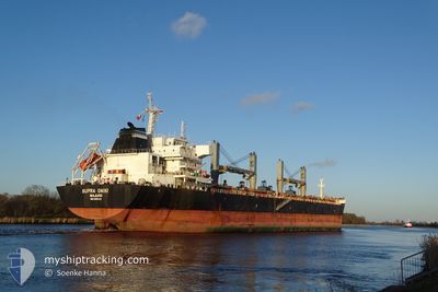
SUPRA ONIKI
Bulk Carrier
Current Trip
| Time Travelled | 11 days |
|---|---|
| Remaining Time | --- |
| Distance Travelled | 2872.93 nm |
| Remaining Distance | --- |
| AVG Speed | 9.9 Knop |
| MAX Speed | 12.4 Knop |
| AVG Wind | 7.4 knots |
| MAX Wind | 20 knots |
| MIN Temp | 26.6°C / 79.88°F |
| MAX Temp | 36°C / 96.8°F |
| Djupgående | 13 m |
| Position mottagen | 7 m sen |
Current Position
| Longitud | 104.00544° |
|---|---|
| Latitude | 1.28955° |
| Status | At anchor |
| Fart | |
| Kurs | 79° |
| Område | Singapore Strait |
| Station | T-AIS |
| Position mottagen | 7 m sen |
Info
Information
The current position of SUPRA ONIKI is in Singapore Strait with coordinates 1.28955° / 104.00544° as reported on 2024-05-09 06:23 by AIS to our vessel tracker app. The vessel's current speed is 0 Knop
The vessel SUPRA ONIKI (IMO: 9492414, MMSI: 538009399) is a Bulk Carrier that was built in 2010 ( 14 År gammal ). It's sailing under the flag of [MH] Marshall Is.
In this page you can find informations about the vessels current position, last detected port calls, and current voyage information. If the vessels is not in coverage by AIS you will find the latest position.
The current position of SUPRA ONIKI is detected by our AIS receivers and we are not responsible for the reliability of the data. The last position was recorded while the vessel was in Coverage by the Ais receivers of our vessel tracking app.
The current draught of SUPRA ONIKI as reported by AIS is 13 meters
Weather
| Temperature | 29.4°C / 84.92°F |
|---|---|
| Wind Speed | 2 knots |
| Direction | 109° ESE |
| Pressure | 1007.8 hPa |
| Humidity | 73.5 % |
| Cloud Coverage | 55 % |
Featured Company
Last Port Calls
| Port | Arrival | Departure | Time In Port |
|---|---|---|---|
| 2024-04-24 19:18 | 2024-04-27 11:11 | 2 d | |
| 2024-04-08 01:46 | 2024-04-09 10:41 | 1 d | |
| 2024-03-06 03:56 | 2024-03-07 17:16 | 1 d | |
| 2024-03-02 16:01 |
Most Visited Ports (Last year)
| Port | Arrivals | |
|---|---|---|
| 2 | ||
| 2 | ||
| 1 | ||
| 1 | ||
| 1 | ||
| 1 |
Last Trips
| Origin | Departure | Destination | Arrival | Distance | |
|---|---|---|---|---|---|
| 2024-04-09 16:11 | 2024-04-25 00:48 | 2252.02 nm | |||
| 2024-03-07 21:16 | 2024-04-08 07:16 | 3873.06 nm | |||
| 2024-03-02 20:01 | 2024-03-06 07:56 | 120.65 nm |
Events
| Tid | Event | Detaljer | Position / Dest | Information |
|---|---|---|---|---|
| 2024-05-09 06:16 | Djupgående ändrat | 13 12.8 |
1.28955 / 104.00549
CN LZO
|
Fart: Kurs: 75° |
| 2024-05-09 06:16 | Destination ändrad | CN LZO SG SIN_PEBGB |
1.28955 / 104.00549
CN LZO
|
Fart: Kurs: 75° |
| 2024-05-09 06:16 | ETA ändrat | 2024/05/20 08:00 2024/05/08 19:30 |
1.28955 / 104.00549
CN LZO
|
Fart: Kurs: 75° |
| 2024-05-09 05:45 | Status ändrad | At anchor Default |
1.28955 / 104.00549
SG SIN_PEBGB
|
Fart: Kurs: -1° |
| 2024-05-09 05:26 | Status ändrad | Default At anchor |
1.28833 / 104.00500
SG SIN_PEBGB
|
Fart: Kurs: 77° |
| 2024-05-09 04:02 | Status ändrad | At anchor Default |
1.28851 / 104.00525
SG SIN_PEBGB
|
Fart: Kurs: -1° |
| 2024-05-09 03:44 | I täckningsområde |
1.28851 / 104.00525
Singapore Strait
|
Fart: Kurs: 146.3° |
|
| 2024-05-09 02:35 | Status ändrad | Default At anchor |
1.28953 / 104.00542
SG SIN_PEBGB
|
Fart: Kurs: 95° |
| 2024-05-09 02:02 | Status ändrad | At anchor Default |
1.28805 / 104.00623
SG SIN_PEBGB
|
Fart: Kurs: 95° |
| 2024-05-09 02:02 | UTANFÖR täckningsområde |
1.28805 / 104.00623
Singapore Strait
|
Fart: Kurs: 192.4° |